 |
|
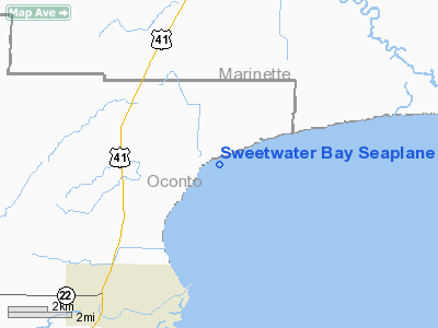
Sweetwater Bay Seaplane Base Airport |
Location & QuickFacts
| FAA Information Effective: | 2008-09-25 |
| Airport Identifier: | 30W |
| Airport Status: | Operational |
| Longitude/Latitude: | 087-48-30.3720W/44-57-06.9590N
-87.808437/44.951933 (Estimated) |
| Elevation: | 579 ft / 176.48 m (Estimated) |
| Land: | 0 acres |
| From nearest city: | 6 nautical miles NE of Oconto, WI |
| Location: | Oconto County, WI |
| Magnetic Variation: | 02W (1990) |
Owner & Manager
| Ownership: | Privately owned |
| Owner: | Thomas A. Hinrichs |
| Address: | 7890 Hwy Y
Oconto, WI 54153 |
| Phone number: | 920-834-5509 |
| Manager: | Thomas A. Hinrichs |
| Address: | 7890 Hwy Y
Oconto, WI 54153 |
| Phone number: | 920-834-5509 |
Airport Operations and Facilities
| Airport Use: | Open to public |
| Wind indicator: | Yes |
| Segmented Circle: | No |
| Control Tower: | No |
| Sectional chart: | Green Bay |
| Region: | AGL - Great Lakes |
| Boundary ARTCC: | ZMP - Minneapolis |
| Tie-in FSS: | GRB - Green Bay |
| FSS Toll Free: | 1-800-WX-BRIEF |
| NOTAMs Facility: | GRB (NOTAM-d service avaliable) |
Airport Communications
Airport Services
Runway Information
Runway ALL/WAY
| Dimension: | 10000 x 250 ft / 3048.0 x 76.2 m |
| Surface: | WATER, |
| |
Runway ALL |
Runway WAY |
| Traffic Pattern: | Left | Left |
|
Radio Navigation Aids
| ID |
Type |
Name |
Ch |
Freq |
Var |
Dist |
| OCQ | NDB | Oconto | | 388.00 | 03W | 6.4 nm |
| SUE | NDB | Sturgeon Bay | | 414.00 | 03W | 17.8 nm |
| SG | NDB | Depre | | 332.00 | 02W | 36.0 nm |
| CLI | NDB | Clintonville | | 209.00 | 02W | 44.2 nm |
| MNM | VOR/DME | Menominee | 033X | 109.60 | 00E | 15.3 nm |
| MTW | VOR/DME | Manitowoc | 047X | 111.00 | 02W | 49.8 nm |
| GRB | VORTAC | Green Bay | 102X | 115.50 | 01E | 29.0 nm |
Remarks
- APCH FROM THE WEST OR NORTHWEST OVER WESTERN SHORELINE; TREES UP TO 85 FT ALONG SHORELINE.
Images and information placed above are from
http://www.airport-data.com/airport/30W/
We thank them for the data!
| General Info
|
| Country |
United States
|
| State |
WISCONSIN
|
| FAA ID |
30W
|
| Latitude |
44-57-06.959N
|
| Longitude |
087-48-30.372W
|
| Elevation |
579 feet
|
| Near City |
OCONTO
|
We don't guarantee the information is fresh and accurate. The data may
be wrong or outdated.
For more up-to-date information please refer to other sources.
|
|


