 |
|
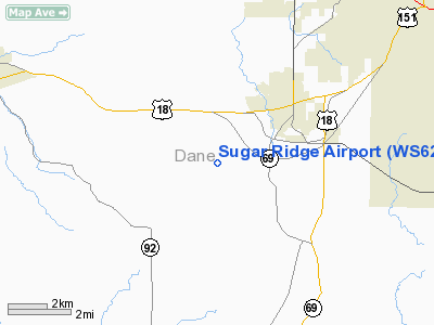
Location & QuickFacts
| FAA Information Effective: | 2008-09-25 |
| Airport Identifier: | WS62 |
| Airport Status: | Operational |
| Longitude/Latitude: | 089-34-51.4380W/42-57-48.9940N
-89.580955/42.963609 (Estimated) |
| Elevation: | 1080 ft / 329.18 m (Estimated) |
| Land: | 5 acres |
| From nearest city: | 2 nautical miles SW of Verona, WI |
| Location: | Dane County, WI |
| Magnetic Variation: | 01E (1985) |
Owner & Manager
| Ownership: | Privately owned |
| Owner: | Thomas J Kretschman |
| Address: | 7550 Sugar Ridge
Verona, WI 53593 |
| Phone number: | 608-845-6230 |
| Manager: | Thomas J Kretschman |
| Address: | 7550 Sugar Ridge
Verona, WI 53593 |
| Phone number: | 608-845-6230 |
Airport Operations and Facilities
| Airport Use: | Private |
| Wind indicator: | Yes |
| Segmented Circle: | No |
| Control Tower: | No |
| Beacon Color: | Clear-Green (lighted land airport) |
| Sectional chart: | Chicago |
| Region: | AGL - Great Lakes |
| Boundary ARTCC: | ZAU - Chicago |
| Tie-in FSS: | GRB - Green Bay |
| FSS Toll Free: | 1-800-WX-BRIEF |
Runway Information
Runway 09/27
| Dimension: | 1600 x 90 ft / 487.7 x 27.4 m |
| Surface: | TURF, |
| Edge Lights: | Low
ACTVT LIRL RY 09/27 AND ROTG BCN - 122.85. |
| |
Runway 09 |
Runway 27 |
| Traffic Pattern: | Left | Left |
|
Radio Navigation Aids
| ID |
Type |
Name |
Ch |
Freq |
Var |
Dist |
| MS | NDB | Monah | | 400.00 | 00E | 11.9 nm |
| MRJ | NDB | Mineral Point | | 365.00 | 00W | 28.8 nm |
| JVL | NDB | Janesville | | 375.00 | 03E | 31.7 nm |
| RYV | NDB | Rock River | | 371.00 | 01W | 39.6 nm |
| PVB | NDB | Platteville | | 203.00 | 01E | 41.2 nm |
| FEP | NDB | Freeport | | 335.00 | 00E | 43.2 nm |
| LVV | NDB | Lake Lawn | | 404.00 | 00W | 46.4 nm |
| UNU | NDB | Juneau | | 344.00 | 01W | 47.6 nm |
| LNR | VOR/DME | Lone Rock | 075X | 112.80 | 00E | 31.3 nm |
| JVL | VOR/DME | Janesville | 090X | 114.30 | 03E | 32.2 nm |
| RFD | VOR/DME | Rockford | 045X | 110.80 | 01E | 47.5 nm |
| MSN | VORTAC | Madison | 023X | 108.60 | 03E | 15.2 nm |
| DLL | VORTAC | Dells | 117X | 117.00 | 03E | 36.2 nm |
Images and information placed above are from
http://www.airport-data.com/airport/WS62/
We thank them for the data!
| General Info
|
| Country |
United States
|
| State |
WISCONSIN
|
| FAA ID |
WS62
|
| Latitude |
42-57-48.994N
|
| Longitude |
089-34-51.438W
|
| Elevation |
1080 feet
|
| Near City |
VERONA
|
We don't guarantee the information is fresh and accurate. The data may
be wrong or outdated.
For more up-to-date information please refer to other sources.
|
|


