 |
|
Location & QuickFacts
| FAA Information Effective: | 2008-09-25 |
| Airport Identifier: | 44WI |
| Airport Status: | Operational |
| Longitude/Latitude: | 090-23-06.2400W/44-46-19.9800N
-90.385067/44.772217 (Estimated) |
| Elevation: | 1298 ft / 395.63 m (Estimated) |
| Land: | 0 acres |
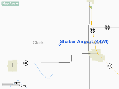
| From nearest city: | 4 nautical miles W of Spencer, WI |
| Location: | Clark County, WI |
| Magnetic Variation: | () |
Owner & Manager
| Ownership: | Privately owned |
| Owner: | Daniel L. Stoiber |
| Address: | W1414 Rock Creek Rd
Spencer, WI 54479 |
| Phone number: | 715-659-5121 |
| Manager: | Daniel L. Stoiber |
| Address: | W1414 Rock Creek Rd
Spencer, WI 54479 |
| Phone number: | 715-659-5121 |
Airport Operations and Facilities
| Airport Use: | Private |
| Control Tower: | No |
| Sectional chart: | Green Bay |
| Region: | AGL - Great Lakes |
| Boundary ARTCC: | ZMP - Minneapolis |
| Tie-in FSS: | GRB - Green Bay |
| FSS Toll Free: | 1-800-WX-BRIEF |
Runway Information
Runway 03/21
| Dimension: | 1550 x 60 ft / 472.4 x 18.3 m |
| Surface: | TURF, |
| |
Runway 03 |
Runway 21 |
| Traffic Pattern: | Left | Left |
| Obstruction: | | 50 ft trees, 225.0 ft from runway |
|
Radio Navigation Aids
| ID |
Type |
Name |
Ch |
Freq |
Var |
Dist |
| MFI | NDB | Marshfield | | 391.00 | 00E | 11.6 nm |
| VIQ | NDB | Neillsville | | 368.00 | 01W | 14.1 nm |
| MDZ | NDB | Medford | | 335.00 | 00E | 20.3 nm |
| FZK | NDB | Wausau | | 243.00 | 01E | 33.7 nm |
| ISW | NDB | Wisconsin Rapids | | 215.00 | 01W | 33.9 nm |
| BCK | NDB | Black River Falls | | 362.00 | 00E | 36.9 nm |
| RRL | NDB | Merrill | | 257.00 | 01W | 38.7 nm |
| AUW | VORTAC | Wausau | 053X | 111.60 | 02E | 34.3 nm |
| STE | VORTAC | Stevens Point | 043X | 110.60 | 01W | 39.0 nm |
| EAU | VORTAC | Eau Claire | 076X | 112.90 | 04E | 47.2 nm |
Remarks
- PRVDD VFR OPNS AND PVT USE.
Images and information placed above are from
http://www.airport-data.com/airport/44WI/
We thank them for the data!
| General Info
|
| Country |
United States
|
| State |
WISCONSIN
|
| FAA ID |
44WI
|
| Latitude |
45-12-14.959N
|
| Longitude |
087-05-55.404W
|
| Elevation |
685 feet
|
| Near City |
SISTER BAY
|
We don't guarantee the information is fresh and accurate. The data may
be wrong or outdated.
For more up-to-date information please refer to other sources.
|
|


