 |
|
Stevens Point Muni Airport |
Coordinates: 44°32′42″N 089°31′49″W / 44.545°N 89.53028°W / 44.545; -89.53028
| Stevens Point Municipal Airport |
| IATA: STE – ICAO: KSTE – FAA LID: STE |
| Summary |
| Airport type |
Public |
| Owner/Operator |
City of Stevens Point |
| Location |
Stevens Point, Wisconsin |
| Elevation AMSL |
1,110 ft / 338 m |
| Runways |
| Direction |
Length |
Surface |
| ft |
m |
| 3/21 |
6,028 |
1,837 |
Asphalt |
| 12/30 |
3,635 |
1,108 |
Asphalt |
| Statistics (2005) |
| Aircraft operations |
36,750 |
| Based aircraft |
50 |
| Source: Federal Aviation Administration |
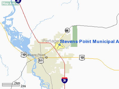
Stevens Point Municipal Airport (IATA: STE, ICAO: KSTE, FAA LID: STE) is a public airport located three miles (5 km) northeast of the central business district of Stevens Point, a city in Portage County, Wisconsin, United States. It is owned and operated by the City of Stevens Point.
Facilities and aircraft
Stevens Point Municipal Airport covers an area of 725 acres (293 ha) which contains two asphalt paved runways: 3/21 measuring 6,028 x 120 ft (1,837 x 37 m) and 12/30 measuring 3,635 x 75 ft (1,108 x 23 m).
For the 12-month period ending May 25, 2005, the airport had 36,750 aircraft operations, an average of 100 per day: 91% general aviation, 8% air taxi and <1% military. There are 50 aircraft based at this airport: 90% single engine, 6% jet aircraft, 2% multi-engine and 2% ultralights.
The above content comes from Wikipedia and is published under free licenses – click here to read more.
Location & QuickFacts
| FAA Information Effective: | 2008-09-25 |
| Airport Identifier: | STE |
| Airport Status: | Operational |
| Longitude/Latitude: | 089-31-49.0240W/44-32-42.4880N
-89.530284/44.545136 (Estimated) |
| Elevation: | 1110 ft / 338.33 m (Surveyed) |
| Land: | 725 acres |
| From nearest city: | 3 nautical miles NE of Stevens Point, WI |
| Location: | Portage County, WI |
| Magnetic Variation: | 01W (1995) |
Owner & Manager
| Ownership: | Publicly owned |
| Owner: | Stevens Point |
| Address: | Airport Committee
Stevens Point, WI 54481 |
| Phone number: | 715-346-2276 |
| Manager: | Mike Pinney |
| Address: | 4501 Hwy 66, Suite 3
Stevens Point, WI 54481 |
| Phone number: | 715-345-8989
AFT HRS CALL 715-887-3077. |
Airport Operations and Facilities
| Airport Use: | Open to public |
| Wind indicator: | Yes |
| Segmented Circle: | Yes |
| Control Tower: | No |
| Lighting Schedule: | DUSK-DAWN
ACTVT HIRL RYS 03/21 & 12/30 & MALS RY 21 & REIL RY 03 & PAPI RYS 03/21- CTAF. |
| Beacon Color: | Clear-Green (lighted land airport) |
| Landing fee charge: | No |
| Sectional chart: | Green Bay |
| Region: | AGL - Great Lakes |
| Traffic Pattern Alt: | 1000 ft |
| Boundary ARTCC: | ZMP - Minneapolis |
| Tie-in FSS: | GRB - Green Bay |
| FSS on Airport: | No |
| FSS Toll Free: | 1-800-WX-BRIEF |
| NOTAMs Facility: | STE (NOTAM-d service avaliable) |
| Federal Agreements: | NGY |
Airport Communications
| CTAF: | 122.700 |
| Unicom: | 122.700 |
Airport Services
| Fuel available: | 100LLA |
| Airframe Repair: | MAJOR |
| Power Plant Repair: | MAJOR |
Runway Information
Runway 03/21
| Dimension: | 6028 x 120 ft / 1837.3 x 36.6 m |
| Surface: | ASPH, Fair Condition |
| Weight Limit: | Single wheel: 30000 lbs.
Dual wheel: 75000 lbs.
Dual tandem wheel: 195000 lbs. |
| Edge Lights: | High |
| |
Runway 03 |
Runway 21 |
| Longitude: | 089-32-11.7700W | 089-31-30.6100W |
| Latitude: | 44-32-18.3500N | 44-33-10.0800N |
| Elevation: | 1103.00 ft | 1110.00 ft |
| Alignment: | 30 | 127 |
| Traffic Pattern: | Left | Left |
| Markings: | Non-precision instrument, Good Condition | Non-precision instrument, Good Condition |
| Crossing Height: | 38.00 ft | 37.00 ft |
| VASI: | 2-light PAPI on left side | 2-light PAPI on left side |
| Visual Glide Angle: | 3.00° | 3.00° |
| Approach lights: | | MALS |
| Runway End Identifier: | Yes | No |
| Centerline Lights: | No | No |
| Touchdown Lights: | No | No |
| Obstruction: | 34 ft trees, 1650.0 ft from runway, 200 ft right of centerline, 42:1 slope to clear | 60 ft tree, 2500.0 ft from runway, 100 ft left of centerline, 38:1 slope to clear |
|
Runway 12/30
| Dimension: | 3635 x 75 ft / 1107.9 x 22.9 m |
| Surface: | ASPH, Fair Condition |
| Weight Limit: | Single wheel: 9000 lbs.
Dual wheel: 75000 lbs. |
| Edge Lights: | High |
| |
Runway 12 |
Runway 30 |
| Longitude: | 089-32-07.1700W | 089-31-23.5600W |
| Latitude: | 44-32-48.4000N | 44-32-30.6400N |
| Elevation: | 1105.00 ft | 1103.00 ft |
| Alignment: | 120 | 127 |
| Traffic Pattern: | Left | Left |
| Markings: | Non-precision instrument, Good Condition | Non-precision instrument, Good Condition |
| Runway End Identifier: | No | No |
| Centerline Lights: | No | No |
| Touchdown Lights: | No | No |
| Obstruction: | 15 ft road, 570.0 ft from runway, 24:1 slope to clear | 40 ft trees, 1200.0 ft from runway, 200 ft left of centerline, 25:1 slope to clear |
|
Radio Navigation Aids
| ID |
Type |
Name |
Ch |
Freq |
Var |
Dist |
| ISW | NDB | Wisconsin Rapids | | 215.00 | 01W | 17.2 nm |
| FZK | NDB | Wausau | | 243.00 | 01E | 23.4 nm |
| PCZ | NDB | Waupaca | | 382.00 | 01W | 25.5 nm |
| MFI | NDB | Marshfield | | 391.00 | 00E | 28.7 nm |
| CLI | NDB | Clintonville | | 209.00 | 02W | 34.4 nm |
| RRL | NDB | Merrill | | 257.00 | 01W | 40.0 nm |
| AIG | NDB | Antigo | | 347.00 | 02W | 40.9 nm |
| VIQ | NDB | Neillsville | | 368.00 | 01W | 42.2 nm |
| MDZ | NDB | Medford | | 335.00 | 00E | 47.3 nm |
| VOK | TACAN | Volk | 041X | | 00E | 47.9 nm |
| STE | VORTAC | Stevens Point | 043X | 110.60 | 01W | 0.1 nm |
| AUW | VORTAC | Wausau | 053X | 111.60 | 02E | 18.3 nm |
Remarks
- DEER & MIGRATORY WATERFOWL ON & INVOF ARPT.
Images and information placed above are from
http://www.airport-data.com/airport/STE/
We thank them for the data!
| General Info
|
| Country |
United States
|
| State |
WISCONSIN
|
| FAA ID |
STE
|
| Latitude |
44-32-42.488N
|
| Longitude |
089-31-49.024W
|
| Elevation |
1110 feet
|
| Near City |
STEVENS POINT
|
We don't guarantee the information is fresh and accurate. The data may
be wrong or outdated.
For more up-to-date information please refer to other sources.
|
|


