 |
|
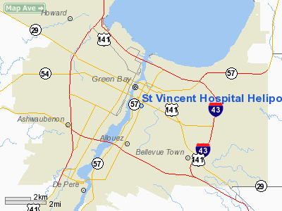
St Vincent Hospital Heliport |
Location & QuickFacts
| FAA Information Effective: | 2008-09-25 |
| Airport Identifier: | 7WI3 |
| Airport Status: | Operational |
| Longitude/Latitude: | 088-00-41.3730W/44-30-04.9720N
-88.011493/44.501381 (Estimated) |
| Elevation: | 659 ft / 200.86 m (Estimated) |
| Land: | 0 acres |
| From nearest city: | 0 nautical miles N of Green Bay, WI |
| Location: | Brown County, WI |
| Magnetic Variation: | 01E (1985) |
Owner & Manager
| Ownership: | Privately owned |
| Owner: | St Vincent Hospital |
| Address: | 835 S. Van Buren St
Green Bay, WI 54301 |
| Phone number: | 414-433-0111 |
| Manager: | Joseph J. Neidenbach, Admir |
| Address: | 835 S. Van Buren St
Green Bay, WI 54301 |
Airport Operations and Facilities
| Airport Use: | Private
MEDICAL USE. |
| Wind indicator: | Yes |
| Segmented Circle: | No |
| Control Tower: | No |
| Lighting Schedule: | PHONE REQ
FOR ROTG BEACON & PERIMETER LGTS CALL 414-433-0111. |
| Beacon Color: | Clear-Green-Yellow (heliport) |
| Sectional chart: | Chicago |
| Region: | AGL - Great Lakes |
| Boundary ARTCC: | ZMP - Minneapolis |
| Tie-in FSS: | GRB - Green Bay |
| FSS on Airport: | No |
| FSS Toll Free: | 1-800-WX-BRIEF |
Runway Information
Helipad H1
| Dimension: | 60 x 55 ft / 18.3 x 16.8 m |
| Surface: | CONC, |
| |
Runway H1 |
Runway |
| Traffic Pattern: | Left | Left |
|
Radio Navigation Aids
| ID |
Type |
Name |
Ch |
Freq |
Var |
Dist |
| SG | NDB | Depre | | 332.00 | 02W | 8.1 nm |
| OCQ | NDB | Oconto | | 388.00 | 03W | 22.9 nm |
| AQ | NDB | Kooky | | 407.00 | 02W | 23.9 nm |
| CLI | NDB | Clintonville | | 209.00 | 02W | 31.7 nm |
| SUE | NDB | Sturgeon Bay | | 414.00 | 03W | 32.3 nm |
| PCZ | NDB | Waupaca | | 382.00 | 01W | 44.3 nm |
| MTW | VOR/DME | Manitowoc | 047X | 111.00 | 02W | 26.6 nm |
| MNM | VOR/DME | Menominee | 033X | 109.60 | 00E | 43.7 nm |
| FAH | VOR/DME | Falls | 37X | 110.00 | 02W | 44.6 nm |
| GRB | VORTAC | Green Bay | 102X | 115.50 | 01E | 8.5 nm |
| OSH | VORTAC | Oshkosh | 055X | 111.80 | 02E | 38.6 nm |
Remarks
- OPERATIONS ARE CONDUCTED ONLY AT 90 DEGREES; AREA IS MARKED; WIND INDICATOR IS MAINTAINED.
Images and information placed above are from
http://www.airport-data.com/airport/7WI3/
We thank them for the data!
| General Info
|
| Country |
United States
|
| State |
WISCONSIN
|
| FAA ID |
7WI3
|
| Latitude |
44-30-04.972N
|
| Longitude |
088-00-41.373W
|
| Elevation |
659 feet
|
| Near City |
GREEN BAY
|
We don't guarantee the information is fresh and accurate. The data may
be wrong or outdated.
For more up-to-date information please refer to other sources.
|
|


