 |
|
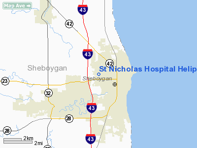
St Nicholas Hospital Heliport |
Location & QuickFacts
| FAA Information Effective: | 2008-09-25 |
| Airport Identifier: | WS56 |
| Airport Status: | Operational |
| Longitude/Latitude: | 087-44-56.3100W/43-45-40.9800N
-87.748975/43.761383 (Estimated) |
| Elevation: | 680 ft / 207.26 m (Estimated) |
| Land: | 0 acres |
| From nearest city: | 0 nautical miles N of Sheboygan, WI |
| Location: | Sheboygan County, WI |
| Magnetic Variation: | 01W (1985) |
Owner & Manager
| Ownership: | Privately owned |
| Owner: | St Nicholas Hospital |
| Address: | 1601 N. Taylor Dr
Sheboygan, WI 53081 |
| Phone number: | 414-459-8300 |
| Manager: | Edward J. Lenn |
| Address: | 1601 N. Taylor Dr
Sheboygan, WI 53081 |
| Phone number: | 414-459-8300 |
Airport Operations and Facilities
| Airport Use: | Private
MEDICAL |
| Wind indicator: | Yes |
| Segmented Circle: | No |
| Control Tower: | No |
| Lighting Schedule: | PHONE REQ
FOR PERIMETER LIGHTS CALL 414-459-8300. |
| Sectional chart: | Chicago |
| Region: | AGL - Great Lakes |
| Boundary ARTCC: | ZAU - Chicago |
| Tie-in FSS: | GRB - Green Bay |
| FSS Toll Free: | 1-800-WX-BRIEF |
Runway Information
Helipad H1
| Dimension: | 30 x 30 ft / 9.1 x 9.1 m |
| Surface: | CONC, |
| |
Runway H1 |
Runway |
| Traffic Pattern: | Left | Left |
|
Radio Navigation Aids
| ID |
Type |
Name |
Ch |
Freq |
Var |
Dist |
| LLE | NDB | Kettle Moraine | | 329.00 | 01W | 26.1 nm |
| HXF | NDB | Hartford | | 200.00 | 00E | 37.6 nm |
| AQ | NDB | Kooky | | 407.00 | 02W | 39.2 nm |
| SG | NDB | Depre | | 332.00 | 02W | 41.7 nm |
| BL | NDB | Yanks | | 260.00 | 02W | 42.5 nm |
| UNU | NDB | Juneau | | 344.00 | 01W | 46.1 nm |
| UES | NDB | Waukesha | | 359.00 | 01W | 48.0 nm |
| BJB | VOR | West Bend | | 109.80 | 01W | 26.2 nm |
| FAH | VOR/DME | Falls | 37X | 110.00 | 02W | 4.3 nm |
| MTW | VOR/DME | Manitowoc | 047X | 111.00 | 02W | 22.3 nm |
| LJT | VOR/DME | Timmerman | 072X | 112.50 | 02W | 41.1 nm |
| OSH | VORTAC | Oshkosh | 055X | 111.80 | 02E | 37.6 nm |
| BAE | VORTAC | Badger | 111X | 116.40 | 02E | 45.2 nm |
| MKE | VOT | Milwaukee | | 109.00 | | 49.3 nm |
Remarks
- REMARKS-FILED FOR RECORD PURPOSES ONLY
Images and information placed above are from
http://www.airport-data.com/airport/WS56/
We thank them for the data!
| General Info
|
| Country |
United States
|
| State |
WISCONSIN
|
| FAA ID |
WS56
|
| Latitude |
43-45-40.980N
|
| Longitude |
087-44-56.310W
|
| Elevation |
680 feet
|
| Near City |
SHEBOYGAN
|
We don't guarantee the information is fresh and accurate. The data may
be wrong or outdated.
For more up-to-date information please refer to other sources.
|
|


