 |
|
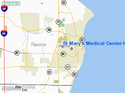
St Mary's Medical Center Heliport |
Location & QuickFacts
| FAA Information Effective: | 2008-09-25 |
| Airport Identifier: | WS53 |
| Airport Status: | Operational |
| Longitude/Latitude: | 087-49-37.0000W/42-43-50.0000N
-87.826944/42.730556 (Estimated) |
| Elevation: | 686 ft / 209.09 m (Estimated) |
| Land: | 0 acres |
| From nearest city: | 0 nautical miles N of Racine, WI |
| Location: | Racine County, WI |
| Magnetic Variation: | 01W (1985) |
Owner & Manager
| Ownership: | Privately owned |
| Owner: | St Mary's Medical Center |
| Address: | 3801 Spring St
Racine, WI 53405 |
| Phone number: | 262-687-5447 |
| Manager: | Bill Lauzon |
| Address: | St Mary's Medical Center, 3801 Spring St
Racine, WI 53405 |
| Phone number: | 262-687-5447 |
Airport Operations and Facilities
| Airport Use: | Private
MEDICAL USE |
| Wind indicator: | Yes |
| Segmented Circle: | No |
| Control Tower: | No |
| Sectional chart: | Chicago |
| Region: | AGL - Great Lakes |
| Boundary ARTCC: | ZAU - Chicago |
| Tie-in FSS: | GRB - Green Bay |
| FSS Toll Free: | 1-800-WX-BRIEF |
Runway Information
Helipad H1
| Dimension: | 50 x 50 ft / 15.2 x 15.2 m |
| Surface: | CONC, |
| |
Runway H1 |
Runway |
| Traffic Pattern: | Left | Left |
|
Helipad H2
| Dimension: | 50 x 50 ft / 15.2 x 15.2 m |
| Surface: | ALUMINUM, |
| |
Runway H2 |
Runway |
| Traffic Pattern: | Left | Left |
|
Radio Navigation Aids
| ID |
Type |
Name |
Ch |
Freq |
Var |
Dist |
| RA | NDB | Paser | | 206.00 | 00E | 4.3 nm |
| GM | NDB | Teels | | 242.00 | 02W | 14.3 nm |
| BL | NDB | Yanks | | 260.00 | 02W | 19.9 nm |
| UES | NDB | Waukesha | | 359.00 | 01W | 26.1 nm |
| LVV | NDB | Lake Lawn | | 404.00 | 00W | 33.9 nm |
| LLE | NDB | Kettle Moraine | | 329.00 | 01W | 43.8 nm |
| HXF | NDB | Hartford | | 200.00 | 00E | 44.8 nm |
| ME | NDB | Deana | | 350.00 | 00E | 46.7 nm |
| RYV | NDB | Rock River | | 371.00 | 01W | 47.7 nm |
| BJB | VOR | West Bend | | 109.80 | 01W | 43.6 nm |
| HRK | VOR/DME | Horlick | 124X | 117.70 | 02W | 2.0 nm |
| ENW | VOR/DME | Kenosha | 029X | 109.20 | 02W | 9.2 nm |
| BUU | VOR/DME | Burbun | 092X | 114.50 | 01W | 21.1 nm |
| LJT | VOR/DME | Timmerman | 072X | 112.50 | 02W | 24.6 nm |
| OBK | VOR/DME | Northbrook | 077X | 113.00 | 02W | 31.1 nm |
| ORD | VOR/DME | Chicago O'hare | 086X | 113.90 | 02E | 44.8 nm |
| BAE | VORTAC | Badger | 111X | 116.40 | 02E | 30.7 nm |
| MKE | VOT | Milwaukee | | 109.00 | | 13.4 nm |
| ORD | VOT | Chicago O'hare Intl | | 112.00 | | 45.1 nm |
Remarks
- REMARKS FILED FOR RECORD PURPOSES ONLY
Images and information placed above are from
http://www.airport-data.com/airport/WS53/
We thank them for the data!
| General Info
|
| Country |
United States
|
| State |
WISCONSIN
|
| FAA ID |
WS53
|
| Latitude |
42-43-53.070N
|
| Longitude |
087-49-39.274W
|
| Elevation |
686 feet
|
| Near City |
RACINE
|
We don't guarantee the information is fresh and accurate. The data may
be wrong or outdated.
For more up-to-date information please refer to other sources.
|
|


