 |
|
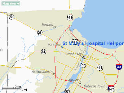
St Mary's Hospital Heliport |
Location & QuickFacts
| FAA Information Effective: | 2008-09-25 |
| Airport Identifier: | 33WI |
| Airport Status: | Operational |
| Longitude/Latitude: | 088-03-57.3730W/44-31-55.9700N
-88.065937/44.532214 (Estimated) |
| Elevation: | 617 ft / 188.06 m (Estimated) |
| Land: | 0 acres |
| From nearest city: | 0 nautical miles N of Green Bay, WI |
| Location: | Brown County, WI |
| Magnetic Variation: | 02W (1990) |
Owner & Manager
| Ownership: | Privately owned |
| Owner: | St Mary's Hospital Med Ctr |
| Address: | 1726 Shawano Ave
Green Bay, WI 54303 |
| Phone number: | 920-498-4200 |
| Manager: | Stephen Pelch |
| Address: | 1726 Shawano Ave.
Green Bay, WI 54303 |
| Phone number: | 920-498-4379 |
Airport Operations and Facilities
| Airport Use: | Private
MEDICAL USE. |
| Segmented Circle: | No |
| Control Tower: | No |
| Lighting Schedule: | PHONE REQ
FOR FLOODLGTS PHONE 414-498-4613. |
| Sectional chart: | Green Bay |
| Region: | AGL - Great Lakes |
| Boundary ARTCC: | ZMP - Minneapolis |
| Tie-in FSS: | GRB - Green Bay |
| FSS Toll Free: | 1-800-WX-BRIEF |
Runway Information
Helipad H1
| Dimension: | 125 x 60 ft / 38.1 x 18.3 m |
| Surface: | ASPH, |
| |
Runway H1 |
Runway |
| Traffic Pattern: | Left | Left |
|
Radio Navigation Aids
| ID |
Type |
Name |
Ch |
Freq |
Var |
Dist |
| SG | NDB | Depre | | 332.00 | 02W | 8.5 nm |
| OCQ | NDB | Oconto | | 388.00 | 03W | 21.7 nm |
| AQ | NDB | Kooky | | 407.00 | 02W | 23.8 nm |
| CLI | NDB | Clintonville | | 209.00 | 02W | 29.0 nm |
| SUE | NDB | Sturgeon Bay | | 414.00 | 03W | 33.0 nm |
| PCZ | NDB | Waupaca | | 382.00 | 01W | 42.5 nm |
| MTW | VOR/DME | Manitowoc | 047X | 111.00 | 02W | 29.4 nm |
| MNM | VOR/DME | Menominee | 033X | 109.60 | 00E | 42.8 nm |
| FAH | VOR/DME | Falls | 37X | 110.00 | 02W | 46.8 nm |
| GRB | VORTAC | Green Bay | 102X | 115.50 | 01E | 5.7 nm |
| OSH | VORTAC | Oshkosh | 055X | 111.80 | 02E | 38.8 nm |
Remarks
- GROUND BASED HELIPORT REPLACED BY ROOF MOUNTED HELIPORT CONSTRUCTED FOR 12,000LB MGW HELICOPTERS.
- FOR RECORD PURPOSES ONLY.
Images and information placed above are from
http://www.airport-data.com/airport/33WI/
We thank them for the data!
| General Info
|
| Country |
United States
|
| State |
WISCONSIN
|
| FAA ID |
33WI
|
| Latitude |
44-31-55.970N
|
| Longitude |
088-03-57.373W
|
| Elevation |
617 feet
|
| Near City |
GREEN BAY
|
We don't guarantee the information is fresh and accurate. The data may
be wrong or outdated.
For more up-to-date information please refer to other sources.
|
|


