 |
|
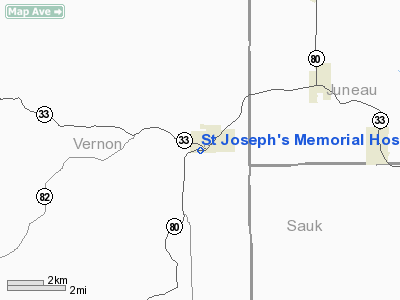
St Joseph's Memorial Hospital Heliport |
Location & QuickFacts
| FAA Information Effective: | 2008-09-25 |
| Airport Identifier: | WI63 |
| Airport Status: | Operational |
| Longitude/Latitude: | 090-20-44.4640W/43-38-54.9050N
-90.345684/43.648585 (Estimated) |
| Elevation: | 960 ft / 292.61 m (Estimated) |
| Land: | 0 acres |
| From nearest city: | 0 nautical miles N of Hillsboro, WI |
| Location: | Vernon County, WI |
| Magnetic Variation: | 01E (1985) |
Owner & Manager
| Ownership: | Privately owned |
| Owner: | St Joseph's Mem Hospital Inc |
| Address: | 400 Water Avenue
Hillsboro, WI 54634 |
| Phone number: | 608-489-2211 |
| Manager: | John Chioutsis |
| Address: | 400 Water Avenue
Hillsboro, WI 54634 |
| Phone number: | 608-489-2211 |
Airport Operations and Facilities
| Airport Use: | Private
MEDICAL |
| Wind indicator: | Yes |
| Segmented Circle: | No |
| Control Tower: | No |
| Sectional chart: | Chicago |
| Region: | AGL - Great Lakes |
| Boundary ARTCC: | ZAU - Chicago |
| Tie-in FSS: | GRB - Green Bay |
| FSS Toll Free: | 1-800-WX-BRIEF |
Runway Information
Helipad H1
| Dimension: | 30 x 30 ft / 9.1 x 9.1 m |
| Surface: | ASPH, |
| |
Runway H1 |
Runway |
| Traffic Pattern: | Left | Left |
|
Radio Navigation Aids
| ID |
Type |
Name |
Ch |
Freq |
Var |
Dist |
| HBW | NDB | Kickapoo | | 251.00 | 03E | 0.7 nm |
| CMY | NDB | Mccoy | | 412.00 | 00E | 21.6 nm |
| BCK | NDB | Black River Falls | | 362.00 | 00E | 42.4 nm |
| MRJ | NDB | Mineral Point | | 365.00 | 00W | 46.0 nm |
| ISW | NDB | Wisconsin Rapids | | 215.00 | 01W | 48.2 nm |
| CHU | NDB | Caledonia | | 209.00 | 03E | 50.0 nm |
| VOK | TACAN | Volk | 041X | | 00E | 18.1 nm |
| LNR | VOR/DME | Lone Rock | 075X | 112.80 | 00E | 23.2 nm |
| LSE | VOR/DME | La Crosse | 021X | 108.40 | 02E | 41.8 nm |
| DLL | VORTAC | Dells | 117X | 117.00 | 03E | 26.0 nm |
Remarks
- FILED FOR RECORD PURPOSES ONLY.
Images and information placed above are from
http://www.airport-data.com/airport/WI63/
We thank them for the data!
|
|


