 |
|
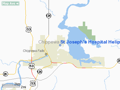
St Joseph's Hospital Heliport |
Location & QuickFacts
| FAA Information Effective: | 2008-09-25 |
| Airport Identifier: | WS47 |
| Airport Status: | Operational |
| Longitude/Latitude: | 091-21-39.5600W/44-56-58.8610N
-91.360989/44.949684 (Estimated) |
| Elevation: | 905 ft / 275.84 m (Estimated) |
| Land: | 1 acres |
| From nearest city: | 0 nautical miles N of Chippewa Falls, WI |
| Location: | Chippewa County, WI |
| Magnetic Variation: | 01E (1995) |
Owner & Manager
| Ownership: | Privately owned |
| Owner: | St Joseph's Hospital |
| Address: | 2661 County Hwy 1
Chippewa Falls, WI 54729 |
| Phone number: | 715-726-3201 |
| Manager: | David B. Fish |
| Address: | 2661 County Hwy 1
Chippewa Falls, WI 54729 |
| Phone number: | 715-723-1811 |
Airport Operations and Facilities
| Airport Use: | Private
MEDICAL USE. |
| Wind indicator: | Yes |
| Segmented Circle: | No |
| Control Tower: | No |
| Lighting Schedule: | PHONE REQ
FOR ROTG BCN & PERIMETER LGTS CALL (715) 723-1811. |
| Beacon Color: | Clear-Green-Yellow (heliport) |
| Sectional chart: | Green Bay |
| Region: | AGL - Great Lakes |
| Boundary ARTCC: | ZMP - Minneapolis |
| Tie-in FSS: | GRB - Green Bay |
| FSS on Airport: | No |
| FSS Toll Free: | 1-800-WX-BRIEF |
Runway Information
Helipad H1
| Dimension: | 50 x 50 ft / 15.2 x 15.2 m |
| Surface: | CONC, |
| |
Runway H1 |
Runway |
| Traffic Pattern: | Left | Left |
| Markings: | Basic, | , |
|
Radio Navigation Aids
| ID |
Type |
Name |
Ch |
Freq |
Var |
Dist |
| RCX | NDB | Rusk County | | 356.00 | 00W | 36.5 nm |
| UBE | NDB | Cumberland | | 375.00 | 01E | 42.5 nm |
| VIQ | NDB | Neillsville | | 368.00 | 01W | 43.1 nm |
| MDZ | NDB | Medford | | 335.00 | 00E | 45.7 nm |
| BCK | NDB | Black River Falls | | 362.00 | 00E | 47.2 nm |
| AHH | NDB | Ameron | | 278.00 | 01E | 47.3 nm |
| RPD | VOR/DME | Rice Lake | 037X | 110.00 | 01E | 33.1 nm |
| EAU | VORTAC | Eau Claire | 076X | 112.90 | 04E | 5.9 nm |
Remarks
- PRVDD APCH/DEP 180-360 CLKWS; AREA IS MKD; NON-OBSTRUCTIVE WIND INDICATIOR IS MAINTAINED; AREA IS SECURE; UNAUZD PERSONS REMOVED FM AREA DURING OPNS; FIRE PROTECTION PER LOCAL CODE AND/OR FAA AC 150/5390-2; SPONSOR INFORM USERS OF SAFETY CONDS.
Images and information placed above are from
http://www.airport-data.com/airport/WS47/
We thank them for the data!
| General Info
|
| Country |
United States
|
| State |
WISCONSIN
|
| FAA ID |
WS98
|
| Latitude |
44-40-37.869N
|
| Longitude |
090-10-46.976W
|
| Elevation |
1350 feet
|
| Near City |
MARSHFIELD
|
We don't guarantee the information is fresh and accurate. The data may
be wrong or outdated.
For more up-to-date information please refer to other sources.
|
|


