 |
|
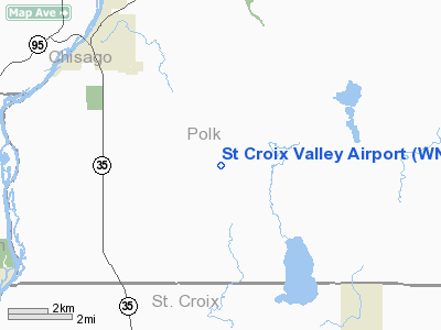
Location & QuickFacts
| FAA Information Effective: | 2008-09-25 |
| Airport Identifier: | WN86 |
| Airport Status: | Operational |
| Longitude/Latitude: | 092-37-17.7310W/45-15-49.8730N
-92.621592/45.263854 (Estimated) |
| Elevation: | 1085 ft / 330.71 m (Estimated) |
| Land: | 35 acres |
| From nearest city: | 5 nautical miles SE of Osceola, WI |
| Location: | Polk County, WI |
| Magnetic Variation: | 03E (1985) |
Owner & Manager
| Ownership: | Privately owned |
| Owner: | Steven Foster & Michael Johnson |
| Address: | 527 Hwys 35 & 64
Somerset, WI 54025 |
| Phone number: | 715-247-5127 |
| Address: |
|
Airport Operations and Facilities
| Airport Use: | Private |
| Wind indicator: | Yes |
| Segmented Circle: | No |
| Control Tower: | No |
| Sectional chart: | Green Bay |
| Region: | AGL - Great Lakes |
| Boundary ARTCC: | ZMP - Minneapolis |
| Tie-in FSS: | GRB - Green Bay |
| FSS on Airport: | No |
| FSS Toll Free: | 1-800-WX-BRIEF |
Runway Information
Runway 18/36
| Dimension: | 3800 x 60 ft / 1158.2 x 18.3 m |
| Surface: | TURF, |
| |
Runway 18 |
Runway 36 |
| Traffic Pattern: | Left | Left |
| Displaced threshold: | 0.00 ft | 700.00 ft |
| Obstruction: | 7 ft road, 300.0 ft from runway | 35 ft trees, 50.0 ft from runway |
|
Radio Navigation Aids
| ID |
Type |
Name |
Ch |
Freq |
Var |
Dist |
| OEO | NDB | Osceola | | 233.00 | 01E | 4.0 nm |
| RNH | NDB | New Richmond | | 257.00 | 02E | 7.9 nm |
| AHH | NDB | Ameron | | 278.00 | 01E | 10.6 nm |
| PPI | NDB | Hopey | | 400.00 | 03E | 27.1 nm |
| ROS | NDB | Rush City | | 282.00 | 02E | 29.6 nm |
| UBE | NDB | Cumberland | | 375.00 | 01E | 31.0 nm |
| CBG | NDB | Cambridge | | 350.00 | 03E | 32.3 nm |
| MS | NDB | Narco | | 266.00 | 02E | 33.0 nm |
| BXR | NDB | Big Doctor | | 203.00 | 02E | 35.2 nm |
| SSQ | NDB | Shell Lake | | 212.00 | 01E | 40.6 nm |
| PNM | NDB | Princeton | | 368.00 | 03E | 45.4 nm |
| JMR | NDB | Mora | | 327.00 | 03E | 46.4 nm |
| MSP | VOR/DME | Minneapolis | 100X | 115.30 | 02E | 34.2 nm |
| RZN | VOR/DME | Siren | 031X | 109.40 | 02E | 35.0 nm |
| RPD | VOR/DME | Rice Lake | 037X | 110.00 | 01E | 36.8 nm |
| FCM | VOR/DME | Flying Cloud | 055X | 111.80 | 06E | 44.2 nm |
| GEP | VORTAC | Gopher | 120X | 117.30 | 06E | 32.6 nm |
| FGT | VORTAC | Farmington | 104X | 115.70 | 06E | 44.9 nm |
| STP | VOT | St Paul | | 114.40 | | 26.9 nm |
| MSP | VOT | Minneapolis St Paul | | 111.00 | | 34.0 nm |
Remarks
- PRVDD OBSTRUCTIONS BE REMOVED/LOWERED TO PROVIDE 20:1 APCH SLOPE; AREA 125' EITHER SIDE OF RY CNTRLN & 300' EACH END BE CLEAR OF OBSTRUCTIONS.
Images and information placed above are from
http://www.airport-data.com/airport/WN86/
We thank them for the data!
| General Info
|
| Country |
United States
|
| State |
WISCONSIN
|
| FAA ID |
WN86
|
| Latitude |
45-15-49.873N
|
| Longitude |
092-37-17.731W
|
| Elevation |
1085 feet
|
| Near City |
OSCEOLA
|
We don't guarantee the information is fresh and accurate. The data may
be wrong or outdated.
For more up-to-date information please refer to other sources.
|
|


