 |
|
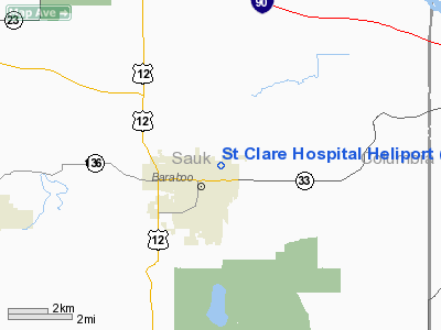
St Clare Hospital Heliport |
Location & QuickFacts
| FAA Information Effective: | 2008-09-25 |
| Airport Identifier: | WI30 |
| Airport Status: | Operational |
| Longitude/Latitude: | 089-43-46.4450W/43-28-52.9380N
-89.729568/43.481372 (Estimated) |
| Elevation: | 965 ft / 294.13 m (Estimated) |
| Land: | 0 acres |
| From nearest city: | 0 nautical miles N of Baraboo, WI |
| Location: | Sauk County, WI |
| Magnetic Variation: | 01E (1985) |
Owner & Manager
| Ownership: | Publicly owned |
| Owner: | St Clare Hospital |
| Address: | 707 14th St
Baraboo, WI 53913 |
| Phone number: | 608-356-5561 |
| Manager: | Richard Hodgson
PLANT OPERATIONS DIRECTOR. |
| Address: | 707 14th St
Baraboo, WI 53913 |
| Phone number: | 608-356-5561 |
Airport Operations and Facilities
| Airport Use: | Private
MEDICAL |
| Segmented Circle: | No |
| Control Tower: | No |
| Lighting Schedule: | PHONE REQ
FOR PERIMETER LGTS PHONE 608-356-5561. |
| Sectional chart: | Chicago |
| Region: | AGL - Great Lakes |
| Boundary ARTCC: | ZAU - Chicago |
| Tie-in FSS: | GRB - Green Bay |
| FSS Toll Free: | 1-800-WX-BRIEF |
Runway Information
Helipad H1
| Dimension: | 60 x 60 ft / 18.3 x 18.3 m |
| Surface: | ASPH, |
| |
Runway H1 |
Runway |
| Traffic Pattern: | Left | Left |
|
Radio Navigation Aids
| ID |
Type |
Name |
Ch |
Freq |
Var |
Dist |
| HBW | NDB | Kickapoo | | 251.00 | 03E | 28.3 nm |
| MS | NDB | Monah | | 400.00 | 00E | 30.3 nm |
| MRJ | NDB | Mineral Point | | 365.00 | 00W | 41.8 nm |
| UNU | NDB | Juneau | | 344.00 | 01W | 44.9 nm |
| RYV | NDB | Rock River | | 371.00 | 01W | 47.6 nm |
| CMY | NDB | Mccoy | | 412.00 | 00E | 48.2 nm |
| VOK | TACAN | Volk | 041X | | 00E | 36.0 nm |
| LNR | VOR/DME | Lone Rock | 075X | 112.80 | 00E | 20.9 nm |
| DLL | VORTAC | Dells | 117X | 117.00 | 03E | 4.4 nm |
| MSN | VORTAC | Madison | 023X | 108.60 | 03E | 26.5 nm |
Remarks
- FILED FOR RECORD PURPOSES ONLY.
Images and information placed above are from
http://www.airport-data.com/airport/WI30/
We thank them for the data!
| General Info
|
| Country |
United States
|
| State |
WISCONSIN
|
| FAA ID |
WI30
|
| Latitude |
43-28-52.938N
|
| Longitude |
089-43-46.445W
|
| Elevation |
965 feet
|
| Near City |
BARABOO
|
We don't guarantee the information is fresh and accurate. The data may
be wrong or outdated.
For more up-to-date information please refer to other sources.
|
|


