 |
|
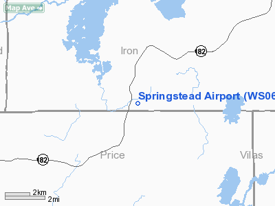
Location & QuickFacts
| FAA Information Effective: | 2008-09-25 |
| Airport Identifier: | WS06 |
| Airport Status: | Operational |
| Longitude/Latitude: | 090-09-48.5820W/45-59-15.8140N
-90.163495/45.987726 (Estimated) |
| Elevation: | 1600 ft / 487.68 m (Estimated) |
| Land: | 0 acres |
| From nearest city: | 14 nautical miles NE of Park Falls, WI |
| Location: | Iron County, WI |
| Magnetic Variation: | 00E (1985) |
Owner & Manager
| Ownership: | Privately owned |
| Owner: | Lugino D. Dalessandro |
| Address: | Hcr 2, Box 185
Park Falls, WI 54552 |
| Phone number: | 715-583-4533 |
| Manager: | Lugino D. Dalessandro |
| Address: | Hcr 2, Box 185
Park Falls, WI 54552 |
| Phone number: | 715-583-4533 |
Airport Operations and Facilities
| Airport Use: | Private |
| Segmented Circle: | No |
| Control Tower: | No |
| Sectional chart: | Green Bay |
| Region: | AGL - Great Lakes |
| Boundary ARTCC: | ZMP - Minneapolis |
| Tie-in FSS: | GRB - Green Bay |
| FSS on Airport: | No |
| FSS Toll Free: | 1-800-WX-BRIEF |
Runway Information
Runway 01/19
| Dimension: | 2000 x 60 ft / 609.6 x 18.3 m |
| Surface: | TURF, |
| |
Runway 01 |
Runway 19 |
| Traffic Pattern: | Left | Left |
|
Radio Navigation Aids
| ID |
Type |
Name |
Ch |
Freq |
Var |
Dist |
| PKF | NDB | Park Falls | | 371.00 | 01W | 11.2 nm |
| MHA | NDB | Manitowish | | 364.00 | 01W | 14.3 nm |
| ARV | NDB | Arbor Vitae | | 221.00 | 01W | 18.5 nm |
| PBH | NDB | Phillips | | 263.00 | 00E | 20.0 nm |
| DO | NDB | Dougy | | 236.00 | 01W | 20.3 nm |
| BDJ | NDB | Boulder Junction | | 206.00 | 02E | 22.9 nm |
| EGV | NDB | Eagle River | | 341.00 | 02W | 37.8 nm |
| LNL | NDB | Land O Lakes | | 396.00 | 02W | 40.9 nm |
| RXW | NDB | Watersmeet | | 407.00 | 01E | 41.0 nm |
| RCX | NDB | Rusk County | | 356.00 | 00W | 45.7 nm |
| ENY | NDB | Kennedy | | 254.00 | 02E | 46.1 nm |
| ASX | VOR/DME | Ashland | 039X | 110.20 | 02E | 46.1 nm |
| IWD | VORTAC | Ironwood | 025X | 108.80 | 01E | 32.8 nm |
| RHI | VORTAC | Rhinelander | 029X | 109.20 | 02E | 36.4 nm |
Images and information placed above are from
http://www.airport-data.com/airport/WS06/
We thank them for the data!
| General Info
|
| Country |
United States
|
| State |
WISCONSIN
|
| FAA ID |
WS06
|
| Latitude |
45-59-15.814N
|
| Longitude |
090-09-48.582W
|
| Elevation |
1600 feet
|
| Near City |
PARK FALLS
|
We don't guarantee the information is fresh and accurate. The data may
be wrong or outdated.
For more up-to-date information please refer to other sources.
|
|


