 |
|
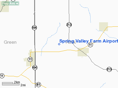
Spring Valley Farm Airport |
Location & QuickFacts
| FAA Information Effective: | 2008-09-25 |
| Airport Identifier: | 1WI0 |
| Airport Status: | Operational |
| Longitude/Latitude: | 089-18-40.4170W/42-38-33.0310N
-89.311227/42.642509 (Estimated) |
| Elevation: | 850 ft / 259.08 m (Estimated) |
| Land: | 0 acres |
| From nearest city: | 3 nautical miles N of Orfordville, WI |
| Location: | Rock County, WI |
| Magnetic Variation: | 00E (1985) |
Owner & Manager
| Ownership: | Privately owned |
| Owner: | Donald F. Wichelt |
| Address: | 9083 Haskell St
Riverside, CA 92503-5715 |
| Phone number: | 608-879-9066 |
| Address: |
|
Airport Operations and Facilities
| Airport Use: | Private |
| Wind indicator: | No |
| Segmented Circle: | No |
| Control Tower: | No |
| Landing fee charge: | No |
| Sectional chart: | Chicago |
| Region: | AGL - Great Lakes |
| Boundary ARTCC: | ZAU - Chicago |
| Tie-in FSS: | GRB - Green Bay |
| FSS on Airport: | No |
| FSS Toll Free: | 1-800-WX-BRIEF |
Airport Services
| Airframe Repair: | NONE |
| Power Plant Repair: | NONE |
Runway Information
Runway 09/27
| Dimension: | 1700 x 75 ft / 518.2 x 22.9 m |
| Surface: | TURF, |
| |
Runway 09 |
Runway 27 |
| Traffic Pattern: | Right | Right |
|
Radio Navigation Aids
| ID |
Type |
Name |
Ch |
Freq |
Var |
Dist |
| JVL | NDB | Janesville | | 375.00 | 03E | 12.1 nm |
| MS | NDB | Monah | | 400.00 | 00E | 25.3 nm |
| FEP | NDB | Freeport | | 335.00 | 00E | 26.8 nm |
| LVV | NDB | Lake Lawn | | 404.00 | 00W | 31.9 nm |
| RYV | NDB | Rock River | | 371.00 | 01W | 41.0 nm |
| MRJ | NDB | Mineral Point | | 365.00 | 00W | 43.0 nm |
| PVB | NDB | Platteville | | 203.00 | 01E | 49.8 nm |
| JVL | VOR/DME | Janesville | 090X | 114.30 | 03E | 10.4 nm |
| RFD | VOR/DME | Rockford | 045X | 110.80 | 01E | 25.5 nm |
| PLL | VOR/DME | Polo | 049X | 111.20 | 03E | 41.8 nm |
| BUU | VOR/DME | Burbun | 092X | 114.50 | 01W | 44.7 nm |
| MSN | VORTAC | Madison | 023X | 108.60 | 03E | 30.2 nm |
Remarks
- ALL DEPARTURES ON RWY 09, ALL ARRIVALS ON RWY 27.
Images and information placed above are from
http://www.airport-data.com/airport/1WI0/
We thank them for the data!
| General Info
|
| Country |
United States
|
| State |
WISCONSIN
|
| FAA ID |
1WI0
|
| Latitude |
42-38-33.031N
|
| Longitude |
089-18-40.417W
|
| Elevation |
850 feet
|
| Near City |
ORFORDVILLE
|
We don't guarantee the information is fresh and accurate. The data may
be wrong or outdated.
For more up-to-date information please refer to other sources.
|
|


