 |
|
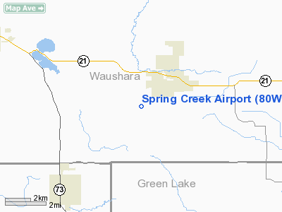
Location & QuickFacts
| FAA Information Effective: | 2008-09-25 |
| Airport Identifier: | 80WI |
| Airport Status: | Operational |
| Longitude/Latitude: | 089-08-18.4230W/44-01-22.9250N
-89.138451/44.023035 (Estimated) |
| Elevation: | 800 ft / 243.84 m (Estimated) |
| Land: | 0 acres |
| From nearest city: | 1 nautical miles E of Spring Lake, WI |
| Location: | Waushara County, WI |
| Magnetic Variation: | 00W (1985) |
Owner & Manager
| Ownership: | Privately owned |
| Owner: | Gerald Bellings |
| Address: | Rte 1 Box 1474
Neshkoro, WI 54960 |
| Phone number: | 414-566-4337 |
| Manager: | Gerald Bellings |
| Address: | Rte 1 Box 1474
Neshkoro, WI 54960 |
| Phone number: | 414-566-4337 |
Airport Operations and Facilities
| Airport Use: | Private |
| Wind indicator: | Yes |
| Segmented Circle: | No |
| Control Tower: | No |
| Sectional chart: | Green Bay |
| Region: | AGL - Great Lakes |
| Boundary ARTCC: | ZAU - Chicago |
| Tie-in FSS: | GRB - Green Bay |
| FSS on Airport: | No |
| FSS Toll Free: | 1-800-WX-BRIEF |
Runway Information
Runway N/S
| Dimension: | 2800 x 100 ft / 853.4 x 30.5 m |
| Surface: | TURF, |
| |
Runway N |
Runway S |
| Traffic Pattern: | Left | Right |
|
Radio Navigation Aids
| ID |
Type |
Name |
Ch |
Freq |
Var |
Dist |
| PCZ | NDB | Waupaca | | 382.00 | 01W | 19.3 nm |
| AQ | NDB | Kooky | | 407.00 | 02W | 34.0 nm |
| ISW | NDB | Wisconsin Rapids | | 215.00 | 01W | 36.5 nm |
| CLI | NDB | Clintonville | | 209.00 | 02W | 39.8 nm |
| UNU | NDB | Juneau | | 344.00 | 01W | 40.4 nm |
| SG | NDB | Depre | | 332.00 | 02W | 48.9 nm |
| VOK | TACAN | Volk | 041X | | 00E | 48.7 nm |
| OSH | VORTAC | Oshkosh | 055X | 111.80 | 02E | 25.3 nm |
| STE | VORTAC | Stevens Point | 043X | 110.60 | 01W | 35.5 nm |
| DLL | VORTAC | Dells | 117X | 117.00 | 03E | 39.3 nm |
Remarks
- PROVIDED ALL TRAFFIC PATTERN OPERATIONS ARE CONDITIONAL ON WEST SIDE OF RUNWAY.
Images and information placed above are from
http://www.airport-data.com/airport/80WI/
We thank them for the data!
| General Info
|
| Country |
United States
|
| State |
WISCONSIN
|
| FAA ID |
80WI
|
| Latitude |
44-01-22.925N
|
| Longitude |
089-08-18.423W
|
| Elevation |
800 feet
|
| Near City |
SPRING LAKE
|
We don't guarantee the information is fresh and accurate. The data may
be wrong or outdated.
For more up-to-date information please refer to other sources.
|
|


