 |
|
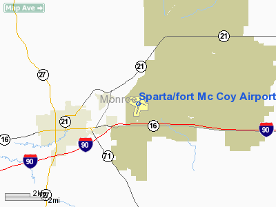
Sparta/fort Mc Coy Airport |
| Sparta/Fort McCoy Airport |
| IATA: CMY – ICAO: KCMY |
| Summary |
| Airport type |
Public |
| Operator |
U.S. Army |
| Location |
Sparta, Wisconsin |
| Elevation AMSL |
837 ft / 255.1 m |
| Coordinates |
43°57′30″N 90°44′16″W / 43.95833°N 90.73778°W / 43.95833; -90.73778Coordinates: 43°57′30″N 90°44′16″W / 43.95833°N 90.73778°W / 43.95833; -90.73778 |
| Runways |
| Direction |
Length |
Surface |
| ft |
m |
| 11/29 |
4,708 |
1,435 |
Asphalt |
| 01/19 |
4,295 |
1,309 |
Asphalt |
Sparta/Fort McCoy Airport (IATA: CMY, ICAO: KCMY) is a public airport located in Monroe County, Wisconsin three miles north-east of Sparta. The airport is also used heavily by the U.S. Army, accounting for 70% of traffic operations, primarily transient military aircraft supporting operations at nearby Fort McCoy, which is a major training facility. The airport has no scheduled civilian air service.
The above content comes from Wikipedia and is published under free licenses – click here to read more.
Location & QuickFacts
| FAA Information Effective: | 2008-09-25 |
| Airport Identifier: | CMY |
| Airport Status: | Operational |
| Longitude/Latitude: | 090-44-16.4310W/43-57-30.0530N
-90.737897/43.958348 (Estimated) |
| Elevation: | 837 ft / 255.12 m (Surveyed) |
| Land: | 640 acres |
| From nearest city: | 3 nautical miles NE of Sparta, WI |
| Location: | Monroe County, WI |
| Magnetic Variation: | 00E (2000) |
Owner & Manager
| Ownership: | Army owned |
| Owner: | U S Army
US ARMY LEASES PART OF ARPT TO CITY OF SPARTA. |
| Address: | Commander
Fort Mc Coy, WI 54656 |
| Phone number: | 608-388-3001 |
| Manager: | Randy Willer
CITY OF SPARTA AMGR JORDAN SKIFF. |
| Address: | Attn:imnw-mcy-pla
Fort Mc Coy, WI 54656 |
| Phone number: | 608-388-4207 |
Airport Operations and Facilities
| Airport Use: | Open to public |
| Wind indicator: | Yes |
| Segmented Circle: | Yes |
| Control Tower: | Yes |
| Lighting Schedule: | DUSK-DAWN
ACTVT MIRL RYS 01/19 & 11/29 - CTAF. |
| Beacon Color: | Clear-Green (lighted land airport) |
| Sectional chart: | Chicago |
| Region: | AGL - Great Lakes |
| Boundary ARTCC: | ZAU - Chicago |
| Tie-in FSS: | GRB - Green Bay |
| FSS on Airport: | No |
| FSS Toll Free: | 1-800-WX-BRIEF |
| NOTAMs Facility: | CMY (NOTAM-d service avaliable) |
| Federal Agreements: | N |
Airport Communications
Airport Services
| Fuel available: | 100LL
PPR FOR FUEL - CALL 608-269-3122. |
Runway Information
Runway 01/19
| Dimension: | 4295 x 50 ft / 1309.1 x 15.2 m |
| Surface: | ASPH, Fair Condition |
| Edge Lights: | Medium |
| |
Runway 01 |
Runway 19 |
| Longitude: | 090-44-24.9000W | 090-44-09.2680W |
| Latitude: | 43-57-03.9500N | 43-57-44.8540N |
| Elevation: | 837.00 ft | 826.00 ft |
| Alignment: | 15 | 127 |
| Traffic Pattern: | Left | Left |
| Markings: | Non-precision instrument, Good Condition | Non-precision instrument, Good Condition |
| Displaced threshold: | 1375.00 ft | 0.00 ft |
| Obstruction: | 15 ft road, 200.0 ft from runway
APCH RATIO 50:1 AT DSPLCD THR.
ROAD 150 FT FM THLD & 250 FT L. | 55 ft trees, 1300.0 ft from runway, 100 ft right of centerline, 20:1 slope to clear
+8' BRUSH 60' FM THR 0-50' R. |
|
Runway 11/29
| Dimension: | 4708 x 100 ft / 1435.0 x 30.5 m |
| Surface: | ASPH, Good Condition |
| Edge Lights: | Medium |
| |
Runway 11 |
Runway 29 |
| Longitude: | 090-44-45.6460W | 090-43-46.0200W |
| Latitude: | 43-57-43.9680N | 43-57-26.4310N |
| Elevation: | 822.00 ft | 832.00 ft |
| Alignment: | 112 | 127 |
| Traffic Pattern: | Left | Left |
| Markings: | Non-precision instrument, Good Condition | Non-precision instrument, Good Condition |
| Crossing Height: | 0.00 ft | 65.00 ft |
| Displaced threshold: | 0.00 ft | 425.00 ft |
| VASI: | | pulsating/steady burning on right side |
| Visual Glide Angle: | 0.00° | 3.00° |
| Runway End Identifier: | Yes | Yes |
| Obstruction: | 26 ft trees, 650.0 ft from runway, 175 ft left of centerline, 17:1 slope to clear | 15 ft road, 200.0 ft from runway, 10 ft left of centerline
APCH RATIO 21:1 AT DSPLCD THR; 15 FT ROAD AT 325 FT; 275 FT L OF CNTRLN.
ROAD 0-200 FT FM THLD 10-100 FT L. |
|
Radio Navigation Aids
| ID |
Type |
Name |
Ch |
Freq |
Var |
Dist |
| CMY | NDB | Mccoy | | 412.00 | 00E | 4.3 nm |
| BCK | NDB | Black River Falls | | 362.00 | 00E | 18.4 nm |
| HBW | NDB | Kickapoo | | 251.00 | 03E | 25.3 nm |
| VIQ | NDB | Neillsville | | 368.00 | 01W | 37.3 nm |
| CHU | NDB | Caledonia | | 209.00 | 03E | 39.6 nm |
| ISW | NDB | Wisconsin Rapids | | 215.00 | 01W | 45.8 nm |
| MFI | NDB | Marshfield | | 391.00 | 00E | 47.4 nm |
| VOK | TACAN | Volk | 041X | | 00E | 20.7 nm |
| LSE | VOR/DME | La Crosse | 021X | 108.40 | 02E | 23.0 nm |
| ONA | VOR/DME | Winona | 051X | 111.40 | 01E | 42.4 nm |
| LNR | VOR/DME | Lone Rock | 075X | 112.80 | 00E | 47.8 nm |
| ODI | VORTAC | Nodine | 126X | 117.90 | 01E | 31.7 nm |
| DLL | VORTAC | Dells | 117X | 117.00 | 03E | 48.9 nm |
Remarks
- GCO AVBL ON FREQ 121.725 THRU FLT SVCS.
- OCCASIONAL WILDGAME & BIRDS ON & INVOF ARPT.
- NO OBJECTION
Images and information placed above are from
http://www.airport-data.com/airport/CMY/
We thank them for the data!
| General Info
|
| Country |
United States
|
| State |
WISCONSIN
|
| FAA ID |
CMY
|
| Latitude |
43-57-30.053N
|
| Longitude |
090-44-16.431W
|
| Elevation |
837 feet
|
| Near City |
SPARTA
|
We don't guarantee the information is fresh and accurate. The data may
be wrong or outdated.
For more up-to-date information please refer to other sources.
|
|


