 |
|
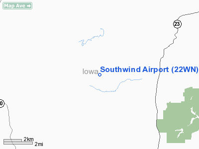
Location & QuickFacts
| FAA Information Effective: | 2008-09-25 |
| Airport Identifier: | 22WN |
| Airport Status: | Operational |
| Longitude/Latitude: | 090-13-10.1400W/43-04-06.9700N
-90.219483/43.068603 (Estimated) |
| Elevation: | 1030 ft / 313.94 m (Estimated) |
| Land: | 5 acres |
| From nearest city: | 9 nautical miles NW of Dodgeville, WI |
| Location: | Iowa County, WI |
| Magnetic Variation: | 00W (2000) |
Owner & Manager
| Ownership: | Privately owned |
| Owner: | Ronald G. Fedler |
| Address: | 3287 Hunter Hollow Rd.
Dodgeville, WI 53533 |
| Phone number: | 608-935-5455 |
| Manager: | Ronald G. Fedler |
| Address: | 3287 Hunter Hollow Rd.
Dodgeville, WI 53533 |
| Phone number: | 608-935-5455 |
Airport Operations and Facilities
| Airport Use: | Private |
| Wind indicator: | Yes |
| Segmented Circle: | No |
| Control Tower: | No |
| Sectional chart: | Green Bay |
| Region: | AGL - Great Lakes |
| Boundary ARTCC: | ZAU - Chicago |
| Tie-in FSS: | GRB - Green Bay |
| FSS Toll Free: | 1-800-WX-BRIEF |
Runway Information
Runway 11/29
| Dimension: | 1800 x 75 ft / 548.6 x 22.9 m |
| Surface: | TURF, |
| |
Runway 11 |
Runway 29 |
| Traffic Pattern: | Left | Left |
|
Radio Navigation Aids
| ID |
Type |
Name |
Ch |
Freq |
Var |
Dist |
| MRJ | NDB | Mineral Point | | 365.00 | 00W | 10.9 nm |
| PVB | NDB | Platteville | | 203.00 | 01E | 24.8 nm |
| HBW | NDB | Kickapoo | | 251.00 | 03E | 35.6 nm |
| MS | NDB | Monah | | 400.00 | 00E | 38.4 nm |
| LNR | VOR/DME | Lone Rock | 075X | 112.80 | 00E | 14.1 nm |
| DLL | VORTAC | Dells | 117X | 117.00 | 03E | 35.2 nm |
| MSN | VORTAC | Madison | 023X | 108.60 | 03E | 38.9 nm |
| DBQ | VORTAC | Dubuque | 105X | 115.80 | 04E | 45.6 nm |
Remarks
- PRVDD CLEAR 20:1 APCH, CLEAR OBSTACLE FREE ZONE, AND CLEAR RUNWAY SAFETY AREA.
Images and information placed above are from
http://www.airport-data.com/airport/22WN/
We thank them for the data!
|
|


