 |
|
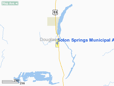
Solon Springs Muni Airport |
Location & QuickFacts
| FAA Information Effective: | 2008-09-25 |
| Airport Identifier: | OLG |
| Airport Status: | Operational |
| Longitude/Latitude: | 091-48-58.9530W/46-18-53.1030N
-91.816376/46.314751 (Estimated) |
| Elevation: | 1102 ft / 335.89 m (Estimated) |
| Land: | 111 acres |
| From nearest city: | 3 nautical miles S of Solon Springs, WI |
| Location: | Douglas County, WI |
| Magnetic Variation: | 01E (1990) |
Owner & Manager
| Ownership: | Publicly owned |
| Owner: | Town Of Solon Springs |
| Address: |
Solon Springs, WI 54873 |
| Phone number: | 715-378-2235 |
| Manager: | George Fairfield |
| Address: | P.o. Box 36
Solon Springs, WI 54573 |
| Phone number: | 715-378-2235 |
Airport Operations and Facilities
| Airport Use: | Open to public |
| Wind indicator: | Yes |
| Segmented Circle: | No |
| Control Tower: | No |
| Lighting Schedule: | DUSK-DAWN
LIRL RY 01/19 PRESET LOW INTST DUSK-DAWN; ACTVT HIGHER INTST - CTAF. |
| Beacon Color: | Clear-Green (lighted land airport) |
| Landing fee charge: | No |
| Sectional chart: | Green Bay |
| Region: | AGL - Great Lakes |
| Traffic Pattern Alt: | 1000 ft |
| Boundary ARTCC: | ZMP - Minneapolis |
| Tie-in FSS: | GRB - Green Bay |
| FSS on Airport: | No |
| FSS Toll Free: | 1-800-WX-BRIEF |
| NOTAMs Facility: | GRB (NOTAM-d service avaliable) |
| Federal Agreements: | 1 |
Airport Communications
Airport Services
| Fuel available: | 100LL |
| Airframe Repair: | MINOR
ACFT MECH ON CALL 715-399-2171. |
| Power Plant Repair: | MINOR |
| Bottled Oxygen: | NONE |
| Bulk Oxygen: | NONE |
Runway Information
Runway 01/19
| Dimension: | 3100 x 60 ft / 944.9 x 18.3 m |
| Surface: | ASPH, Good Condition |
| Weight Limit: | Single wheel: 27000 lbs. |
| Edge Lights: | Low |
| |
Runway 01 |
Runway 19 |
| Longitude: | 091-49-01.9300W | 091-48-55.9750W |
| Latitude: | 46-18-37.9470N | 46-19-08.2580N |
| Elevation: | 1101.00 ft | 1100.00 ft |
| Alignment: | 8 | 127 |
| Traffic Pattern: | Left | Left |
| Markings: | Non-precision instrument, Good Condition | Non-precision instrument, Good Condition |
| Runway End Identifier: | No | No |
| Centerline Lights: | No | No |
| Touchdown Lights: | No | No |
| Obstruction: | 33 ft trees, 1300.0 ft from runway, 200 ft right of centerline, 33:1 slope to clear | 41 ft trees, 1400.0 ft from runway, 250 ft left of centerline, 29:1 slope to clear |
|
Radio Navigation Aids
| ID |
Type |
Name |
Ch |
Freq |
Var |
Dist |
| OLG | NDB | Solon Springs | | 388.00 | 01E | 0.2 nm |
| SLY | NDB | Seeley | | 344.00 | 01E | 21.7 nm |
| SUW | NDB | Bong | | 260.00 | 01E | 25.6 nm |
| SSQ | NDB | Shell Lake | | 212.00 | 01E | 35.5 nm |
| COQ | NDB | Cloquet | | 335.00 | 03E | 36.5 nm |
| BXR | NDB | Big Doctor | | 203.00 | 02E | 37.5 nm |
| DL | NDB | Pykla | | 379.00 | 02E | 38.9 nm |
| ENY | NDB | Kennedy | | 254.00 | 02E | 40.0 nm |
| MZH | NDB | Moose Lake | | 362.00 | 02E | 41.4 nm |
| TWM | NDB | Two Harbors | | 243.00 | 01E | 44.4 nm |
| UBE | NDB | Cumberland | | 375.00 | 01E | 48.9 nm |
| LKI | TACAN | Lakeside | 011X | | 05E | 35.3 nm |
| HYR | VOR/DME | Hayward | 081X | 113.40 | 03E | 23.5 nm |
| RZN | VOR/DME | Siren | 031X | 109.40 | 02E | 37.7 nm |
| ASX | VOR/DME | Ashland | 039X | 110.20 | 02E | 39.8 nm |
| DLH | VORTAC | Duluth | 073X | 112.60 | 05E | 33.4 nm |
Remarks
- TWY TO RAMP FM RY MARKED BY REFLECTORS.
- NUMEROUS DEER ON ARPT.
Images and information placed above are from
http://www.airport-data.com/airport/OLG/
We thank them for the data!
| General Info
|
| Country |
United States
|
| State |
WISCONSIN
|
| FAA ID |
OLG
|
| Latitude |
46-18-53.103N
|
| Longitude |
091-48-58.953W
|
| Elevation |
1102 feet
|
| Near City |
SOLON SPRINGS
|
We don't guarantee the information is fresh and accurate. The data may
be wrong or outdated.
For more up-to-date information please refer to other sources.
|
|


