 |
|
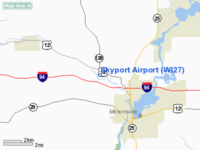
Location & QuickFacts
| FAA Information Effective: | 2008-09-25 |
| Airport Identifier: | WI27 |
| Airport Status: | Operational |
| Longitude/Latitude: | 091-58-29.6400W/44-55-12.8670N
-91.974900/44.920241 (Estimated) |
| Elevation: | 878 ft / 267.61 m (Estimated) |
| Land: | 5 acres |
| From nearest city: | 3 nautical miles NW of Menomonie, WI |
| Location: | Dunn County, WI |
| Magnetic Variation: | 02E (1985) |
Owner & Manager
| Ownership: | Privately owned |
| Owner: | Charles L. Thomas |
| Address: | E 5279 750th Ave
Menomonie, WI 54751 |
| Phone number: | 715-235-5920 |
| Manager: | Charles L. Thomas |
| Address: | E 5279 750th Ave
Menomonie, WI 54751 |
| Phone number: | 715-235-5920 |
Airport Operations and Facilities
| Airport Use: | Private |
| Wind indicator: | Yes |
| Segmented Circle: | No |
| Control Tower: | No |
| Landing fee charge: | No |
| Sectional chart: | Green Bay |
| Region: | AGL - Great Lakes |
| Boundary ARTCC: | ZMP - Minneapolis |
| Tie-in FSS: | GRB - Green Bay |
| FSS on Airport: | No |
| FSS Toll Free: | 1-800-WX-BRIEF |
Airport Services
| Airframe Repair: | NONE |
| Power Plant Repair: | NONE |
Runway Information
Runway 15/33
| Dimension: | 1900 x 65 ft / 579.1 x 19.8 m |
| Surface: | TURF, |
| |
Runway 15 |
Runway 33 |
| Traffic Pattern: | Left | Left |
| Obstruction: | 40 ft pline, 200.0 ft from runway | |
|
Radio Navigation Aids
| ID |
Type |
Name |
Ch |
Freq |
Var |
Dist |
| RNH | NDB | New Richmond | | 257.00 | 02E | 27.4 nm |
| AHH | NDB | Ameron | | 278.00 | 01E | 27.5 nm |
| UBE | NDB | Cumberland | | 375.00 | 01E | 35.4 nm |
| OEO | NDB | Osceola | | 233.00 | 01E | 38.3 nm |
| PPI | NDB | Hopey | | 400.00 | 03E | 41.3 nm |
| MS | NDB | Narco | | 266.00 | 02E | 47.9 nm |
| SSQ | NDB | Shell Lake | | 212.00 | 01E | 48.6 nm |
| RPD | VOR/DME | Rice Lake | 037X | 110.00 | 01E | 30.9 nm |
| EAU | VORTAC | Eau Claire | 076X | 112.90 | 04E | 21.2 nm |
| STP | VOT | St Paul | | 114.40 | | 46.2 nm |
Remarks
Images and information placed above are from
http://www.airport-data.com/airport/WI27/
We thank them for the data!
| General Info
|
| Country |
United States
|
| State |
WISCONSIN
|
| FAA ID |
WI27
|
| Latitude |
44-55-12.867N
|
| Longitude |
091-58-29.640W
|
| Elevation |
878 feet
|
| Near City |
MENOMONIE
|
We don't guarantee the information is fresh and accurate. The data may
be wrong or outdated.
For more up-to-date information please refer to other sources.
|
|


