 |
|
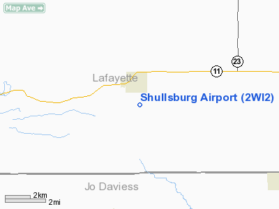
Location & QuickFacts
| FAA Information Effective: | 2008-09-25 |
| Airport Identifier: | 2WI2 |
| Airport Status: | Operational |
| Longitude/Latitude: | 090-13-39.4550W/42-33-25.0090N
-90.227626/42.556947 (Estimated) |
| Elevation: | 1080 ft / 329.18 m (Estimated) |
| Land: | 0 acres |
| From nearest city: | 1 nautical miles S of Shullsburg, WI |
| Location: | Lafayette County, WI |
| Magnetic Variation: | 01E (1985) |
Owner & Manager
| Ownership: | Privately owned |
| Owner: | J.c. And W.p. Hanifan |
| Address: | 135 E. Water St.
Shullsberg, WI 53586 |
| Phone number: | 815-459-1649 |
| Address: |
|
Airport Operations and Facilities
| Airport Use: | Private |
| Wind indicator: | Yes |
| Segmented Circle: | No |
| Control Tower: | No |
| Landing fee charge: | No |
| Sectional chart: | Chicago |
| Region: | AGL - Great Lakes |
| Boundary ARTCC: | ZAU - Chicago |
| Tie-in FSS: | GRB - Green Bay |
| FSS on Airport: | No |
| FSS Toll Free: | 1-800-WX-BRIEF |
Airport Services
| Airframe Repair: | NONE |
| Power Plant Repair: | NONE |
Runway Information
Runway NW/SE
| Dimension: | 1600 x 300 ft / 487.7 x 91.4 m |
| Surface: | TURF, |
| |
Runway NW |
Runway SE |
| Traffic Pattern: | Left | Left |
|
Radio Navigation Aids
| ID |
Type |
Name |
Ch |
Freq |
Var |
Dist |
| PVB | NDB | Platteville | | 203.00 | 01E | 12.1 nm |
| MRJ | NDB | Mineral Point | | 365.00 | 00W | 19.9 nm |
| FEP | NDB | Freeport | | 335.00 | 00E | 34.1 nm |
| OQW | NDB | Maquoketa | | 386.00 | 02E | 38.0 nm |
| CWI | NDB | Clinton | | 377.00 | 01E | 44.0 nm |
| MXO | NDB | Monticello | | 397.00 | 01E | 45.7 nm |
| MS | NDB | Monah | | 400.00 | 00E | 49.4 nm |
| LNR | VOR/DME | Lone Rock | 075X | 112.80 | 00E | 44.5 nm |
| PLL | VOR/DME | Polo | 049X | 111.20 | 03E | 47.4 nm |
| JVL | VOR/DME | Janesville | 090X | 114.30 | 03E | 49.7 nm |
| RFD | VOR/DME | Rockford | 045X | 110.80 | 01E | 49.8 nm |
| DBQ | VORTAC | Dubuque | 105X | 115.80 | 04E | 23.3 nm |
Remarks
- ESTABLISHED PRIOR TO 1959.
Images and information placed above are from
http://www.airport-data.com/airport/2WI2/
We thank them for the data!
| General Info
|
| Country |
United States
|
| State |
WISCONSIN
|
| FAA ID |
2WI2
|
| Latitude |
42-33-25.009N
|
| Longitude |
090-13-39.455W
|
| Elevation |
1080 feet
|
| Near City |
SHULLSBURG
|
We don't guarantee the information is fresh and accurate. The data may
be wrong or outdated.
For more up-to-date information please refer to other sources.
|
|


