 |
|
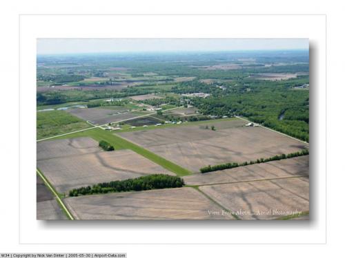 |
(Click on the photo to enlarge) |
Location & QuickFacts
| FAA Information Effective: | 2008-09-25 |
| Airport Identifier: | W34 |
| Airport Status: | Operational |
| Longitude/Latitude: | 088-33-42.3640W/44-27-16.9410N
-88.561768/44.454706 (Estimated) |
| Elevation: | 769 ft / 234.39 m (Estimated) |
| Land: | 45 acres |
| From nearest city: | 1 nautical miles NE of Shiocton, WI |
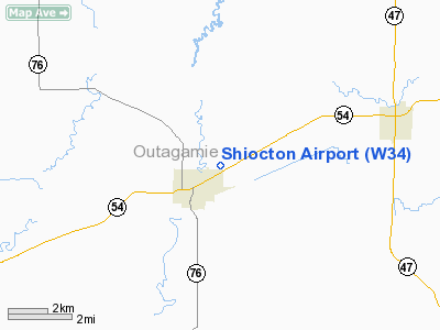
| Location: | Outagamie County, WI |
| Magnetic Variation: | 01W (1985) |
Owner & Manager
| Ownership: | Privately owned |
| Owner: | Shiocton Flyers Club Inc |
| Address: | 7551 Park Ave
Shiocton, WI 54170 |
| Phone number: | 920-986-3690 |
| Manager: | Patrick J Van Straten |
| Address: | 7551 Park Ave
Shiocton, WI 54170 |
| Phone number: | 920-986-3690 |
Airport Operations and Facilities
| Airport Use: | Open to public |
| Wind indicator: | Yes |
| Segmented Circle: | No |
| Control Tower: | No |
| Sectional chart: | Green Bay |
| Region: | AGL - Great Lakes |
| Boundary ARTCC: | ZMP - Minneapolis |
| Tie-in FSS: | GRB - Green Bay |
| FSS Toll Free: | 1-800-WX-BRIEF |
| NOTAMs Facility: | GRB (NOTAM-d service avaliable) |
Airport Communications
Airport Services
Runway Information
Runway 09/27
| Dimension: | 1415 x 110 ft / 431.3 x 33.5 m
RY 09/27 REMEASURED.
RY 18/36 REMEASURED. |
| Surface: | TURF, Good Condition |
| |
Runway 09 |
Runway 27 |
| Longitude: | 088-33-58.4300W | 088-33-40.3000W |
| Latitude: | 44-27-10.9400N | 44-27-10.9400N |
| Elevation: | 770.00 ft | 770.00 ft |
| Traffic Pattern: | Left | Left |
| Obstruction: | 83 ft tree, 1500.0 ft from runway, 100 ft right of centerline, 18:1 slope to clear | 16 ft road, 320.0 ft from runway, 150 ft left of centerline, 20:1 slope to clear |
|
Runway 18/36
| Dimension: | 2340 x 110 ft / 713.2 x 33.5 m
RY 09/27 REMEASURED.
RY 18/36 REMEASURED. |
| Surface: | TURF, Good Condition |
| |
Runway 18 |
Runway 36 |
| Longitude: | 088-33-38.3600W | 088-33-38.3600W |
| Latitude: | 44-27-35.8000N | 44-27-14.0800N |
| Elevation: | 770.00 ft | 770.00 ft |
| Traffic Pattern: | Left | Left |
| Runway End Identifier: | Yes
18/36 NSTD REIL; SOLAR POWERED. | Yes |
| Obstruction: | 76 ft trees, 2600.0 ft from runway, 150 ft left of centerline, 34:1 slope to clear | 27 ft ant, 380.0 ft from runway, 125 ft left of centerline, 14:1 slope to clear |
|
Radio Navigation Aids
| ID |
Type |
Name |
Ch |
Freq |
Var |
Dist |
| CLI | NDB | Clintonville | | 209.00 | 02W | 12.3 nm |
| AQ | NDB | Kooky | | 407.00 | 02W | 16.0 nm |
| SG | NDB | Depre | | 332.00 | 02W | 18.7 nm |
| PCZ | NDB | Waupaca | | 382.00 | 01W | 20.9 nm |
| OCQ | NDB | Oconto | | 388.00 | 03W | 37.6 nm |
| AIG | NDB | Antigo | | 347.00 | 02W | 48.4 nm |
| MTW | VOR/DME | Manitowoc | 047X | 111.00 | 02W | 42.7 nm |
| GRB | VORTAC | Green Bay | 102X | 115.50 | 01E | 16.8 nm |
| OSH | VORTAC | Oshkosh | 055X | 111.80 | 02E | 27.9 nm |
| STE | VORTAC | Stevens Point | 043X | 110.60 | 01W | 41.9 nm |
| AUW | VORTAC | Wausau | 053X | 111.60 | 02E | 49.8 nm |
Remarks
- DEER ACTIVITY ON AND INVOF ARPT.
- PRVDD THRS LCTD/DSPLCD TO PROVIDE 20:1 APCH SLOPE OVR ANY OBSTACLES IN APCH SFC AREAS.
Images and information placed above are from
http://www.airport-data.com/airport/W34/
We thank them for the data!
| General Info
|
| Country |
United States
|
| State |
WISCONSIN
|
| FAA ID |
W34
|
| Latitude |
44-27-16.941N
|
| Longitude |
088-33-42.364W
|
| Elevation |
769 feet
|
| Near City |
SHIOCTON
|
We don't guarantee the information is fresh and accurate. The data may
be wrong or outdated.
For more up-to-date information please refer to other sources.
|
|


