 |
|
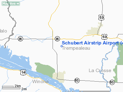
Schubert Airstrip Airport |
Location & QuickFacts
| FAA Information Effective: | 2008-09-25 |
| Airport Identifier: | 40WI |
| Airport Status: | Operational |
| Longitude/Latitude: | 091-25-50.5280W/44-03-29.8640N
-91.430702/44.058296 (Estimated) |
| Elevation: | 750 ft / 228.60 m (Estimated) |
| Land: | 0 acres |
| From nearest city: | 1 nautical miles SE of Centerville, WI |
| Location: | Trempealeau County, WI |
| Magnetic Variation: | 02E (1985) |
Owner & Manager
| Ownership: | Privately owned |
| Owner: | E. Alvin Schubert |
| Address: | Rt 3, Box 629
Galesville, WI 54630 |
| Manager: | E. Alvin Schubert |
| Address: | Rt 3, Box 629
Galesville, WI 54630 |
Airport Operations and Facilities
| Airport Use: | Private |
| Wind indicator: | Yes |
| Segmented Circle: | No |
| Control Tower: | No |
| Sectional chart: | Green Bay |
| Region: | AGL - Great Lakes |
| Boundary ARTCC: | ZMP - Minneapolis |
| Tie-in FSS: | GRB - Green Bay |
| FSS on Airport: | No |
| FSS Toll Free: | 1-800-WX-BRIEF |
Runway Information
Runway 09L/27R
| Dimension: | 2500 x 50 ft / 762.0 x 15.2 m |
| Surface: | TURF, |
| |
Runway 09L |
Runway 27R |
| Traffic Pattern: | Left | Left |
|
Runway 09R/27L
| Dimension: | 2250 x 50 ft / 685.8 x 15.2 m |
| Surface: | TURF, |
| |
Runway 09R |
Runway 27L |
| Traffic Pattern: | Left | Left |
|
Radio Navigation Aids
| ID |
Type |
Name |
Ch |
Freq |
Var |
Dist |
| BCK | NDB | Black River Falls | | 362.00 | 00E | 27.7 nm |
| CHU | NDB | Caledonia | | 209.00 | 03E | 28.5 nm |
| CMY | NDB | Mccoy | | 412.00 | 00E | 34.9 nm |
| DEH | NDB | Decorah | | 236.00 | 01E | 48.9 nm |
| VIQ | NDB | Neillsville | | 368.00 | 01W | 49.5 nm |
| ONA | VOR/DME | Winona | 051X | 111.40 | 01E | 11.9 nm |
| LSE | VOR/DME | La Crosse | 021X | 108.40 | 02E | 13.3 nm |
| ODI | VORTAC | Nodine | 126X | 117.90 | 01E | 8.9 nm |
| UKN | VORTAC | Waukon | 113X | 116.60 | 05E | 47.0 nm |
Remarks
- MODEL PLANES ON OR NEAR WEST END OF RY ON WEEKENDS DURING GOOD WEATHER.
- E111: FILED FOR RECORD PURPOSES.
Images and information placed above are from
http://www.airport-data.com/airport/40WI/
We thank them for the data!
| General Info
|
| Country |
United States
|
| State |
WISCONSIN
|
| FAA ID |
40WI
|
| Latitude |
44-03-29.864N
|
| Longitude |
091-25-50.528W
|
| Elevation |
750 feet
|
| Near City |
CENTERVILLE
|
We don't guarantee the information is fresh and accurate. The data may
be wrong or outdated.
For more up-to-date information please refer to other sources.
|
|


