 |
|
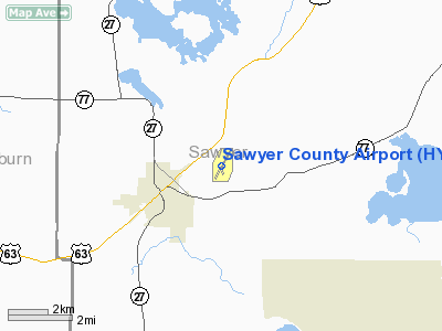
| Sawyer County Airport |
| IATA: HYR – ICAO: KHYR – FAA LID: HYR |
| Summary |
| Owner/Operator |
Sawyer County, Wisconsin |
| Location |
Hayward, Wisconsin |
| Elevation AMSL |
1,216 ft / 370.6 m |
| Coordinates |
46°01.515′N 091°26.657′W / 46.02525°N 91.444283°W / 46.02525; -91.444283Coordinates: 46°01.515′N 091°26.657′W / 46.02525°N 91.444283°W / 46.02525; -91.444283 |
| Runways |
| Direction |
Length |
Surface |
| ft |
m |
| 2/20 |
5,003 |
1,525 |
asphalt |
| 16/34 |
1,240 |
378 |
turf |
| Statistics (2006) |
| Operations |
10,400 |
| Based A/C |
28 |
| Stats for 12 months ending August 30, 2006 |
Sawyer County Airport (IATA: HYR, ICAO: KHYR, FAA LID: HYR) is a public airport located near Hayward, Wisconsin.
Facilities
- Runway 2/20 5,003 x 100 ft. (1,525 x 30 m), asphalt
- Runway 16/34 1,240 x 120 ft. (378 x 37 m), turf
- Hayward (HYR) VOR/DME, 113.4 MHz, is located on field.
- L & L Aviation is the fixed base operator.
The above content comes from Wikipedia and is published under free licenses – click here to read more.
Location & QuickFacts
| FAA Information Effective: | 2008-09-25 |
| Airport Identifier: | HYR |
| Airport Status: | Operational |
| Longitude/Latitude: | 091-26-39.4000W/46-01-30.9000N
-91.444278/46.025250 (Estimated) |
| Elevation: | 1216 ft / 370.64 m (Surveyed) |
| Land: | 380 acres |
| From nearest city: | 2 nautical miles NE of Hayward, WI |
| Location: | Sawyer County, WI |
| Magnetic Variation: | 00E (2000) |
Owner & Manager
| Ownership: | Publicly owned |
| Owner: | Sawyer County |
| Address: | Courthouse
Hayward, WI 54843 |
| Phone number: | 715-634-4866 |
| Manager: | Daniel R. Leslie |
| Address: | 10930 N Arpt Rd
Hayward, WI 54843 |
| Phone number: | 715-634-4624 |
Airport Operations and Facilities
| Airport Use: | Open to public |
| Wind indicator: | Yes |
| Segmented Circle: | No |
| Control Tower: | No |
| Lighting Schedule: | DUSK-DAWN
ACTVT MIRL RY 02/20, PAPI RYS 02, 20, REIL RYS RY 02 & 20 - CTAF |
| Beacon Color: | Clear-Green (lighted land airport) |
| Landing fee charge: | No |
| Sectional chart: | Green Bay |
| Region: | AGL - Great Lakes |
| Boundary ARTCC: | ZMP - Minneapolis |
| Tie-in FSS: | GRB - Green Bay |
| FSS on Airport: | No |
| FSS Toll Free: | 1-800-WX-BRIEF |
| NOTAMs Facility: | HYR (NOTAM-d service avaliable) |
| Federal Agreements: | NGY |
Airport Communications
| CTAF: | 122.800 |
| Unicom: | 122.800 |
Airport Services
| Fuel available: | 100LLA |
| Bulk Oxygen: | NONE |
Runway Information
Runway 02/20
| Dimension: | 5003 x 100 ft / 1524.9 x 30.5 m |
| Surface: | ASPH, Good Condition |
| Weight Limit: | Single wheel: 40000 lbs.
Dual wheel: 65000 lbs. |
| Edge Lights: | Medium |
| |
Runway 02 |
Runway 20 |
| Longitude: | 091-26-54.1272W | 091-26-24.4193W |
| Latitude: | 46-01-10.6624N | 46-01-55.4991N |
| Elevation: | 1209.00 ft | 1216.00 ft |
| Alignment: | 25 | 127 |
| ILS Type: | | LOC/DME
|
| Traffic Pattern: | Left | Left |
| Markings: | Non-precision instrument, Fair Condition | Non-precision instrument, Fair Condition |
| Crossing Height: | 38.00 ft | 36.00 ft |
| VASI: | 4-light PAPI on left side | 4-light PAPI on left side
PAPI OTS INDEFLY. |
| Visual Glide Angle: | 3.00° | 3.00° |
| Runway End Identifier: | Yes | Yes |
| Centerline Lights: | No | No |
| Touchdown Lights: | No | No |
| Obstruction: | 12 ft road, 590.0 ft from runway, 310 ft left of centerline, 32:1 slope to clear | 74 ft trees, 2500.0 ft from runway, 31:1 slope to clear |
|
Runway 16/34
| Dimension: | 1240 x 120 ft / 378.0 x 36.6 m |
| Surface: | TURF, Fair Condition |
| |
Runway 16 |
Runway 34 |
| Longitude: | 091-26-42.8900W | 091-26-36.7800W |
| Latitude: | 46-01-31.4200N | 46-01-19.9400N |
| Elevation: | 1210.00 ft | 1211.00 ft |
| Alignment: | 127 | 127 |
| Traffic Pattern: | Left | Left |
| Runway End Identifier: | No | No |
| Centerline Lights: | No | No |
| Touchdown Lights: | No | No |
| Obstruction: | 38 ft trees, 1100.0 ft from runway, 180 ft right of centerline, 28:1 slope to clear | 21 ft trees, 300.0 ft from runway, 50 ft right of centerline, 14:1 slope to clear |
|
Radio Navigation Aids
| ID |
Type |
Name |
Ch |
Freq |
Var |
Dist |
| SLY | NDB | Seeley | | 344.00 | 01E | 5.8 nm |
| OLG | NDB | Solon Springs | | 388.00 | 01E | 23.3 nm |
| SSQ | NDB | Shell Lake | | 212.00 | 01E | 26.7 nm |
| RCX | NDB | Rusk County | | 356.00 | 00W | 36.5 nm |
| UBE | NDB | Cumberland | | 375.00 | 01E | 38.2 nm |
| ENY | NDB | Kennedy | | 254.00 | 02E | 38.6 nm |
| BXR | NDB | Big Doctor | | 203.00 | 02E | 40.5 nm |
| PKF | NDB | Park Falls | | 371.00 | 01W | 42.7 nm |
| PBH | NDB | Phillips | | 263.00 | 00E | 47.3 nm |
| SUW | NDB | Bong | | 260.00 | 01E | 48.5 nm |
| HYR | VOR/DME | Hayward | 081X | 113.40 | 03E | 0.4 nm |
| ASX | VOR/DME | Ashland | 039X | 110.20 | 02E | 38.4 nm |
| RPD | VOR/DME | Rice Lake | 037X | 110.00 | 01E | 39.3 nm |
| RZN | VOR/DME | Siren | 031X | 109.40 | 02E | 40.8 nm |
Remarks
- RY 16/34 CLSD DEC 1 THRU APR 15.
- DEER ON & INVOF ARPT.
Images and information placed above are from
http://www.airport-data.com/airport/HYR/
We thank them for the data!
| General Info
|
| Country |
United States
|
| State |
WISCONSIN
|
| FAA ID |
HYR
|
| Latitude |
46-01-33.086N
|
| Longitude |
091-26-39.274W
|
| Elevation |
1214 feet
|
| Near City |
HAYWARD
|
We don't guarantee the information is fresh and accurate. The data may
be wrong or outdated.
For more up-to-date information please refer to other sources.
|
|


