 |
|
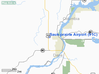
Location & QuickFacts
| FAA Information Effective: | 2008-09-25 |
| Airport Identifier: | 91C |
| Airport Status: | Operational |
| Longitude/Latitude: | 089-45-20.9000W/43-17-52.3000N
-89.755806/43.297861 (Estimated) |
| Elevation: | 832 ft / 253.59 m (Surveyed) |
| Land: | 20 acres |
| From nearest city: | 2 nautical miles W of Prairie Du Sac, WI |
| Location: | Sauk County, WI |
| Magnetic Variation: | 00E (1985) |
Owner & Manager
| Ownership: | Privately owned |
| Owner: | Cfm Investments |
| Address: | One Quench Drive
Prairie Du Sac, WI 53578 |
| Phone number: | 608-643-8530 |
| Manager: | Sauk Prairie Airport Inc. |
| Address: | P O Box 7
Prairie Du Sac, WI 53754 |
| Phone number: | 608-577-3754 |
Airport Operations and Facilities
| Airport Use: | Open to public |
| Wind indicator: | Yes |
| Segmented Circle: | No |
| Control Tower: | No |
| Lighting Schedule: | DUSK-DAWN
ACTVT LIRL RY 18/36 & REIL RYS 18 & 36 - CTAF |
| Beacon Color: | Clear-Green (lighted land airport) |
| Landing fee charge: | No |
| Sectional chart: | Chicago |
| Region: | AGL - Great Lakes |
| Boundary ARTCC: | ZAU - Chicago |
| Tie-in FSS: | GRB - Green Bay |
| FSS on Airport: | No |
| FSS Toll Free: | 1-800-WX-BRIEF |
| NOTAMs Facility: | GRB (NOTAM-d service avaliable) |
| Federal Agreements: | N |
Airport Communications
Airport Services
| Airframe Repair: | MAJOR |
| Power Plant Repair: | MAJOR |
| Bottled Oxygen: | NONE |
| Bulk Oxygen: | NONE |
Runway Information
Runway 18/36
| Dimension: | 2936 x 32 ft / 894.9 x 9.8 m |
| Surface: | ASPH, Good Condition |
| Edge Lights: | Low |
| |
Runway 18 |
Runway 36 |
| Longitude: | 089-45-21.9023W | 089-45-19.9132W |
| Latitude: | 43-18-06.7900N | 43-17-37.8279N |
| Elevation: | 831.00 ft | 820.00 ft |
| Traffic Pattern: | Left | Left |
| Markings: | Non-precision instrument, Good Condition | Non-precision instrument, Good Condition |
| Runway End Identifier: | Yes
NSTD REIL | Yes |
| Centerline Lights: | No | No |
| Touchdown Lights: | No | No |
| Obstruction: | , 50:1 slope to clear | 20 ft tree, 800.0 ft from runway, 60 ft left of centerline, 30:1 slope to clear |
|
Radio Navigation Aids
| ID |
Type |
Name |
Ch |
Freq |
Var |
Dist |
| MS | NDB | Monah | | 400.00 | 00E | 22.9 nm |
| MRJ | NDB | Mineral Point | | 365.00 | 00W | 32.2 nm |
| HBW | NDB | Kickapoo | | 251.00 | 03E | 33.1 nm |
| RYV | NDB | Rock River | | 371.00 | 01W | 45.7 nm |
| UNU | NDB | Juneau | | 344.00 | 01W | 46.7 nm |
| PVB | NDB | Platteville | | 203.00 | 01E | 47.3 nm |
| VOK | TACAN | Volk | 041X | | 00E | 44.5 nm |
| LNR | VOR/DME | Lone Rock | 075X | 112.80 | 00E | 16.5 nm |
| DLL | VORTAC | Dells | 117X | 117.00 | 03E | 15.2 nm |
| MSN | VORTAC | Madison | 023X | 108.60 | 03E | 20.4 nm |
Remarks
- ULTRALIGHT ACTVTY ON & IN VCNTY OF ARPT.
Images and information placed above are from
http://www.airport-data.com/airport/91C/
We thank them for the data!
| General Info
|
| Country |
United States
|
| State |
WISCONSIN
|
| FAA ID |
91C
|
| Latitude |
43-17-48.957N
|
| Longitude |
089-45-21.443W
|
| Elevation |
832 feet
|
| Near City |
PRAIRIE DU SAC
|
We don't guarantee the information is fresh and accurate. The data may
be wrong or outdated.
For more up-to-date information please refer to other sources.
|
|


