 |
|
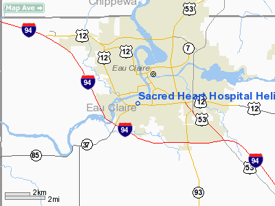
Sacred Heart Hospital Heliport |
Location & QuickFacts
| FAA Information Effective: | 2008-09-25 |
| Airport Identifier: | 25WI |
| Airport Status: | Operational |
| Longitude/Latitude: | 091-30-35.5800W/44-47-40.0000N
-91.509883/44.794444 (Estimated) |
| Elevation: | 880 ft / 268.22 m (Estimated) |
| Land: | 0 acres |
| From nearest city: | 0 nautical miles N of Eau Claire, WI |
| Location: | Eau Claire County, WI |
| Magnetic Variation: | 01E (1990) |
Owner & Manager
| Ownership: | Privately owned |
| Owner: | Sacred Heart Hospital |
| Address: | 900 West Clairemont
Eau Claire, WI 54701 |
| Phone number: | 715-839-4371 |
| Manager: | David R. Nelson
DIRECTOR OF PLANT SERVICES. |
| Address: | 900 West Clairemont
Eau Claire, WI 54701 |
| Phone number: | 715-839-4371 |
Airport Operations and Facilities
| Airport Use: | Private
MEDICAL USE. |
| Segmented Circle: | No |
| Control Tower: | No |
| Lighting Schedule: | PHONE REQ
FOR PERIMETER & FLOOD LGTS CALL 715-839-4371. |
| Sectional chart: | Green Bay |
| Region: | AGL - Great Lakes |
| Boundary ARTCC: | ZMP - Minneapolis |
| Tie-in FSS: | GRB - Green Bay |
| FSS Toll Free: | 1-800-WX-BRIEF |
Runway Information
Helipad H1
| Dimension: | 30 x 30 ft / 9.1 x 9.1 m |
| Surface: | CONC, |
| |
Runway H1 |
Runway |
| Traffic Pattern: | Left | Left |
|
Radio Navigation Aids
| ID |
Type |
Name |
Ch |
Freq |
Var |
Dist |
| BCK | NDB | Black River Falls | | 362.00 | 00E | 43.1 nm |
| VIQ | NDB | Neillsville | | 368.00 | 01W | 44.8 nm |
| AHH | NDB | Ameron | | 278.00 | 01E | 46.9 nm |
| UBE | NDB | Cumberland | | 375.00 | 01E | 47.3 nm |
| RCX | NDB | Rusk County | | 356.00 | 00W | 47.7 nm |
| RNH | NDB | New Richmond | | 257.00 | 02E | 48.4 nm |
| RPD | VOR/DME | Rice Lake | 037X | 110.00 | 01E | 39.0 nm |
| ONA | VOR/DME | Winona | 051X | 111.40 | 01E | 44.0 nm |
| EAU | VORTAC | Eau Claire | 076X | 112.90 | 04E | 6.3 nm |
Remarks
- PRVDD APCH/DEP ROUTE OPS FM 360 DEG TO 180 DEG; WIND INDICATOR IS MAINTAINED; STREET LGT TO EAST BE REMOVED; LGT IN NW CORNER OF PARKING LOT BE REMOVED & SIGN POST ON N SIDE OF PAD BE REMOVED.
Images and information placed above are from
http://www.airport-data.com/airport/25WI/
We thank them for the data!
| General Info
|
| Country |
United States
|
| State |
WISCONSIN
|
| FAA ID |
25WI
|
| Latitude |
44-47-40.000N
|
| Longitude |
091-30-35.580W
|
| Elevation |
880 feet
|
| Near City |
EAU CLAIRE
|
We don't guarantee the information is fresh and accurate. The data may
be wrong or outdated.
For more up-to-date information please refer to other sources.
|
|


