 |
|
Location & QuickFacts
| FAA Information Effective: | 2008-09-25 |
| Airport Identifier: | 39WI |
| Airport Status: | Operational |
| Longitude/Latitude: | 090-37-11.4670W/43-29-04.9130N
-90.619852/43.484698 (Estimated) |
| Elevation: | 1200 ft / 365.76 m (Estimated) |
| Land: | 0 acres |
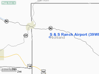
| From nearest city: | 3 nautical miles SE of Viola, WI |
| Location: | Richland County, WI |
| Magnetic Variation: | 01E (1985) |
Owner & Manager
| Ownership: | Privately owned |
| Owner: | Majorie A. Smith |
| Address: | Box 215
Viola, WI 54664 |
| Phone number: | 608-627-1497 |
| Manager: | Samuel L Scaletta |
| Address: | Box 215
Viola, WI 54664 |
| Phone number: | 608-627-1497 |
Airport Operations and Facilities
| Airport Use: | Private |
| Wind indicator: | Yes |
| Segmented Circle: | No |
| Control Tower: | No |
| Sectional chart: | Chicago |
| Region: | AGL - Great Lakes |
| Boundary ARTCC: | ZAU - Chicago |
| Tie-in FSS: | GRB - Green Bay |
| FSS on Airport: | No |
| FSS Toll Free: | 1-800-WX-BRIEF |
Runway Information
Runway 13/31
| Dimension: | 2200 x 30 ft / 670.6 x 9.1 m |
| Surface: | ASPH, |
| |
Runway 13 |
Runway 31 |
| Traffic Pattern: | Left | Left |
|
Radio Navigation Aids
| ID |
Type |
Name |
Ch |
Freq |
Var |
Dist |
| HBW | NDB | Kickapoo | | 251.00 | 03E | 16.2 nm |
| CMY | NDB | Mccoy | | 412.00 | 00E | 27.3 nm |
| CHU | NDB | Caledonia | | 209.00 | 03E | 38.4 nm |
| MRJ | NDB | Mineral Point | | 365.00 | 00W | 39.8 nm |
| BCK | NDB | Black River Falls | | 362.00 | 00E | 47.3 nm |
| PVB | NDB | Platteville | | 203.00 | 01E | 48.6 nm |
| VOK | TACAN | Volk | 041X | | 00E | 31.7 nm |
| LNR | VOR/DME | Lone Rock | 075X | 112.80 | 00E | 24.1 nm |
| LSE | VOR/DME | La Crosse | 021X | 108.40 | 02E | 36.3 nm |
| DLL | VORTAC | Dells | 117X | 117.00 | 03E | 37.5 nm |
| UKN | VORTAC | Waukon | 113X | 116.60 | 05E | 41.9 nm |
| ODI | VORTAC | Nodine | 126X | 117.90 | 01E | 44.9 nm |
Remarks
- FILED FOR RECORD PURPOSES ONLY.
Images and information placed above are from
http://www.airport-data.com/airport/39WI/
We thank them for the data!
| General Info
|
| Country |
United States
|
| State |
WISCONSIN
|
| FAA ID |
39WI
|
| Latitude |
43-29-04.913N
|
| Longitude |
090-37-11.467W
|
| Elevation |
1200 feet
|
| Near City |
VIOLA
|
We don't guarantee the information is fresh and accurate. The data may
be wrong or outdated.
For more up-to-date information please refer to other sources.
|
|


