 |
|
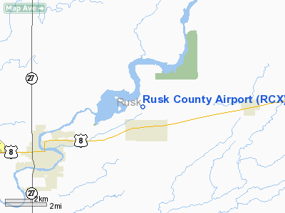
Location & QuickFacts
| FAA Information Effective: | 2008-09-25 |
| Airport Identifier: | RCX |
| Airport Status: | Operational |
| Longitude/Latitude: | 091-00-01.6370W/45-29-48.6100N
-91.000455/45.496836 (Estimated) |
| Elevation: | 1238 ft / 377.34 m (Surveyed) |
| Land: | 240 acres |
| From nearest city: | 4 nautical miles NE of Ladysmith, WI |
| Location: | Rusk County, WI |
| Magnetic Variation: | 00E (1995) |
Owner & Manager
| Ownership: | Publicly owned |
| Owner: | Rusk County |
| Address: | 311 Miner Ave E
Ladysmith, WI 54848 |
| Phone number: | 715-532-2635 |
| Manager: | Michael Naczas |
| Address: | 311 Miner Ave E
Ladysmith, WI 54848 |
| Phone number: | 715-532-2146 |
Airport Operations and Facilities
| Airport Use: | Open to public |
| Wind indicator: | Yes |
| Segmented Circle: | Yes |
| Control Tower: | No |
| Lighting Schedule: | DUSK-DAWN
ACTVT MIRL RY 14/32, 01/19 & PAPI RYS 14 & 32 & REIL RYS 14 & 32 - 122.8. |
| Beacon Color: | Clear-Green (lighted land airport) |
| Landing fee charge: | No |
| Sectional chart: | Green Bay |
| Region: | AGL - Great Lakes |
| Boundary ARTCC: | ZMP - Minneapolis |
| Tie-in FSS: | GRB - Green Bay |
| FSS on Airport: | No |
| FSS Toll Free: | 1-800-WX-BRIEF |
| NOTAMs Facility: | GRB (NOTAM-d service avaliable) |
| Federal Agreements: | NGY |
Airport Communications
| CTAF: | 122.800 |
| Unicom: | 122.800 |
Airport Services
| Fuel available: | 100LL80
ALL FUEL 24 HR SELF SERVE. |
| Airframe Repair: | MAJOR |
| Power Plant Repair: | MAJOR |
| Bottled Oxygen: | NONE |
| Bulk Oxygen: | NONE |
Runway Information
Runway 01/19
| Dimension: | 3200 x 75 ft / 975.4 x 22.9 m |
| Surface: | ASPH, |
| Edge Lights: | Medium |
| |
Runway 01 |
Runway 19 |
| Longitude: | 091-00-02.6200W | 090-59-57.5300W |
| Latitude: | 45-29-29.8100N | 45-30-01.2000N |
| Elevation: | 1222.00 ft | 1238.00 ft |
| Alignment: | 7 | 127 |
| Traffic Pattern: | Left | Left |
| Markings: | Non-precision instrument, Good Condition | Non-precision instrument, |
| Touchdown Lights: | | No |
| Obstruction: | 40 ft tree, 1100.0 ft from runway, 50 ft left of centerline, 22:1 slope to clear | 17 ft road, 650.0 ft from runway, 150 ft right of centerline, 26:1 slope to clear |
|
Runway 14/32
| Dimension: | 4000 x 75 ft / 1219.2 x 22.9 m |
| Surface: | ASPH, Good Condition |
| Weight Limit: | Single wheel: 25000 lbs. |
| Edge Lights: | Medium |
| |
Runway 14 |
Runway 32 |
| Longitude: | 091-00-20.7460W | 090-59-45.0270W |
| Latitude: | 45-30-06.3300N | 45-29-35.8570N |
| Elevation: | 1234.00 ft | 1224.00 ft |
| Alignment: | 127 | 127 |
| Traffic Pattern: | Left | Left |
| Markings: | Non-precision instrument, Good Condition | Non-precision instrument, Good Condition |
| Crossing Height: | 25.00 ft | 25.00 ft |
| VASI: | 2-light PAPI on left side | 2-light PAPI on left side |
| Visual Glide Angle: | 3.00° | 3.00° |
| Runway End Identifier: | Yes | Yes
LEFT SIDE REIL OTS INDEFLY. |
| Centerline Lights: | No | No |
| Touchdown Lights: | No | No |
| Obstruction: | 10 ft trees, 400.0 ft from runway, 150 ft left of centerline, 20:1 slope to clear | 58 ft trees, 1550.0 ft from runway, 150 ft left of centerline, 23:1 slope to clear |
|
Radio Navigation Aids
| ID |
Type |
Name |
Ch |
Freq |
Var |
Dist |
| RCX | NDB | Rusk County | | 356.00 | 00W | 0.3 nm |
| PBH | NDB | Phillips | | 263.00 | 00E | 27.7 nm |
| PKF | NDB | Park Falls | | 371.00 | 01W | 36.5 nm |
| MDZ | NDB | Medford | | 335.00 | 00E | 37.5 nm |
| SLY | NDB | Seeley | | 344.00 | 01E | 40.3 nm |
| SSQ | NDB | Shell Lake | | 212.00 | 01E | 41.1 nm |
| UBE | NDB | Cumberland | | 375.00 | 01E | 41.1 nm |
| RPD | VOR/DME | Rice Lake | 037X | 110.00 | 01E | 33.1 nm |
| HYR | VOR/DME | Hayward | 081X | 113.40 | 03E | 36.5 nm |
| EAU | VORTAC | Eau Claire | 076X | 112.90 | 04E | 41.3 nm |
Remarks
- OCNL DEER INVOF ARPT
- GCO AVBL ON FREQ 121.725 THRU FLT SVCS.
Images and information placed above are from
http://www.airport-data.com/airport/RCX/
We thank them for the data!
| General Info
|
| Country |
United States
|
| State |
WISCONSIN
|
| FAA ID |
RCX
|
| Latitude |
45-29-53.725N
|
| Longitude |
091-00-06.709W
|
| Elevation |
1238 feet
|
| Near City |
LADYSMITH
|
We don't guarantee the information is fresh and accurate. The data may
be wrong or outdated.
For more up-to-date information please refer to other sources.
|
|


