 |
|
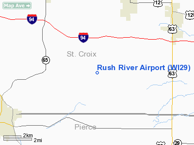
Location & QuickFacts
| FAA Information Effective: | 2008-09-25 |
| Airport Identifier: | WI29 |
| Airport Status: | Operational |
| Longitude/Latitude: | 092-29-00.6940W/44-54-19.8800N
-92.483526/44.905522 (Estimated) |
| Elevation: | 1078 ft / 328.57 m (Estimated) |
| Land: | 5 acres |
| From nearest city: | 5 nautical miles S of Baldwin, WI |
| Location: | St Croix County, WI |
| Magnetic Variation: | 03E (1985) |
Owner & Manager
| Ownership: | Privately owned |
| Owner: | Richard D & Marlene Walton |
| Address: | Rt 2 1964-30th Ave
Baldwin, WI 54002 |
| Phone number: | 715-684-2071 |
| Manager: | Richard D & Marlene Walton |
| Address: | Rt 2 1964-30th Ave
Baldwin, WI 54002 |
| Phone number: | 715-684-2071 |
Airport Operations and Facilities
| Airport Use: | Private |
| Wind indicator: | Yes |
| Segmented Circle: | No |
| Control Tower: | No |
| Sectional chart: | Green Bay |
| Region: | AGL - Great Lakes |
| Boundary ARTCC: | ZMP - Minneapolis |
| Tie-in FSS: | GRB - Green Bay |
| FSS Toll Free: | 1-800-WX-BRIEF |
Runway Information
Runway 18/36
| Dimension: | 2600 x 75 ft / 792.5 x 22.9 m |
| Surface: | TURF, |
| |
Runway 18 |
Runway 36 |
| Traffic Pattern: | Left | Left |
| Displaced threshold: | 0.00 ft | 480.00 ft |
| Obstruction: | | 24 ft pline, 0.0 ft from runway |
|
Radio Navigation Aids
| ID |
Type |
Name |
Ch |
Freq |
Var |
Dist |
| RNH | NDB | New Richmond | | 257.00 | 02E | 14.7 nm |
| PPI | NDB | Hopey | | 400.00 | 03E | 19.6 nm |
| AHH | NDB | Ameron | | 278.00 | 01E | 23.1 nm |
| OEO | NDB | Osceola | | 233.00 | 01E | 25.8 nm |
| MS | NDB | Narco | | 266.00 | 02E | 26.3 nm |
| UBE | NDB | Cumberland | | 375.00 | 01E | 42.2 nm |
| MSP | VOR/DME | Minneapolis | 100X | 115.30 | 02E | 32.1 nm |
| FCM | VOR/DME | Flying Cloud | 055X | 111.80 | 06E | 41.7 nm |
| RPD | VOR/DME | Rice Lake | 037X | 110.00 | 01E | 42.8 nm |
| FGT | VORTAC | Farmington | 104X | 115.70 | 06E | 34.1 nm |
| GEP | VORTAC | Gopher | 120X | 117.30 | 06E | 40.5 nm |
| EAU | VORTAC | Eau Claire | 076X | 112.90 | 04E | 42.8 nm |
| STP | VOT | St Paul | | 114.40 | | 24.6 nm |
| MSP | VOT | Minneapolis St Paul | | 111.00 | | 31.2 nm |
Images and information placed above are from
http://www.airport-data.com/airport/WI29/
We thank them for the data!
| General Info
|
| Country |
United States
|
| State |
WISCONSIN
|
| FAA ID |
WI29
|
| Latitude |
44-54-19.880N
|
| Longitude |
092-29-00.694W
|
| Elevation |
1078 feet
|
| Near City |
BALDWIN
|
We don't guarantee the information is fresh and accurate. The data may
be wrong or outdated.
For more up-to-date information please refer to other sources.
|
|


