 |
|
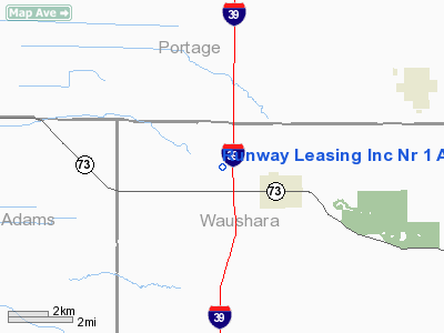
Runway Leasing Inc Nr 1 Airport |
Location & QuickFacts
| FAA Information Effective: | 2008-09-25 |
| Airport Identifier: | 8WI2 |
| Airport Status: | Operational |
| Longitude/Latitude: | 089-31-51.4320W/44-13-28.8990N
-89.530953/44.224694 (Estimated) |
| Elevation: | 1100 ft / 335.28 m (Estimated) |
| Land: | 0 acres |
| From nearest city: | 2 nautical miles NW of Plainfield, WI |
| Location: | Waushara County, WI |
| Magnetic Variation: | 00W (1985) |
Owner & Manager
| Ownership: | Privately owned |
| Owner: | Runway Leasing Inc |
| Address: | Po Box 24
Waupun, WI 53963 |
| Phone number: | 414-324-3519 |
| Manager: | Runway Leasing Inc |
| Address: | Po Box 24
Waupun, WI 53963 |
| Phone number: | 414-324-3519 |
Airport Operations and Facilities
| Airport Use: | Private |
| Wind indicator: | Yes |
| Segmented Circle: | No |
| Control Tower: | No |
| Landing fee charge: | No |
| Sectional chart: | Green Bay |
| Region: | AGL - Great Lakes |
| Boundary ARTCC: | ZMP - Minneapolis |
| Tie-in FSS: | GRB - Green Bay |
| FSS on Airport: | No |
| FSS Toll Free: | 1-800-WX-BRIEF |
Runway Information
Runway 18L/36R
| Dimension: | 2400 x 125 ft / 731.5 x 38.1 m |
| Surface: | GRVL-DIRT,
N 1200' ASPH; S 1200' GRVL. |
| |
Runway 18L |
Runway 36R |
| Traffic Pattern: | Left | Left |
|
Runway 18R/36L
| Dimension: | 2400 x 125 ft / 731.5 x 38.1 m |
| Surface: | ASPH-GRVL,
N 1200' ASPH; S 1200' GRVL. |
| |
Runway 18R |
Runway 36L |
| Traffic Pattern: | Left | Left |
|
Radio Navigation Aids
| ID |
Type |
Name |
Ch |
Freq |
Var |
Dist |
| ISW | NDB | Wisconsin Rapids | | 215.00 | 01W | 15.7 nm |
| PCZ | NDB | Waupaca | | 382.00 | 01W | 23.1 nm |
| MFI | NDB | Marshfield | | 391.00 | 00E | 37.7 nm |
| CLI | NDB | Clintonville | | 209.00 | 02W | 41.6 nm |
| FZK | NDB | Wausau | | 243.00 | 01E | 42.5 nm |
| VIQ | NDB | Neillsville | | 368.00 | 01W | 46.8 nm |
| HBW | NDB | Kickapoo | | 251.00 | 03E | 48.8 nm |
| AQ | NDB | Kooky | | 407.00 | 02W | 48.8 nm |
| VOK | TACAN | Volk | 041X | | 00E | 35.7 nm |
| STE | VORTAC | Stevens Point | 043X | 110.60 | 01W | 19.1 nm |
| AUW | VORTAC | Wausau | 053X | 111.60 | 02E | 37.5 nm |
| DLL | VORTAC | Dells | 117X | 117.00 | 03E | 41.7 nm |
| OSH | VORTAC | Oshkosh | 055X | 111.80 | 02E | 44.4 nm |
Images and information placed above are from
http://www.airport-data.com/airport/8WI2/
We thank them for the data!
| General Info
|
| Country |
United States
|
| State |
WISCONSIN
|
| FAA ID |
8WI2
|
| Latitude |
44-13-28.899N
|
| Longitude |
089-31-51.432W
|
| Elevation |
1100 feet
|
| Near City |
PLAINFIELD
|
We don't guarantee the information is fresh and accurate. The data may
be wrong or outdated.
For more up-to-date information please refer to other sources.
|
|


