 |
|
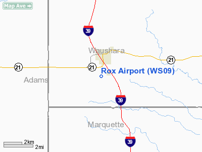
Location & QuickFacts
| FAA Information Effective: | 2008-09-25 |
| Airport Identifier: | WS09 |
| Airport Status: | Operational |
| Longitude/Latitude: | 089-31-29.4420W/44-00-47.9060N
-89.524845/44.013307 (Estimated) |
| Elevation: | 1017 ft / 309.98 m (Estimated) |
| Land: | 0 acres |
| From nearest city: | 2 nautical miles S of Coloma, WI |
| Location: | Waushara County, WI |
| Magnetic Variation: | 00W (1985) |
Owner & Manager
| Ownership: | Privately owned |
| Owner: | James L Rox |
| Address: | Po Box 9
Coloma, WI 54930 |
| Phone number: | 715-228-2691 |
| Manager: | James L Rox |
| Address: | Po Box 9
Coloma, WI 54930 |
| Phone number: | 715-228-2692 |
Airport Operations and Facilities
| Airport Use: | Private |
| Wind indicator: | Yes |
| Segmented Circle: | No |
| Control Tower: | No |
| Landing fee charge: | No |
| Sectional chart: | Green Bay |
| Region: | AGL - Great Lakes |
| Boundary ARTCC: | ZAU - Chicago |
| Tie-in FSS: | GRB - Green Bay |
| FSS on Airport: | No |
| FSS Toll Free: | 1-800-WX-BRIEF |
Runway Information
Runway 04/22
| Dimension: | 2200 x 100 ft / 670.6 x 30.5 m |
| Surface: | TURF, |
| |
Runway 04 |
Runway 22 |
| Traffic Pattern: | Left | Left |
| Obstruction: | 30 ft trees, 300.0 ft from runway | 15 ft pline, 75.0 ft from runway |
|
Radio Navigation Aids
| ID |
Type |
Name |
Ch |
Freq |
Var |
Dist |
| ISW | NDB | Wisconsin Rapids | | 215.00 | 01W | 25.1 nm |
| PCZ | NDB | Waupaca | | 382.00 | 01W | 29.1 nm |
| HBW | NDB | Kickapoo | | 251.00 | 03E | 41.1 nm |
| MFI | NDB | Marshfield | | 391.00 | 00E | 47.3 nm |
| CMY | NDB | Mccoy | | 412.00 | 00E | 48.5 nm |
| CLI | NDB | Clintonville | | 209.00 | 02W | 49.8 nm |
| VOK | TACAN | Volk | 041X | | 00E | 32.0 nm |
| DLL | VORTAC | Dells | 117X | 117.00 | 03E | 29.7 nm |
| STE | VORTAC | Stevens Point | 043X | 110.60 | 01W | 31.9 nm |
| OSH | VORTAC | Oshkosh | 055X | 111.80 | 02E | 41.9 nm |
Images and information placed above are from
http://www.airport-data.com/airport/WS09/
We thank them for the data!
| General Info
|
| Country |
United States
|
| State |
WISCONSIN
|
| FAA ID |
WS09
|
| Latitude |
44-00-47.906N
|
| Longitude |
089-31-29.442W
|
| Elevation |
1017 feet
|
| Near City |
COLOMA
|
We don't guarantee the information is fresh and accurate. The data may
be wrong or outdated.
For more up-to-date information please refer to other sources.
|
|


