 |
|
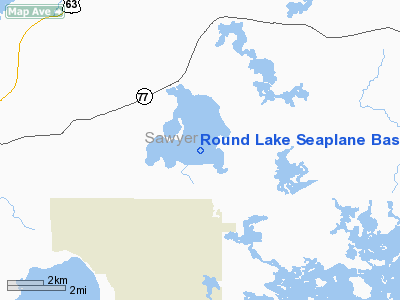
Round Lake Seaplane Base Airport |
Location & QuickFacts
| FAA Information Effective: | 2008-09-25 |
| Airport Identifier: | WS24 |
| Airport Status: | Operational |
| Longitude/Latitude: | 091-18-37.6240W/46-00-24.8380N
-91.310451/46.006899 (Estimated) |
| Elevation: | 1346 ft / 410.26 m (Estimated) |
| Land: | 0 acres |
| From nearest city: | 7 nautical miles E of Hayward, WI |
| Location: | Sawyer County, WI |
| Magnetic Variation: | 01E (1985) |
Owner & Manager
| Ownership: | Privately owned |
| Owner: | John A. Frisbie |
| Address: | 10119 N Filter Bay Rd
Hayward, WI 54843 |
| Phone number: | 715-462-3792 |
| Manager: | John A. Frisbie |
| Address: | 10119 N Filter Bay Rd
Hayward, WI 54843 |
| Phone number: | 715-462-3792 |
Airport Operations and Facilities
| Airport Use: | Private |
| Wind indicator: | Yes |
| Segmented Circle: | No |
| Control Tower: | No |
| Landing fee charge: | No |
| Sectional chart: | Green Bay |
| Region: | AGL - Great Lakes |
| Boundary ARTCC: | ZMP - Minneapolis |
| Tie-in FSS: | GRB - Green Bay |
| FSS on Airport: | No |
| FSS Toll Free: | 1-800-WX-BRIEF |
Airport Communications
Airport Services
| Fuel available: | 80
FUEL BY PRIOR REQ; CALL 715-462-3792. |
Runway Information
Runway 09W/27W
| Dimension: | 5000 x 500 ft / 1524.0 x 152.4 m |
| Surface: | WATER, |
| |
Runway 09W |
Runway 27W |
| Traffic Pattern: | Left | Left |
|
Runway 14W/32W
| Dimension: | 5000 x 500 ft / 1524.0 x 152.4 m |
| Surface: | WATER, |
| |
Runway 14W |
Runway 32W |
| Traffic Pattern: | Left | Left |
|
Radio Navigation Aids
| ID |
Type |
Name |
Ch |
Freq |
Var |
Dist |
| SLY | NDB | Seeley | | 344.00 | 01E | 7.0 nm |
| OLG | NDB | Solon Springs | | 388.00 | 01E | 28.1 nm |
| SSQ | NDB | Shell Lake | | 212.00 | 01E | 30.5 nm |
| RCX | NDB | Rusk County | | 356.00 | 00W | 33.0 nm |
| ENY | NDB | Kennedy | | 254.00 | 02E | 36.7 nm |
| PKF | NDB | Park Falls | | 371.00 | 01W | 37.1 nm |
| UBE | NDB | Cumberland | | 375.00 | 01E | 40.9 nm |
| PBH | NDB | Phillips | | 263.00 | 00E | 41.8 nm |
| BXR | NDB | Big Doctor | | 203.00 | 02E | 45.5 nm |
| HYR | VOR/DME | Hayward | 081X | 113.40 | 03E | 5.7 nm |
| ASX | VOR/DME | Ashland | 039X | 110.20 | 02E | 36.5 nm |
| RPD | VOR/DME | Rice Lake | 037X | 110.00 | 01E | 40.6 nm |
| RZN | VOR/DME | Siren | 031X | 109.40 | 02E | 45.9 nm |
Images and information placed above are from
http://www.airport-data.com/airport/WS24/
We thank them for the data!
| General Info
|
| Country |
United States
|
| State |
WISCONSIN
|
| FAA ID |
WS24
|
| Latitude |
46-00-24.838N
|
| Longitude |
091-18-37.624W
|
| Elevation |
1346 feet
|
| Near City |
HAYWARD
|
We don't guarantee the information is fresh and accurate. The data may
be wrong or outdated.
For more up-to-date information please refer to other sources.
|
|


