 |
|
Location & QuickFacts
| FAA Information Effective: | 2008-09-25 |
| Airport Identifier: | 3WI9 |
| Airport Status: | Operational |
| Longitude/Latitude: | 091-23-00.5620W/44-59-59.8600N
-91.383489/44.999961 (Estimated) |
| Elevation: | 940 ft / 286.51 m (Estimated) |
| Land: | 8 acres |
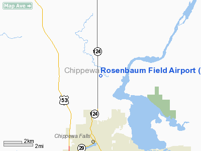
| From nearest city: | 3 nautical miles N of Chippewa Falls, WI |
| Location: | Chippewa County, WI |
| Magnetic Variation: | 01E (1985) |
Owner & Manager
| Ownership: | Privately owned |
| Owner: | Chippewa Falls Squadron Inc |
| Address: | 14523 105th Ave
Chippewa Falls, WI 54729 |
| Phone number: | 715-288-6346 |
| Manager: | David Carlson |
| Address: | 718 Miles St
Chippewa Falls, WI 54729 |
| Phone number: | 715-723-6495 |
Airport Operations and Facilities
| Airport Use: | Private |
| Wind indicator: | Yes |
| Segmented Circle: | No |
| Control Tower: | No |
| Lighting Schedule: | PHONE REQ
FOR NSTD LIRL RY 18/36 CALL 715-723-3705 OR 715-288-6346. |
| Landing fee charge: | No |
| Sectional chart: | Green Bay |
| Region: | AGL - Great Lakes |
| Boundary ARTCC: | ZMP - Minneapolis |
| Tie-in FSS: | GRB - Green Bay |
| FSS on Airport: | No |
| FSS Toll Free: | 1-800-WX-BRIEF |
Airport Services
| Airframe Repair: | NONE |
| Power Plant Repair: | NONE |
Runway Information
Runway 18/36
| Dimension: | 2600 x 100 ft / 792.5 x 30.5 m |
| Surface: | TURF, |
| Edge Lights: | Non-standard lighting system
LIRL ON BOTH SIDES OF RY. |
| |
Runway 18 |
Runway 36 |
| Traffic Pattern: | Left | Left |
|
Radio Navigation Aids
| ID |
Type |
Name |
Ch |
Freq |
Var |
Dist |
| RCX | NDB | Rusk County | | 356.00 | 00W | 34.2 nm |
| UBE | NDB | Cumberland | | 375.00 | 01E | 39.6 nm |
| AHH | NDB | Ameron | | 278.00 | 01E | 45.2 nm |
| VIQ | NDB | Neillsville | | 368.00 | 01W | 45.6 nm |
| MDZ | NDB | Medford | | 335.00 | 00E | 46.1 nm |
| SSQ | NDB | Shell Lake | | 212.00 | 01E | 49.3 nm |
| RNH | NDB | New Richmond | | 257.00 | 02E | 49.6 nm |
| RPD | VOR/DME | Rice Lake | 037X | 110.00 | 01E | 30.0 nm |
| EAU | VORTAC | Eau Claire | 076X | 112.90 | 04E | 7.4 nm |
Images and information placed above are from
http://www.airport-data.com/airport/3WI9/
We thank them for the data!
| General Info
|
| Country |
United States
|
| State |
WISCONSIN
|
| FAA ID |
3WI9
|
| Latitude |
44-59-59.860N
|
| Longitude |
091-23-00.562W
|
| Elevation |
940 feet
|
| Near City |
CHIPPEWA FALLS
|
We don't guarantee the information is fresh and accurate. The data may
be wrong or outdated.
For more up-to-date information please refer to other sources.
|
|


