 |
|
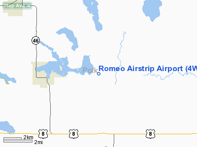
Location & QuickFacts
| FAA Information Effective: | 2008-09-25 |
| Airport Identifier: | 4WN5 |
| Airport Status: | Operational |
| Longitude/Latitude: | 092-22-41.9010W/45-27-25.2940N
-92.378306/45.457026 (Estimated) |
| Elevation: | 1155 ft / 352.04 m (Estimated) |
| Land: | 0 acres |
| From nearest city: | 3 nautical miles E of Balsam Lake, WI |
| Location: | Polk County, WI |
| Magnetic Variation: | 01E () |
Owner & Manager
| Ownership: | Privately owned |
| Owner: | David & Sandra Randall |
| Address: | 1740 108th St
Balsam Lake, WI 54810 |
| Phone number: | 715-857-5433 |
| Manager: | David & Sandra Randall |
| Address: | 1740 108th St
Balsam Lake, WI 54810 |
| Phone number: | 715-857-5433 |
Airport Operations and Facilities
| Airport Use: | Private |
| Segmented Circle: | No |
| Control Tower: | No |
| Sectional chart: | Green Bay |
| Region: | AGL - Great Lakes |
| Boundary ARTCC: | ZMP - Minneapolis |
| Tie-in FSS: | GRB - Green Bay |
| FSS Toll Free: | 1-800-WX-BRIEF |
Runway Information
Runway 18/36
| Dimension: | 2552 x 65 ft / 777.8 x 19.8 m |
| Surface: | TURF, |
| |
Runway 18 |
Runway 36 |
| Longitude: | 092-22-40.3800W | 092-22-42.7800W |
| Latitude: | 45-27-37.9800N | 45-27-12.8400N |
| Traffic Pattern: | Left | Left |
|
Radio Navigation Aids
| ID |
Type |
Name |
Ch |
Freq |
Var |
Dist |
| AHH | NDB | Ameron | | 278.00 | 01E | 10.6 nm |
| OEO | NDB | Osceola | | 233.00 | 01E | 15.8 nm |
| UBE | NDB | Cumberland | | 375.00 | 01E | 17.2 nm |
| RNH | NDB | New Richmond | | 257.00 | 02E | 19.7 nm |
| BXR | NDB | Big Doctor | | 203.00 | 02E | 21.9 nm |
| SSQ | NDB | Shell Lake | | 212.00 | 01E | 25.2 nm |
| ROS | NDB | Rush City | | 282.00 | 02E | 28.2 nm |
| CBG | NDB | Cambridge | | 350.00 | 03E | 37.7 nm |
| PPI | NDB | Hopey | | 400.00 | 03E | 42.5 nm |
| JMR | NDB | Mora | | 327.00 | 03E | 45.5 nm |
| MS | NDB | Narco | | 266.00 | 02E | 48.5 nm |
| RZN | VOR/DME | Siren | 031X | 109.40 | 02E | 21.8 nm |
| RPD | VOR/DME | Rice Lake | 037X | 110.00 | 01E | 25.4 nm |
| MSP | VOR/DME | Minneapolis | 100X | 115.30 | 02E | 49.6 nm |
| GEP | VORTAC | Gopher | 120X | 117.30 | 06E | 46.0 nm |
| STP | VOT | St Paul | | 114.40 | | 42.4 nm |
| MSP | VOT | Minneapolis St Paul | | 111.00 | | 49.4 nm |
Remarks
- CLSD WINTER MONTH,
- 80 FT WATER TOWER 3NM W, 425 FT TOWER & ANT 4 NM W, AND 90 FT SILO 800 FT W OF ARPT.
- PRVDD CLEAR 20:1 APCHS, CLEAR OBSTACLE FREE ZONE, AND CLEAR RY SAFTEY AREA.
Images and information placed above are from
http://www.airport-data.com/airport/4WN5/
We thank them for the data!
|
|


