|
|
| Richard I. Bong Airport |
| IATA: SUW – ICAO: KSUW – FAA LID: SUW |
| Summary |
| Airport type |
Public |
| Owner/Operator |
City of Superior, Wisconsin |
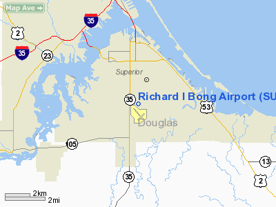
| Location |
Superior, Wisconsin |
| Elevation AMSL |
674 ft / 205.4 m |
| Coordinates |
46°41.383′N 092°5.679′W / 46.689717°N 92.09465°W / 46.689717; -92.09465Coordinates: 46°41.383′N 092°5.679′W / 46.689717°N 92.09465°W / 46.689717; -92.09465 |
| Runways |
| Direction |
Length |
Surface |
| ft |
m |
| 3/21 |
5,100 |
1,554 |
asphalt |
| 13/31 |
4,000 |
1,219 |
asphalt |
| Statistics (2006) |
| Operations |
19,250 |
| Based A/C |
44 |
| Stats for 12 months ending August 8, 2006 |
Richard I. Bong Airport (IATA: SUW, ICAO: KSUW, FAA LID: SUW) is a public airport located in Superior, Wisconsin. Facilities
- Runway 3/21 5,100 x 75 ft. (1,554 x 23 m), asphalt
- Runway 13/31 4,000 x 75 ft. (1,219 x 23 m), asphalt
- BONG (SUW) non-directional beacon, 260 kHz, is located on field.
- Twin Ports Flying Service is the fixed base operator.
The above content comes from Wikipedia and is published under free licenses – click here to read more.
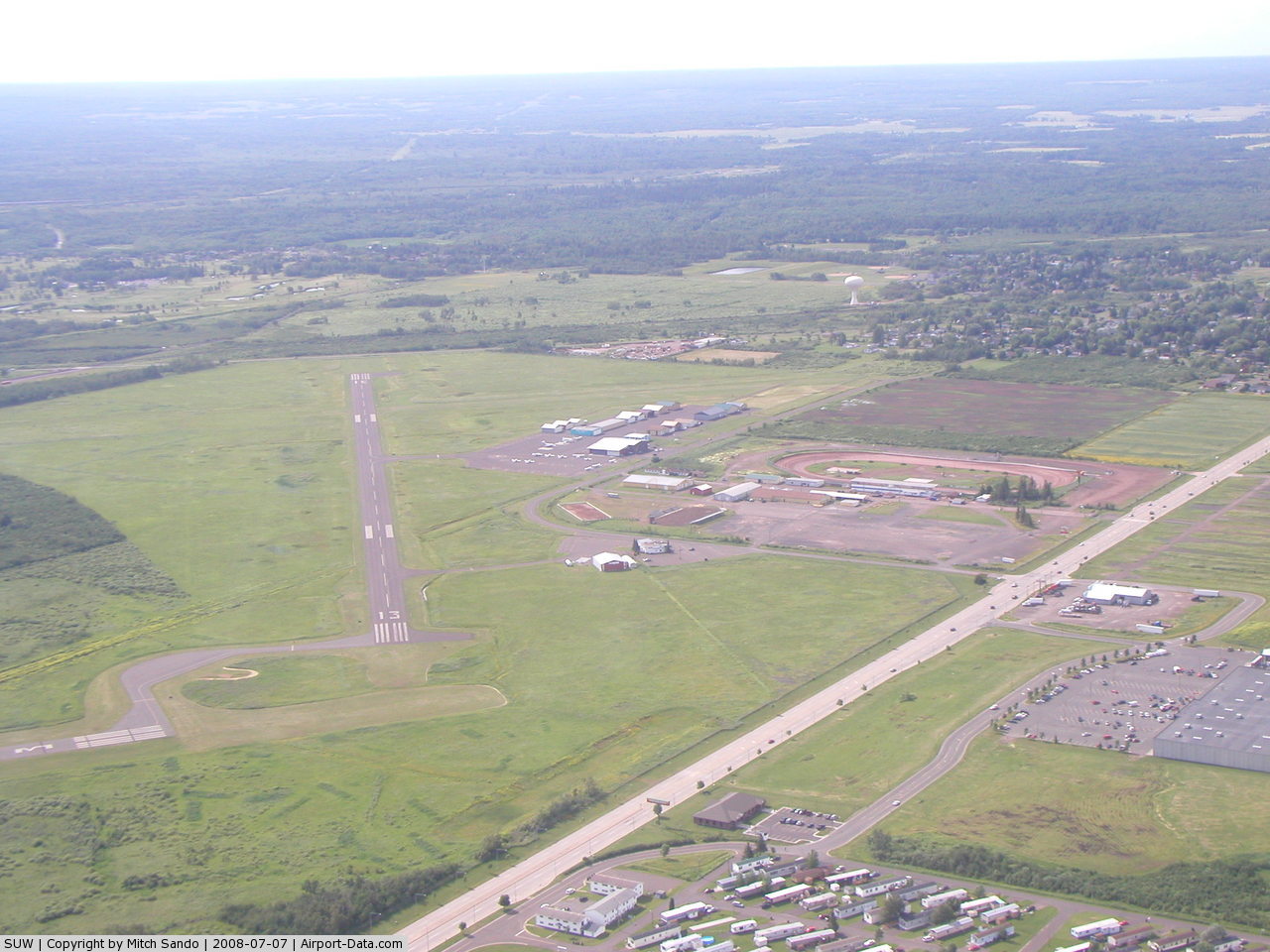
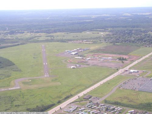 |
(Click on the photo to enlarge) |
Location & QuickFacts
| FAA Information Effective: | 2008-09-25 |
| Airport Identifier: | SUW |
| Airport Status: | Operational |
| Longitude/Latitude: | 092-05-40.7580W/46-41-22.9830N
-92.094655/46.689718 (Estimated) |
| Elevation: | 674 ft / 205.44 m (Surveyed) |
| Land: | 571 acres |
| From nearest city: | 3 nautical miles S of Superior, WI |
| Location: | Douglas County, WI |
| Magnetic Variation: | 01E (1995) |
Owner & Manager
| Ownership: | Publicly owned |
| Owner: | City Of Superior |
| Address: |
Superior, WI 54880 |
| Phone number: | 715-394-0282 |
| Manager: | William Amorde |
| Address: | 4804 Hammond Ave
Superior, WI 54880 |
| Phone number: | 715-394-6444 |
Airport Operations and Facilities
| Airport Use: | Open to public |
| Wind indicator: | Yes |
| Segmented Circle: | No |
| Control Tower: | No |
| Lighting Schedule: | DUSK-DAWN
ACTVT MIRL RYS 13/31 & 03/21 AND REIL RYS 13/31 & 03/21 - CTAF. |
| Beacon Color: | Clear-Green (lighted land airport) |
| Landing fee charge: | No |
| Sectional chart: | Green Bay |
| Region: | AGL - Great Lakes |
| Boundary ARTCC: | ZMP - Minneapolis |
| Tie-in FSS: | GRB - Green Bay |
| FSS on Airport: | No |
| FSS Toll Free: | 1-800-WX-BRIEF |
| NOTAMs Facility: | SUW (NOTAM-d service avaliable) |
| Federal Agreements: | NGY |
Airport Communications
| CTAF: | 122.700 |
| Unicom: | 122.700 |
Airport Services
| Fuel available: | 100LLA |
| Airframe Repair: | MAJOR |
| Power Plant Repair: | MAJOR |
| Bottled Oxygen: | NONE |
| Bulk Oxygen: | NONE |
Runway Information
Runway 03/21
| Dimension: | 5100 x 75 ft / 1554.5 x 22.9 m |
| Surface: | ASPH, Good Condition |
| Edge Lights: | Medium |
| |
Runway 03 |
Runway 21 |
| Longitude: | 092-06-01.0600W | 092-05-17.3700W |
| Latitude: | 46-41-20.9500N | 46-42-01.6800N |
| Elevation: | 671.00 ft | 660.00 ft |
| Traffic Pattern: | Left | Left |
| Markings: | Non-precision instrument, Fair Condition | Non-precision instrument, Fair Condition |
| Crossing Height: | 28.00 ft | 0.00 ft |
| VASI: | 4-light PAPI on left side | |
| Visual Glide Angle: | 3.00° | 0.00° |
| Runway End Identifier: | Yes | Yes |
| Obstruction: | 27 ft pole, 1175.0 ft from runway, 280 ft left of centerline, 36:1 slope to clear | 48 ft trees, 1500.0 ft from runway, 27:1 slope to clear |
|
Runway 13/31
| Dimension: | 4000 x 75 ft / 1219.2 x 22.9 m |
| Surface: | ASPH, Good Condition |
| Edge Lights: | Medium |
| |
Runway 13 |
Runway 31 |
| Longitude: | 092-06-01.1090W | 092-05-24.3350W |
| Latitude: | 46-41-14.7670N | 46-40-44.4550N |
| Elevation: | 672.00 ft | 673.00 ft |
| Alignment: | 127 | 127 |
| Traffic Pattern: | Left | Left |
| Markings: | Non-precision instrument, Good Condition | Non-precision instrument, Good Condition |
| VASI: | | 4-light PAPI on left side |
| Visual Glide Angle: | 0.00° | 4.00° |
| Runway End Identifier: | Yes | Yes |
| Centerline Lights: | No | No |
| Touchdown Lights: | No | No |
| Obstruction: | 33 ft trees, 1100.0 ft from runway, 220 ft right of centerline, 27:1 slope to clear | 15 ft road, 500.0 ft from runway, 20:1 slope to clear |
|
Radio Navigation Aids
| ID |
Type |
Name |
Ch |
Freq |
Var |
Dist |
| SUW | NDB | Bong | | 260.00 | 01E | 0.4 nm |
| DL | NDB | Pykla | | 379.00 | 02E | 14.2 nm |
| COQ | NDB | Cloquet | | 335.00 | 03E | 16.9 nm |
| OLG | NDB | Solon Springs | | 388.00 | 01E | 25.2 nm |
| TWM | NDB | Two Harbors | | 243.00 | 01E | 26.1 nm |
| MZH | NDB | Moose Lake | | 362.00 | 02E | 33.6 nm |
| BFW | NDB | Silver Bay | | 350.00 | 00E | 43.8 nm |
| SLY | NDB | Seeley | | 344.00 | 01E | 45.5 nm |
| ENY | NDB | Kennedy | | 254.00 | 02E | 49.4 nm |
| LKI | TACAN | Lakeside | 011X | | 05E | 10.0 nm |
| HIB | VOR/DME | Hibbing | 045X | 110.80 | 02E | 44.5 nm |
| EVM | VOR/DME | Eveleth | 019X | 108.20 | 01E | 47.0 nm |
| HYR | VOR/DME | Hayward | 081X | 113.40 | 03E | 48.5 nm |
| ASX | VOR/DME | Ashland | 039X | 110.20 | 02E | 49.3 nm |
| DLH | VORTAC | Duluth | 073X | 112.60 | 05E | 8.1 nm |
Remarks
- TWY NW END OF RWY 13/31 IS MKD WITH REFLECTORS.
Images and information placed above are from
http://www.airport-data.com/airport/SUW/
We thank them for the data!
| General Info
|
| Country |
United States
|
| State |
WISCONSIN
|
| FAA ID |
SUW
|
| Latitude |
46-41-22.983N
|
| Longitude |
092-05-40.758W
|
| Elevation |
674 feet
|
| Near City |
SUPERIOR
|
We don't guarantee the information is fresh and accurate. The data may
be wrong or outdated.
For more up-to-date information please refer to other sources.
|
|