 |
|
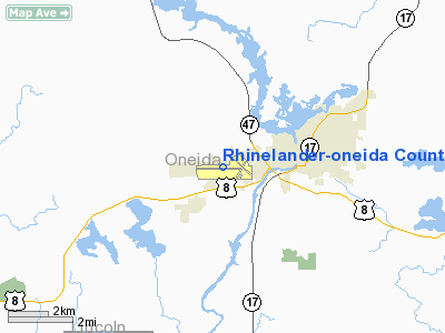
Rhinelander-oneida County Airport |
| Rhinelander-Oneida County Airport |
| IATA: RHI – ICAO: KRHI |
| Summary |
| Airport type |
Public |
| Operator |
City of Rhinelander & Oneida County |
| Location |
Rhinelander, Wisconsin |
| Elevation AMSL |
1,624 ft / 495 m |
| Coordinates |
45°37′53″N 89°28′03″W / 45.63139°N 89.4675°W / 45.63139; -89.4675Coordinates: 45°37′53″N 89°28′03″W / 45.63139°N 89.4675°W / 45.63139; -89.4675 |
| Runways |
| Direction |
Length |
Surface |
| ft |
m |
| 9/27 |
6,799 |
2,072 |
Concrete |
| 15/33 |
4,501 |
1,372 |
Asphalt |
Rhinelander-Oneida County Airport (IATA: RHI, ICAO: KRHI) is a public airport located two miles (3 km) southwest of Rhinelander, in Oneida County, Wisconsin, USA. The airport covers 1,259 acres (509 ha) and has two runways. It is mostly used for general aviation, but is also served by two commercial airlines.
Airlines and destinations
| Airlines |
Destinations |
| Delta Connection operated by Mesaba Airlines |
Minneapolis/St. Paul |
| Delta Connection operated by Pinnacle Airlines |
Minneapolis/St. Paul |
| Great Lakes Airlines |
Ironwood, Milwaukee |
The above content comes from Wikipedia and is published under free licenses – click here to read more.
Location & QuickFacts
| FAA Information Effective: | 2008-09-25 |
| Airport Identifier: | RHI |
| Airport Status: | Operational |
| Longitude/Latitude: | 089-28-02.9000W/45-37-52.3000N
-89.467472/45.631194 (Estimated) |
| Elevation: | 1624 ft / 495.00 m (Surveyed) |
| Land: | 1259 acres |
| From nearest city: | 2 nautical miles SW of Rhinelander, WI |
| Location: | Oneida County, WI |
| Magnetic Variation: | 01E (1980) |
Owner & Manager
| Ownership: | Publicly owned |
| Owner: | Rhinelander & Oneida Co. |
| Address: | 3375 Airport Road
Rhinelander, WI 54501 |
| Phone number: | 715-365-3416 |
| Manager: | Joe Brauer |
| Address: | 3375 Airport Rd
Rhinelander, WI 54501 |
| Phone number: | 715-365-3416 |
Airport Operations and Facilities
| Airport Use: | Open to public |
| Wind indicator: | Yes |
| Segmented Circle: | Yes |
| Control Tower: | No |
| Lighting Schedule: | DUSK-DAWN
HIRL RY 09/27 PRESET ON LOW INTST; TO INCR INTST & ACTVT HIRL RY 15/33; VASI RYS 09; 27; 15 & PAPI RY 33; REIL RYS 15; 33 & 27; MALSR RY 09 - CTAF. |
| Beacon Color: | Clear-Green (lighted land airport) |
| Landing fee charge: | No |
| Sectional chart: | Green Bay |
| Region: | AGL - Great Lakes |
| Boundary ARTCC: | ZMP - Minneapolis |
| Tie-in FSS: | GRB - Green Bay |
| FSS on Airport: | No |
| FSS Toll Free: | 1-800-WX-BRIEF |
| NOTAMs Facility: | RHI (NOTAM-d service avaliable) |
| Certification type/date: | I A S 05/1973
PPR FOR UNSKED ACR OPNS WITH MORE THAN 9 PSGR SEATS CALL AMGR 715-365-3416 OR 715-365-3419. |
| Federal Agreements: | NGSY |
Airport Communications
| CTAF: | 123.000 |
| Unicom: | 123.000 |
Airport Services
| Fuel available: | 100LLA |
| Airframe Repair: | MAJOR |
| Power Plant Repair: | MAJOR |
| Bottled Oxygen: | NONE |
| Bulk Oxygen: | NONE |
Runway Information
Runway 09/27
| Dimension: | 6799 x 150 ft / 2072.3 x 45.7 m |
| Surface: | CONC, Good Condition |
| Surface Treatment: | Saw-cut or plastic Grooved |
| Weight Limit: | Single wheel: 95000 lbs.
Dual wheel: 150000 lbs.
Dual tandem wheel: 235000 lbs. |
| Edge Lights: | High |
| |
Runway 09 |
Runway 27 |
| Longitude: | 089-29-11.7807W | 089-27-36.1514W |
| Latitude: | 45-37-49.0628N | 45-37-51.0775N |
| Elevation: | 1624.00 ft | 1600.00 ft |
| Alignment: | 88 | 127 |
| ILS Type: | ILS
| |
| Traffic Pattern: | Left | Left |
| Markings: | Precision instrument, Fair Condition | Precision instrument, Fair Condition |
| Crossing Height: | 52.00 ft | 49.00 ft |
| VASI: | 4-box on left side | 4-box on left side |
| Visual Glide Angle: | 3.00° | 3.00° |
| Approach lights: | MALSR | |
| Runway End Identifier: | No | Yes |
| Centerline Lights: | No | No |
| Touchdown Lights: | No | No |
| Obstruction: | , 50:1 slope to clear | 50 ft trees, 2300.0 ft from runway, 410 ft right of centerline, 42:1 slope to clear |
|
Runway 15/33
| Dimension: | 4501 x 100 ft / 1371.9 x 30.5 m |
| Surface: | ASPH, Good Condition |
| Weight Limit: | Single wheel: 55000 lbs.
Dual wheel: 95000 lbs.
Dual tandem wheel: 160000 lbs. |
| Edge Lights: | High |
| |
Runway 15 |
Runway 33 |
| Longitude: | 089-27-48.0578W | 089-27-13.9471W |
| Latitude: | 45-38-14.3944N | 45-37-36.9594N |
| Elevation: | 1598.00 ft | 1606.00 ft |
| Alignment: | 127 | 127 |
| Traffic Pattern: | Left | Left |
| Markings: | Non-precision instrument, Good Condition | Non-precision instrument, Good Condition |
| Crossing Height: | 50.00 ft | 25.00 ft |
| VASI: | 4-box on left side
OTS INDEFLY. | 4-light PAPI on left side |
| Visual Glide Angle: | 3.75° | 3.00° |
| Runway End Identifier: | Yes | Yes |
| Centerline Lights: | No | No |
| Touchdown Lights: | No | No |
| Obstruction: | 75 ft trees, 1490.0 ft from runway, 30 ft left of centerline, 17:1 slope to clear | 34 ft , 5000.0 ft from runway, 50:1 slope to clear |
|
Radio Navigation Aids
| ID |
Type |
Name |
Ch |
Freq |
Var |
Dist |
| DO | NDB | Dougy | | 236.00 | 01W | 16.5 nm |
| EGV | NDB | Eagle River | | 341.00 | 02W | 20.0 nm |
| ARV | NDB | Arbor Vitae | | 221.00 | 01W | 20.9 nm |
| RRL | NDB | Merrill | | 257.00 | 01W | 27.9 nm |
| BDJ | NDB | Boulder Junction | | 206.00 | 02E | 31.2 nm |
| AIG | NDB | Antigo | | 347.00 | 02W | 32.1 nm |
| LNL | NDB | Land O Lakes | | 396.00 | 02W | 33.0 nm |
| MHA | NDB | Manitowish | | 364.00 | 01W | 34.3 nm |
| PBH | NDB | Phillips | | 263.00 | 00E | 39.9 nm |
| RXW | NDB | Watersmeet | | 407.00 | 01E | 40.3 nm |
| FZK | NDB | Wausau | | 243.00 | 01E | 42.8 nm |
| PKF | NDB | Park Falls | | 371.00 | 01W | 44.6 nm |
| MDZ | NDB | Medford | | 335.00 | 00E | 47.5 nm |
| RHI | VORTAC | Rhinelander | 029X | 109.20 | 02E | 0.4 nm |
| AUW | VORTAC | Wausau | 053X | 111.60 | 02E | 47.4 nm |
Remarks
- BIRDS & COYOTE ON & INVOF ARPT.
Images and information placed above are from
http://www.airport-data.com/airport/RHI/
We thank them for the data!
| General Info
|
| Country |
United States
|
| State |
WISCONSIN
|
| FAA ID |
RHI
|
| Latitude |
45-37-52.295N
|
| Longitude |
089-28-02.833W
|
| Elevation |
1623 feet
|
| Near City |
RHINELANDER
|
We don't guarantee the information is fresh and accurate. The data may
be wrong or outdated.
For more up-to-date information please refer to other sources.
|
|


