 |
|
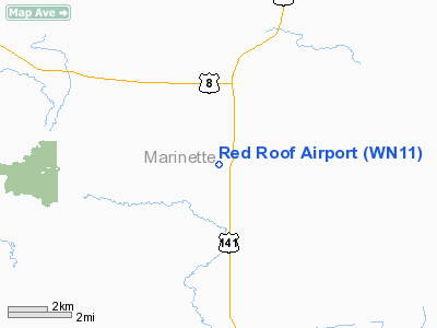
Location & QuickFacts
| FAA Information Effective: | 2008-09-25 |
| Airport Identifier: | WN11 |
| Airport Status: | Operational |
| Longitude/Latitude: | 088-00-13.4240W/45-35-08.8650N
-88.003729/45.585796 (Estimated) |
| Elevation: | 963 ft / 293.52 m (Estimated) |
| Land: | 60 acres |
| From nearest city: | 1 nautical miles SW of Beecher, WI |
| Location: | Marinette County, WI |
| Magnetic Variation: | 02W (1985) |
Owner & Manager
| Ownership: | Privately owned |
| Owner: | James & Elizabeth Hensel |
| Address: | N16565 Vinger Lane
Pembine, WI 54156 |
| Phone number: | 715-324-6361 |
| Manager: | James & Elizabeth Hensel |
| Address: | N16565 Vinger Lane
Pembine, WI 54156 |
| Phone number: | 715-324-6361 |
Airport Operations and Facilities
| Airport Use: | Private |
| Wind indicator: | Yes |
| Segmented Circle: | Yes |
| Control Tower: | No |
| Sectional chart: | Green Bay |
| Region: | AGL - Great Lakes |
| Boundary ARTCC: | ZMP - Minneapolis |
| Tie-in FSS: | GRB - Green Bay |
| FSS on Airport: | No |
| FSS Toll Free: | 1-800-WX-BRIEF |
Runway Information
Runway 09/27
| Dimension: | 2640 x 100 ft / 804.7 x 30.5 m |
| Surface: | TURF, |
| |
Runway 09 |
Runway 27 |
| Traffic Pattern: | Left | Left |
| Displaced threshold: | 300.00 ft | 640.00 ft |
| Obstruction: | | 30 ft pline |
|
Runway 13/31
| Dimension: | 1900 x 80 ft / 579.1 x 24.4 m |
| Surface: | TURF, |
| |
Runway 13 |
Runway 31 |
| Traffic Pattern: | Left | Left |
| Displaced threshold: | 300.00 ft | 200.00 ft |
| Obstruction: | | 10 ft hill, 100.0 ft from runway |
|
Radio Navigation Aids
| ID |
Type |
Name |
Ch |
Freq |
Var |
Dist |
| OCQ | NDB | Oconto | | 388.00 | 03W | 42.8 nm |
| IMT | VOR/DME | Iron Mountain | 049X | 111.20 | 02W | 14.6 nm |
| MNM | VOR/DME | Menominee | 033X | 109.60 | 00E | 28.7 nm |
| ESC | VOR/DME | Escanaba | 045X | 110.80 | 00E | 39.3 nm |
Images and information placed above are from
http://www.airport-data.com/airport/WN11/
We thank them for the data!
| General Info
|
| Country |
United States
|
| State |
WISCONSIN
|
| FAA ID |
WN11
|
| Latitude |
45-35-08.865N
|
| Longitude |
088-00-13.424W
|
| Elevation |
963 feet
|
| Near City |
BEECHER
|
We don't guarantee the information is fresh and accurate. The data may
be wrong or outdated.
For more up-to-date information please refer to other sources.
|
|


