 |
|
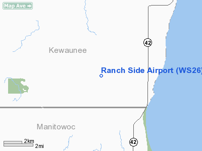
Location & QuickFacts
| FAA Information Effective: | 2008-09-25 |
| Airport Identifier: | WS26 |
| Airport Status: | Operational |
| Longitude/Latitude: | 087-36-25.3060W/44-21-32.9870N
-87.607029/44.359163 (Estimated) |
| Elevation: | 710 ft / 216.41 m (Estimated) |
| Land: | 0 acres |
| From nearest city: | 7 nautical miles SW of Kewaunee, WI |
| Location: | Kewaunee County, WI |
| Magnetic Variation: | 02W (1985) |
Owner & Manager
| Ownership: | Privately owned |
| Owner: | Kenneth J. Langer |
| Address: | E3285 Fur Lane
Kewaunee, WI 54216 |
| Phone number: | 414-776-1120 |
| Address: |
|
Airport Operations and Facilities
| Airport Use: | Private |
| Wind indicator: | Yes |
| Segmented Circle: | No |
| Control Tower: | No |
| Sectional chart: | Green Bay |
| Region: | AGL - Great Lakes |
| Boundary ARTCC: | ZMP - Minneapolis |
| Tie-in FSS: | GRB - Green Bay |
| FSS on Airport: | No |
| FSS Toll Free: | 1-800-WX-BRIEF |
Runway Information
Runway 18/36
| Dimension: | 1300 x 30 ft / 396.2 x 9.1 m |
| Surface: | TURF, |
| |
Runway 18 |
Runway 36 |
| Traffic Pattern: | Left | Left |
|
Radio Navigation Aids
| ID |
Type |
Name |
Ch |
Freq |
Var |
Dist |
| SG | NDB | Depre | | 332.00 | 02W | 22.7 nm |
| SUE | NDB | Sturgeon Bay | | 414.00 | 03W | 29.8 nm |
| OCQ | NDB | Oconto | | 388.00 | 03W | 33.7 nm |
| AQ | NDB | Kooky | | 407.00 | 02W | 35.1 nm |
| MTW | VOR/DME | Manitowoc | 047X | 111.00 | 02W | 14.2 nm |
| FAH | VOR/DME | Falls | 37X | 110.00 | 02W | 37.0 nm |
| MNM | VOR/DME | Menominee | 033X | 109.60 | 00E | 49.4 nm |
| GRB | VORTAC | Green Bay | 102X | 115.50 | 01E | 27.8 nm |
| OSH | VORTAC | Oshkosh | 055X | 111.80 | 02E | 46.5 nm |
Images and information placed above are from
http://www.airport-data.com/airport/WS26/
We thank them for the data!
| General Info
|
| Country |
United States
|
| State |
WISCONSIN
|
| FAA ID |
WS26
|
| Latitude |
44-21-32.987N
|
| Longitude |
087-36-25.306W
|
| Elevation |
710 feet
|
| Near City |
KEWAUNEE
|
We don't guarantee the information is fresh and accurate. The data may
be wrong or outdated.
For more up-to-date information please refer to other sources.
|
|


