 |
|
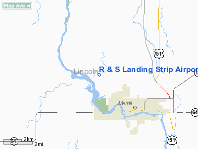
R & S Landing Strip Airport |
Location & QuickFacts
| FAA Information Effective: | 2008-09-25 |
| Airport Identifier: | WS23 |
| Airport Status: | Operational |
| Longitude/Latitude: | 089-44-50.0000W/45-12-58.0000N
-89.747222/45.216111 (Estimated) |
| Elevation: | 1309 ft / 398.98 m (Estimated) |
| Land: | 0 acres |
| From nearest city: | 2 nautical miles SE of Merrill, WI |
| Location: | Lincoln County, WI |
| Magnetic Variation: | () |
Owner & Manager
| Ownership: | Privately owned |
| Owner: | Rob & Shirley Pichelman |
| Address: | N2701 Snow Road
Merrill, WI 54452 |
| Phone number: | 715-536-1386 |
| Manager: | Rob & Shirley Pichelman |
| Address: | N2701 Snow Road
Merrill, WI 54452 |
| Phone number: | 715-536-1386 |
Airport Operations and Facilities
| Airport Use: | Private |
| Wind indicator: | Yes |
| Control Tower: | No |
| Sectional chart: | Green Bay |
| Region: | AGL - Great Lakes |
| Traffic Pattern Alt: | 500 ft |
| Boundary ARTCC: | ZMP - Minneapolis |
| Tie-in FSS: | GRB - Green Bay |
| FSS Toll Free: | 1-800-WX-BRIEF |
Runway Information
Runway 12/30
| Dimension: | 1500 x 60 ft / 457.2 x 18.3 m |
| Surface: | TURF, |
| |
Runway 12 |
Runway 30 |
| Traffic Pattern: | Left | Left |
| Obstruction: | 50 ft trees | 50 ft trees |
|
Radio Navigation Aids
| ID |
Type |
Name |
Ch |
Freq |
Var |
Dist |
| RRL | NDB | Merrill | | 257.00 | 01W | 2.1 nm |
| FZK | NDB | Wausau | | 243.00 | 01E | 18.1 nm |
| MDZ | NDB | Medford | | 335.00 | 00E | 24.7 nm |
| AIG | NDB | Antigo | | 347.00 | 02W | 27.1 nm |
| DO | NDB | Dougy | | 236.00 | 01W | 37.2 nm |
| MFI | NDB | Marshfield | | 391.00 | 00E | 39.3 nm |
| PBH | NDB | Phillips | | 263.00 | 00E | 40.5 nm |
| ARV | NDB | Arbor Vitae | | 221.00 | 01W | 42.7 nm |
| EGV | NDB | Eagle River | | 341.00 | 02W | 47.6 nm |
| AUW | VORTAC | Wausau | 053X | 111.60 | 02E | 23.2 nm |
| RHI | VORTAC | Rhinelander | 029X | 109.20 | 02E | 27.9 nm |
| STE | VORTAC | Stevens Point | 043X | 110.60 | 01W | 41.5 nm |
Remarks
- ALL TFC MONITOR RRL CTAF 122.8.
- ALL TFC REMAIN W OF SWEDE RD.
- ALL TFC FLY TPA OF 500 FT.
- SEE AIRSPACE CASE 2004-AGL-865-NRA.
Images and information placed above are from
http://www.airport-data.com/airport/WS23/
We thank them for the data!
| General Info
|
| Country |
United States
|
| State |
WISCONSIN
|
| FAA ID |
WS23
|
| Latitude |
43-04-25.028N
|
| Longitude |
088-27-32.353W
|
| Elevation |
890 feet
|
| Near City |
OCONOMOWOC
|
We don't guarantee the information is fresh and accurate. The data may
be wrong or outdated.
For more up-to-date information please refer to other sources.
|
|


