 |
|
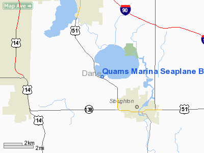
Quams Marina Seaplane Base Airport |
Location & QuickFacts
| FAA Information Effective: | 2008-09-25 |
| Airport Identifier: | 99C |
| Airport Status: | Operational |
| Longitude/Latitude: | 089-16-15.4210W/42-57-04.0010N
-89.270950/42.951111 (Estimated) |
| Elevation: | 843 ft / 256.95 m (Estimated) |
| Land: | 0 acres |
| From nearest city: | 3 nautical miles NW of Stoughton, WI |
| Location: | Dane County, WI |
| Magnetic Variation: | 00E (1985) |
Owner & Manager
| Ownership: | Privately owned |
| Owner: | Robert I. Quam |
| Address: | 1878 Country Club Rd.
Stoughton, WI 53589 |
| Phone number: | 608-873-6754 |
| Manager: | Robert I. Quam |
| Address: | 1896 Barber Drive
Stoughton, WI 53589
QUAM'S SPB |
| Phone number: | 608-873-3366
AFT HRS PHONE 608-873-6754. |
Airport Operations and Facilities
| Airport Use: | Open to public |
| Wind indicator: | No |
| Segmented Circle: | No |
| Control Tower: | No |
| Landing fee charge: | No |
| Sectional chart: | Chicago |
| Region: | AGL - Great Lakes |
| Traffic Pattern Alt: | 1000 ft |
| Boundary ARTCC: | ZAU - Chicago |
| Tie-in FSS: | GRB - Green Bay |
| FSS on Airport: | No |
| FSS Toll Free: | 1-800-WX-BRIEF |
| NOTAMs Facility: | GRB (NOTAM-d service avaliable) |
Airport Communications
Airport Services
| Fuel available: | MOGAS |
| Airframe Repair: | NONE |
| Power Plant Repair: | NONE |
| Bottled Oxygen: | NONE |
| Bulk Oxygen: | NONE |
Runway Information
Runway ALL/WAY
| Dimension: | 15000 x 4000 ft / 4572.0 x 1219.2 m |
| Surface: | WATER, |
| |
Runway ALL |
Runway WAY |
| Traffic Pattern: | Left | Left |
|
Radio Navigation Aids
| ID |
Type |
Name |
Ch |
Freq |
Var |
Dist |
| MS | NDB | Monah | | 400.00 | 00E | 7.5 nm |
| JVL | NDB | Janesville | | 375.00 | 03E | 22.6 nm |
| RYV | NDB | Rock River | | 371.00 | 01W | 27.4 nm |
| LVV | NDB | Lake Lawn | | 404.00 | 00W | 33.5 nm |
| UNU | NDB | Juneau | | 344.00 | 01W | 38.0 nm |
| MRJ | NDB | Mineral Point | | 365.00 | 00W | 42.2 nm |
| FEP | NDB | Freeport | | 335.00 | 00E | 44.6 nm |
| HXF | NDB | Hartford | | 200.00 | 00E | 45.2 nm |
| UES | NDB | Waukesha | | 359.00 | 01W | 45.9 nm |
| JVL | VOR/DME | Janesville | 090X | 114.30 | 03E | 24.7 nm |
| LNR | VOR/DME | Lone Rock | 075X | 112.80 | 00E | 43.1 nm |
| RFD | VOR/DME | Rockford | 045X | 110.80 | 01E | 43.7 nm |
| BUU | VOR/DME | Burbun | 092X | 114.50 | 01W | 45.5 nm |
| MSN | VORTAC | Madison | 023X | 108.60 | 03E | 12.0 nm |
| DLL | VORTAC | Dells | 117X | 117.00 | 03E | 42.0 nm |
| BAE | VORTAC | Badger | 111X | 116.40 | 02E | 44.5 nm |
Images and information placed above are from
http://www.airport-data.com/airport/99C/
We thank them for the data!
| General Info
|
| Country |
United States
|
| State |
WISCONSIN
|
| FAA ID |
99C
|
| Latitude |
42-57-04.001N
|
| Longitude |
089-16-15.421W
|
| Elevation |
843 feet
|
| Near City |
STOUGHTON
|
We don't guarantee the information is fresh and accurate. The data may
be wrong or outdated.
For more up-to-date information please refer to other sources.
|
|


