 |
|
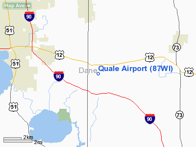
Location & QuickFacts
| FAA Information Effective: | 2008-09-25 |
| Airport Identifier: | 87WI |
| Airport Status: | Operational |
| Longitude/Latitude: | 089-11-07.4130W/43-01-09.9960N
-89.185393/43.019443 (Estimated) |
| Elevation: | 955 ft / 291.08 m (Estimated) |
| Land: | 1 acres |
| From nearest city: | 4 nautical miles NW of Cottage Grove, WI |
| Location: | Dane County, WI |
| Magnetic Variation: | 00W (1985) |
Owner & Manager
| Ownership: | Privately owned |
| Owner: | Richard B. Quale |
| Address: | 3114 North Star Road
Cottage Grove, WI 53527 |
| Phone number: | 608-873-6366 |
| Manager: | Richard B. Quale |
| Address: | 3114 North Star Road
Cottage Grove, WI 53527 |
| Phone number: | 608-873-6366 |
Airport Operations and Facilities
| Airport Use: | Private |
| Wind indicator: | No |
| Segmented Circle: | No |
| Control Tower: | No |
| Landing fee charge: | No |
| Sectional chart: | Chicago |
| Region: | AGL - Great Lakes |
| Boundary ARTCC: | ZAU - Chicago |
| Tie-in FSS: | GRB - Green Bay |
| FSS on Airport: | No |
| FSS Toll Free: | 1-800-WX-BRIEF |
Runway Information
Runway 01/19
| Dimension: | 1200 x 30 ft / 365.8 x 9.1 m |
| Surface: | TURF, |
| |
Runway 01 |
Runway 19 |
| Traffic Pattern: | Right | Left |
| Obstruction: | | 35 ft pline, 800.0 ft from runway |
|
Radio Navigation Aids
| ID |
Type |
Name |
Ch |
Freq |
Var |
Dist |
| MS | NDB | Monah | | 400.00 | 00E | 7.5 nm |
| RYV | NDB | Rock River | | 371.00 | 01W | 22.2 nm |
| JVL | NDB | Janesville | | 375.00 | 03E | 25.1 nm |
| LVV | NDB | Lake Lawn | | 404.00 | 00W | 32.4 nm |
| UNU | NDB | Juneau | | 344.00 | 01W | 32.5 nm |
| HXF | NDB | Hartford | | 200.00 | 00E | 39.8 nm |
| UES | NDB | Waukesha | | 359.00 | 01W | 41.8 nm |
| MRJ | NDB | Mineral Point | | 365.00 | 00W | 46.5 nm |
| FEP | NDB | Freeport | | 335.00 | 00E | 49.8 nm |
| JVL | VOR/DME | Janesville | 090X | 114.30 | 03E | 28.0 nm |
| BUU | VOR/DME | Burbun | 092X | 114.50 | 01W | 43.7 nm |
| LNR | VOR/DME | Lone Rock | 075X | 112.80 | 00E | 44.7 nm |
| RFD | VOR/DME | Rockford | 045X | 110.80 | 01E | 47.7 nm |
| MSN | VORTAC | Madison | 023X | 108.60 | 03E | 10.1 nm |
| BAE | VORTAC | Badger | 111X | 116.40 | 02E | 40.0 nm |
| DLL | VORTAC | Dells | 117X | 117.00 | 03E | 40.7 nm |
Remarks
- LACK OF SUFFICIENT AIRSPACE FOR THE ESTABLISHMENT OF TRAFFIC PATTERNS WHICH WOULD BE COMPATIBLE WITH LITTLE WHEEL FIELD AIRPORT.
Images and information placed above are from
http://www.airport-data.com/airport/87WI/
We thank them for the data!
| General Info
|
| Country |
United States
|
| State |
WISCONSIN
|
| FAA ID |
87WI
|
| Latitude |
43-01-09.996N
|
| Longitude |
089-11-07.413W
|
| Elevation |
955 feet
|
| Near City |
COTTAGE GROVE
|
We don't guarantee the information is fresh and accurate. The data may
be wrong or outdated.
For more up-to-date information please refer to other sources.
|
|


