 |
|
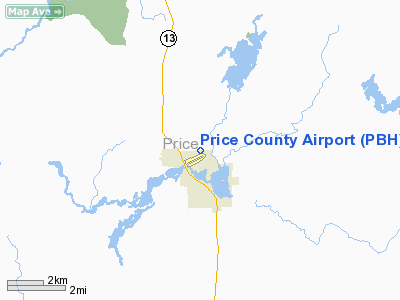
Location & QuickFacts
| FAA Information Effective: | 2008-09-25 |
| Airport Identifier: | PBH |
| Airport Status: | Operational |
| Longitude/Latitude: | 090-24-09.0000W/45-42-32.2000N
-90.402500/45.708944 (Estimated) |
| Elevation: | 1497 ft / 456.29 m (Surveyed) |
| Land: | 518 acres |
| From nearest city: | 1 nautical miles NW of Phillips, WI |
| Location: | Price County, WI |
| Magnetic Variation: | 00E (1985) |
Owner & Manager
| Ownership: | Publicly owned |
| Owner: | Price County
LAWRENCE PALECEK - CHMN ARPT COMM - 715-762-4540. |
| Address: | 126 Cherry St.
Phillips, WI 54555 |
| Phone number: | 715-339-3325 |
| Manager: | Chris Hallstrand |
| Address: | Price Co Arpt N1205 Arpt Rd
Phillips, WI 54555 |
| Phone number: | 715-339-3701 |
Airport Operations and Facilities
| Airport Use: | Open to public |
| Wind indicator: | Yes |
| Segmented Circle: | Yes |
| Control Tower: | No |
| Lighting Schedule: | DUSK-DAWN
ACTVT MIRL RYS 06/24 & 01/19; VASI RYS 06 & 24; PAPI RYS 01 & 19; REIL RYS 01; 19 & 24 - CTAF. |
| Beacon Color: | Clear-Green (lighted land airport) |
| Landing fee charge: | No |
| Sectional chart: | Green Bay |
| Region: | AGL - Great Lakes |
| Boundary ARTCC: | ZMP - Minneapolis |
| Tie-in FSS: | GRB - Green Bay |
| FSS on Airport: | No |
| FSS Toll Free: | 1-800-WX-BRIEF |
| NOTAMs Facility: | PBH (NOTAM-d service avaliable) |
| Federal Agreements: | NGY |
Airport Communications
| CTAF: | 122.800 |
| Unicom: | 122.800 |
Airport Services
| Fuel available: | 100LLA MOGAS
FUEL AVBL 24 HRS WITH CREDIT CARD. |
| Airframe Repair: | MAJOR |
| Power Plant Repair: | MAJOR |
| Bottled Oxygen: | NONE |
| Bulk Oxygen: | NONE |
Runway Information
Runway 01/19
| Dimension: | 5000 x 75 ft / 1524.0 x 22.9 m |
| Surface: | ASPH, Good Condition |
| Weight Limit: | Dual wheel: 60000 lbs. |
| Edge Lights: | Medium |
| |
Runway 01 |
Runway 19 |
| Longitude: | 090-24-12.1408W | 090-24-03.5225W |
| Latitude: | 45-42-17.5975N | 45-43-06.5826N |
| Elevation: | 1465.00 ft | 1497.00 ft |
| Alignment: | 7 | 127 |
| Traffic Pattern: | Left | Left |
| Markings: | Non-precision instrument, Good Condition | Non-precision instrument, Good Condition |
| Crossing Height: | 35.00 ft | 30.00 ft |
| VASI: | 4-light PAPI on left side | 4-light PAPI on left side
OTS INDEFLY. |
| Visual Glide Angle: | 3.00° | 3.00° |
| Runway End Identifier: | Yes | Yes |
| Obstruction: | 54 ft trees, 2040.0 ft from runway, 10 ft right of centerline, 34:1 slope to clear | 75 ft trees, 2750.0 ft from runway, 150 ft right of centerline, 34:1 slope to clear |
|
Runway 06/24
| Dimension: | 3950 x 75 ft / 1204.0 x 22.9 m |
| Surface: | ASPH, Fair Condition |
| Weight Limit: | Single wheel: 28000 lbs.
Dual wheel: 40000 lbs. |
| Edge Lights: | Medium |
| |
Runway 06 |
Runway 24 |
| Longitude: | 090-24-34.2235W | 090-23-46.5131W |
| Latitude: | 45-42-09.6456N | 45-42-29.7500N |
| Elevation: | 1465.00 ft | 1472.00 ft |
| Alignment: | 59 | 127 |
| Traffic Pattern: | Left | Left |
| Markings: | Non-precision instrument, Fair Condition
MARKINGS FADED. | Non-precision instrument, Fair Condition |
| Crossing Height: | 47.00 ft | 45.00 ft |
| VASI: | 2-box on left side | 2-box on left side |
| Visual Glide Angle: | 3.00° | 3.00° |
| Runway End Identifier: | | Yes |
| Centerline Lights: | No | No |
| Touchdown Lights: | No | No |
| Obstruction: | 50 ft tree, 1500.0 ft from runway, 205 ft right of centerline, 26:1 slope to clear | 59 ft trees, 2050.0 ft from runway, 31:1 slope to clear |
|
Radio Navigation Aids
| ID |
Type |
Name |
Ch |
Freq |
Var |
Dist |
| PBH | NDB | Phillips | | 263.00 | 00E | 0.6 nm |
| PKF | NDB | Park Falls | | 371.00 | 01W | 14.7 nm |
| RCX | NDB | Rusk County | | 356.00 | 00W | 28.1 nm |
| DO | NDB | Dougy | | 236.00 | 01W | 29.2 nm |
| ARV | NDB | Arbor Vitae | | 221.00 | 01W | 31.1 nm |
| MHA | NDB | Manitowish | | 364.00 | 01W | 33.0 nm |
| MDZ | NDB | Medford | | 335.00 | 00E | 36.5 nm |
| BDJ | NDB | Boulder Junction | | 206.00 | 02E | 40.3 nm |
| RRL | NDB | Merrill | | 257.00 | 01W | 42.5 nm |
| SLY | NDB | Seeley | | 344.00 | 01E | 47.7 nm |
| EGV | NDB | Eagle River | | 341.00 | 02W | 49.6 nm |
| HYR | VOR/DME | Hayward | 081X | 113.40 | 03E | 47.5 nm |
| RHI | VORTAC | Rhinelander | 029X | 109.20 | 02E | 39.9 nm |
Remarks
- BIRDS ON & VCNTY OF ARPT.
- DEER ON & INVOF ARPT.
Images and information placed above are from
http://www.airport-data.com/airport/PBH/
We thank them for the data!
| General Info
|
| Country |
United States
|
| State |
WISCONSIN
|
| FAA ID |
PBH
|
| Latitude |
45-42-32.221N
|
| Longitude |
090-24-08.945W
|
| Elevation |
1497 feet
|
| Near City |
PHILLIPS
|
We don't guarantee the information is fresh and accurate. The data may
be wrong or outdated.
For more up-to-date information please refer to other sources.
|
|


