 |
|
Location & QuickFacts
| FAA Information Effective: | 2008-09-25 |
| Airport Identifier: | 5N2 |
| Airport Status: | Operational |
| Longitude/Latitude: | 090-16-45.5390W/45-32-34.8700N
-90.279316/45.543019 (Estimated) |
| Elevation: | 1578 ft / 480.97 m (Surveyed) |
| Land: | 28 acres |
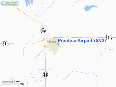
| From nearest city: | 1 nautical miles E of Prentice, WI |
| Location: | Price County, WI |
| Magnetic Variation: | 00E (1985) |
Owner & Manager
| Ownership: | Publicly owned |
| Owner: | Village Of Prentice |
| Address: | 605 Spruce St
Prentice, WI 54556 |
| Phone number: | 715-428-2124 |
| Manager: | Marv Steliga |
| Address: | 605 Spruce St
Prentice, WI 54556 |
| Phone number: | 715-428-2555
OTHER MGR; DALE HEIKKINEN; 715-428-2001. |
Airport Operations and Facilities
| Airport Use: | Open to public |
| Wind indicator: | Yes |
| Segmented Circle: | Yes |
| Control Tower: | No |
| Lighting Schedule: | DUSK-DAWN
ACTVT MIRL RY 09/27 & TWY LGTS - CTAF. |
| Beacon Color: | Clear-Green (lighted land airport) |
| Landing fee charge: | No |
| Sectional chart: | Green Bay |
| Region: | AGL - Great Lakes |
| Boundary ARTCC: | ZMP - Minneapolis |
| Tie-in FSS: | GRB - Green Bay |
| FSS on Airport: | No |
| FSS Toll Free: | 1-800-WX-BRIEF |
| NOTAMs Facility: | GRB (NOTAM-d service avaliable) |
Airport Communications
| CTAF: | 123.000 |
| Unicom: | 123.000 |
Airport Services
Runway Information
Runway 09/27
| Dimension: | 3250 x 60 ft / 990.6 x 18.3 m |
| Surface: | ASPH, Good Condition |
| Edge Lights: | Medium |
| |
Runway 09 |
Runway 27 |
| Longitude: | 090-16-56.8400W | 090-16-00.6700W |
| Latitude: | 45-32-17.8500N | 45-32-16.7300N |
| Elevation: | 1562.00 ft | 1574.00 ft |
| Traffic Pattern: | Left | Left |
| Markings: | Basic, Good Condition | Basic, Good Condition |
| Displaced threshold: | 350.00 ft | 120.00 ft |
| Obstruction: | 23 ft rr, 200.0 ft from runway, 125 ft right of centerline
APCH RATIO 23:1 TO DSPLCD THLD.
RR 200 FT FM THLD 125 FT L; 5 FT SIGN 190 FT FM THLD 63 FT L. | 54 ft tree, 1520.0 ft from runway, 30 ft left of centerline, 24:1 slope to clear
APCH RATIO 30:1 TO DSPLCD THLD.
ROAD 178 FT FM THR. |
|
Radio Navigation Aids
| ID |
Type |
Name |
Ch |
Freq |
Var |
Dist |
| PBH | NDB | Phillips | | 263.00 | 00E | 11.1 nm |
| PKF | NDB | Park Falls | | 371.00 | 01W | 25.4 nm |
| MDZ | NDB | Medford | | 335.00 | 00E | 26.3 nm |
| DO | NDB | Dougy | | 236.00 | 01W | 29.0 nm |
| RCX | NDB | Rusk County | | 356.00 | 00W | 30.5 nm |
| RRL | NDB | Merrill | | 257.00 | 01W | 31.9 nm |
| ARV | NDB | Arbor Vitae | | 221.00 | 01W | 32.6 nm |
| MHA | NDB | Manitowish | | 364.00 | 01W | 38.6 nm |
| BDJ | NDB | Boulder Junction | | 206.00 | 02E | 44.1 nm |
| FZK | NDB | Wausau | | 243.00 | 01E | 46.2 nm |
| EGV | NDB | Eagle River | | 341.00 | 02W | 48.6 nm |
| RHI | VORTAC | Rhinelander | 029X | 109.20 | 02E | 35.0 nm |
Remarks
- PRVDD THRS ARE LCTD TO PRVD MIN 20:1 CLRNC OVER OBSTNS.
Images and information placed above are from
http://www.airport-data.com/airport/5N2/
We thank them for the data!
| General Info
|
| Country |
United States
|
| State |
WISCONSIN
|
| FAA ID |
5N2
|
| Latitude |
45-32-34.870N
|
| Longitude |
090-16-45.539W
|
| Elevation |
1578 feet
|
| Near City |
PRENTICE
|
We don't guarantee the information is fresh and accurate. The data may
be wrong or outdated.
For more up-to-date information please refer to other sources.
|
|


