 |
|
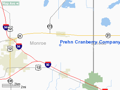
Prehn Cranberry Company Airport |
Location & QuickFacts
| FAA Information Effective: | 2008-09-25 |
| Airport Identifier: | 01WI |
| Airport Status: | Operational |
| Longitude/Latitude: | 090-23-21.0000W/44-00-36.0000N
-90.389167/44.010000 (Estimated) |
| Elevation: | 930 ft / 283.46 m (Estimated) |
| Land: | 0 acres |
| From nearest city: | 5 nautical miles NE of Tomah, WI |
| Location: | Monroe County, WI |
| Magnetic Variation: | 00E (1995) |
Owner & Manager
| Ownership: | Privately owned |
| Owner: | Frederick C Prehn |
| Address: | 413 Jefferson St
Wausau, WI 54401 |
| Phone number: | 715-842-1270 |
| Manager: | Frederick C Prehn |
| Address: | 413 Jefferson St
Wausau, WI 54401 |
| Phone number: | 608-372-6777 |
Airport Operations and Facilities
| Airport Use: | Private |
| Wind indicator: | Yes |
| Segmented Circle: | No |
| Control Tower: | No |
| Sectional chart: | Green Bay |
| Region: | AGL - Great Lakes |
| Boundary ARTCC: | ZAU - Chicago |
| Tie-in FSS: | GRB - Green Bay |
| FSS Toll Free: | 1-800-WX-BRIEF |
Runway Information
Runway 01/19
| Dimension: | 2300 x 120 ft / 701.0 x 36.6 m |
| Surface: | TURF, |
| |
Runway 01 |
Runway 19 |
| Traffic Pattern: | Left | Left |
| Obstruction: | | 30 ft trees, 400.0 ft from runway |
|
Radio Navigation Aids
| ID |
Type |
Name |
Ch |
Freq |
Var |
Dist |
| CMY | NDB | Mccoy | | 412.00 | 00E | 11.8 nm |
| HBW | NDB | Kickapoo | | 251.00 | 03E | 21.5 nm |
| BCK | NDB | Black River Falls | | 362.00 | 00E | 24.7 nm |
| ISW | NDB | Wisconsin Rapids | | 215.00 | 01W | 31.8 nm |
| VIQ | NDB | Neillsville | | 368.00 | 01W | 33.3 nm |
| MFI | NDB | Marshfield | | 391.00 | 00E | 38.9 nm |
| VOK | TACAN | Volk | 041X | | 00E | 6.9 nm |
| LSE | VOR/DME | La Crosse | 021X | 108.40 | 02E | 38.4 nm |
| LNR | VOR/DME | Lone Rock | 075X | 112.80 | 00E | 44.4 nm |
| DLL | VORTAC | Dells | 117X | 117.00 | 03E | 38.7 nm |
| ODI | VORTAC | Nodine | 126X | 117.90 | 01E | 47.0 nm |
| STE | VORTAC | Stevens Point | 043X | 110.60 | 01W | 48.9 nm |
Remarks
- PROVIDED ANY OBSTRUCTION BE REMOVED OR LOWERED OR THLD DSPLCD TO PROVIDE A CLEAR 20:1 APCH; AREA 125 FT EITHER SIDE AND 200 FT OFF RY ENDS IS CLEAR; AREA 60 FT EITHER SIDE AND 240 FT OFF RY ENDS HAS NO HAZARDS.
Images and information placed above are from
http://www.airport-data.com/airport/01WI/
We thank them for the data!
| General Info
|
| Country |
United States
|
| State |
WISCONSIN
|
| FAA ID |
01WI
|
| Latitude |
44-00-36.000N
|
| Longitude |
090-23-21.000W
|
| Elevation |
930 feet
|
| Near City |
TOMAH
|
We don't guarantee the information is fresh and accurate. The data may
be wrong or outdated.
For more up-to-date information please refer to other sources.
|
|


