|
|
Prairie Du Chien Muni Airport |
| Prairie du Chien Municipal Airport |
 |
| IATA: PCD – ICAO: KPDC – FAA LID: PDC |
| Summary |
| Airport type |
Public |
| Owner/Operator |
City of Prairie du Chien |
| Serves |
Prairie du Chien, Wisconsin |
| Elevation AMSL |
661 ft / 201 m |
| Coordinates |
43°01′09″N 091°07′25″W / 43.01917°N 91.12361°W / 43.01917; -91.12361 |
| Runways |
| Direction |
Length |
Surface |
| ft |
m |
| 14/32 |
5,000 |
1,524 |
Asphalt |
| 11/29 |
3,999 |
1,219 |
Asphalt |
| Statistics (2007) |
| Aircraft operations |
12,500 |
| Source: Federal Aviation Administration |
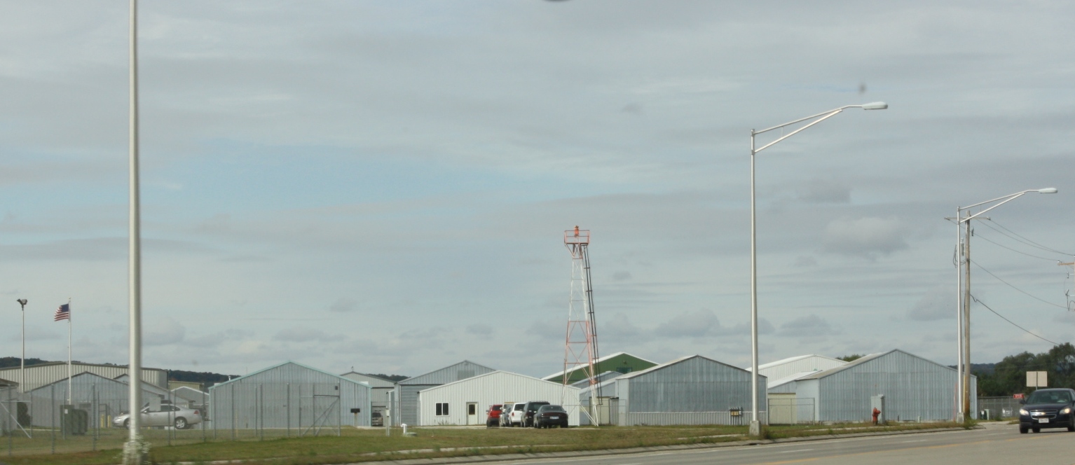
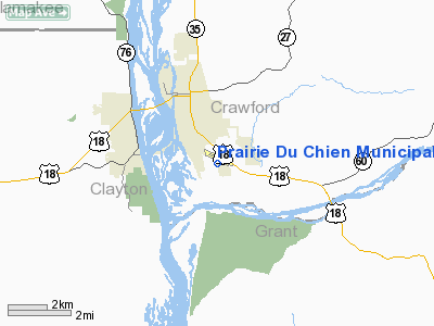
Prairie du Chien Municipal Airport (IATA: PCD, ICAO: KPDC, FAA LID: PDC) is a city-owned public-use airport located two nautical miles (4 km) southeast of the central business district of Prairie du Chien, a city in Crawford County, Wisconsin, United States.
Although most U.S. airports use the same three-letter location identifier for the FAA and IATA, this airport is assigned PDC by the FAA and PCD by the IATA (which assigned PDC to Mueo, New Caledonia). Facilities and aircraft
Prairie du Chien Municipal Airport covers an area of 257 acres (104 ha) at an elevation of 661 feet (201 m) above mean sea level. It has two asphalt paved runways: 14/32 is 5,000 by 75 feet (1,524 x 23 m); 11/29 is 3,999 by 75 feet (1,219 x 23 m). For the 12-month period ending September 11, 2007, the airport had 12,500 aircraft operations, an average of 34 per day: 94% general aviation, 6% air taxi and <1% military.
The above content comes from Wikipedia and is published under free licenses – click here to read more.
Location & QuickFacts
| FAA Information Effective: | 2008-09-25 |
| Airport Identifier: | PDC |
| Airport Status: | Operational |
| Longitude/Latitude: | 091-07-25.4380W/43-01-09.4270N
-91.123733/43.019285 (Estimated) |
| Elevation: | 661 ft / 201.47 m (Surveyed) |
| Land: | 257 acres |
| From nearest city: | 2 nautical miles SE of Prairie Du Chien, WI |
| Location: | Crawford County, WI |
| Magnetic Variation: | 00E (2000) |
Owner & Manager
| Ownership: | Publicly owned |
| Owner: | City Of Prairie Du Chien |
| Address: | P O Box 324
Prairie Du Chien, WI 53821 |
| Phone number: | 608-326-6406 |
| Manager: | Glen Meyer
OTHER MGR RICHARD YEOMANS. |
| Address: | 37735 Us Hwy 18
Prairie Du Chien, WI 53821 |
| Phone number: | 608-326-2118 |
Airport Operations and Facilities
| Airport Use: | Open to public |
| Wind indicator: | Yes |
| Segmented Circle: | Yes |
| Control Tower: | No |
| Lighting Schedule: | DUSK-DAWN
ACTVT MIRL RYS 11/29, 14/32, PAPI RYS 14 & 32 & REIL RYS 14 & 32 - CTAF. |
| Beacon Color: | Clear-Green (lighted land airport) |
| Landing fee charge: | No |
| Sectional chart: | Chicago |
| Region: | AGL - Great Lakes |
| Traffic Pattern Alt: | 1000 ft |
| Boundary ARTCC: | ZAU - Chicago |
| Tie-in FSS: | GRB - Green Bay |
| FSS on Airport: | No |
| FSS Toll Free: | 1-800-WX-BRIEF |
| NOTAMs Facility: | PDC (NOTAM-d service avaliable) |
| Federal Agreements: | NGY |
Airport Communications
| CTAF: | 122.800 |
| Unicom: | 122.800 |
Airport Services
| Fuel available: | 100LLA
24 HR SELF SERVICE |
Runway Information
Runway 11/29
| Dimension: | 3999 x 75 ft / 1218.9 x 22.9 m |
| Surface: | ASPH, Fair Condition |
| Weight Limit: | Single wheel: 24000 lbs.
Dual wheel: 40000 lbs. |
| Edge Lights: | Medium |
| |
Runway 11 |
Runway 29 |
| Longitude: | 091-07-53.8830W | 091-07-03.4060W |
| Latitude: | 43-01-25.4730N | 43-01-11.7170N |
| Elevation: | 651.00 ft | 659.00 ft |
| Alignment: | 110 | 127 |
| Traffic Pattern: | Left | Left |
| Runway End Identifier: | No | No |
| Centerline Lights: | No | No |
| Touchdown Lights: | No | No |
| Obstruction: | 71 ft stack, 1850.0 ft from runway, 300 ft right of centerline, 23:1 slope to clear | 44 ft trees, 1300.0 ft from runway, 300 ft left of centerline, 25:1 slope to clear |
|
Runway 14/32
| Dimension: | 5000 x 75 ft / 1524.0 x 22.9 m |
| Surface: | ASPH, Good Condition |
| Weight Limit: | Single wheel: 30000 lbs.
Dual wheel: 60000 lbs. |
| Edge Lights: | Medium |
| |
Runway 14 |
Runway 32 |
| Longitude: | 091-07-44.5030W | 091-07-01.2440W |
| Latitude: | 43-01-21.0100N | 43-00-43.1770N |
| Elevation: | 651.00 ft | 650.00 ft |
| Alignment: | 127 | 127 |
| Traffic Pattern: | Left | Left |
| Markings: | Non-precision instrument, Good Condition | Non-precision instrument, Good Condition |
| Crossing Height: | 28.00 ft | 30.00 ft |
| VASI: | 2-light PAPI on left side | 2-light PAPI on left side |
| Visual Glide Angle: | 3.00° | 4.00° |
| Runway End Identifier: | Yes | Yes |
| Obstruction: | 56 ft pole, 2104.0 ft from runway, 325 ft left of centerline, 34:1 slope to clear | 52 ft trees, 1250.0 ft from runway, 120 ft left of centerline, 20:1 slope to clear |
|
Radio Navigation Aids
| ID |
Type |
Name |
Ch |
Freq |
Var |
Dist |
| XWY | NDB | West Union | | 278.00 | 02E | 29.3 nm |
| DEH | NDB | Decorah | | 236.00 | 01E | 31.0 nm |
| PVB | NDB | Platteville | | 203.00 | 01E | 36.2 nm |
| CHU | NDB | Caledonia | | 209.00 | 03E | 37.7 nm |
| MRJ | NDB | Mineral Point | | 365.00 | 00W | 40.3 nm |
| OLZ | NDB | Oelwein | | 260.00 | 02E | 42.6 nm |
| CJJ | NDB | Cresco | | 293.00 | 02E | 48.8 nm |
| MXO | NDB | Monticello | | 397.00 | 01E | 49.2 nm |
| IIB | NDB | Wapsie | | 206.00 | 02E | 50.0 nm |
| LNR | VOR/DME | Lone Rock | 075X | 112.80 | 00E | 46.5 nm |
| UKN | VORTAC | Waukon | 113X | 116.60 | 05E | 24.0 nm |
| DBQ | VORTAC | Dubuque | 105X | 115.80 | 04E | 41.4 nm |
Images and information placed above are from
http://www.airport-data.com/airport/PDC/
We thank them for the data!
| General Info
|
| Country |
United States
|
| State |
WISCONSIN
|
| FAA ID |
PDC
|
| Latitude |
43-01-09.427N
|
| Longitude |
091-07-25.438W
|
| Elevation |
661 feet
|
| Near City |
PRAIRIE DU CHIEN
|
We don't guarantee the information is fresh and accurate. The data may
be wrong or outdated.
For more up-to-date information please refer to other sources.
|
|