 |
|
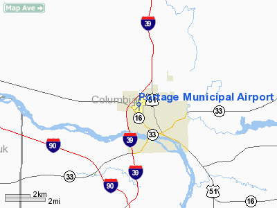
Location & QuickFacts
| FAA Information Effective: | 2008-09-25 |
| Airport Identifier: | C47 |
| Airport Status: | Operational |
| Longitude/Latitude: | 089-28-58.2984W/43-33-37.1288N
-89.482861/43.560314 (Estimated) |
| Elevation: | 825 ft / 251.46 m (Surveyed) |
| Land: | 256 acres |
| From nearest city: | 2 nautical miles NW of Portage, WI |
| Location: | Columbia County, WI |
| Magnetic Variation: | 00E (1985) |
Owner & Manager
| Ownership: | Publicly owned |
| Owner: | City Of Portage |
| Address: | 115 Pleasant
Portage, WI 53901 |
| Phone number: | 608-742-2176 |
| Manager: | John Poppy |
| Address: | Box 319, 1011 Silver Lake Drive
Portage, WI 53901 |
| Phone number: | 608-742-3300 |
Airport Operations and Facilities
| Airport Use: | Open to public |
| Wind indicator: | Yes |
| Segmented Circle: | Yes |
| Control Tower: | No |
| Lighting Schedule: | DUSK-DAWN |
| Beacon Color: | Clear-Green (lighted land airport) |
| Landing fee charge: | No |
| Sectional chart: | Chicago |
| Region: | AGL - Great Lakes |
| Traffic Pattern Alt: | 1000 ft |
| Boundary ARTCC: | ZAU - Chicago |
| Tie-in FSS: | GRB - Green Bay |
| FSS on Airport: | No |
| FSS Toll Free: | 1-800-WX-BRIEF |
| NOTAMs Facility: | GRB (NOTAM-d service avaliable) |
| Federal Agreements: | N |
Airport Communications
| CTAF: | 122.700 |
| Unicom: | 122.700 |
Airport Services
| Fuel available: | 100LLMOGAS
FUEL AVBL 24 HRS WITH CREDIT CARD. |
| Bottled Oxygen: | NONE |
| Bulk Oxygen: | NONE |
Runway Information
Runway 04/22
| Dimension: | 2560 x 40 ft / 780.3 x 12.2 m |
| Surface: | ASPH, Poor Condition
SEVERE CRACKING & PLANTS GROWING THRU PAVEMENT. |
| |
Runway 04 |
Runway 22 |
| Longitude: | 089-29-08.9800W | 089-28-45.2500W |
| Latitude: | 43-33-26.2900N | 43-33-44.7700N |
| Elevation: | 824.00 ft | 816.00 ft |
| Alignment: | 43 | 127 |
| Traffic Pattern: | Left | Left |
| Markings: | Nonstandard, Good Condition
RY 4/22 NUMBERS ONLY. | Nonstandard, Good Condition |
| Displaced threshold: | 60.00 ft | 0.00 ft |
| Runway End Identifier: | No | No |
| Centerline Lights: | No | No |
| Touchdown Lights: | No | No |
| Obstruction: | 13 ft road, 200.0 ft from runway, 50 ft right of centerline
+70 FT TREE 60 FT FM THR 130 FT R; +65 FT TREE 90 FT FM THR 100 FT R. | 10 ft road, 200.0 ft from runway, 120 ft left of centerline
+60 FT TREES AT THLD 150 FT L. |
|
Runway 17/35
| Dimension: | 3775 x 60 ft / 1150.6 x 18.3 m |
| Surface: | ASPH, Good Condition
SEVERE CRACKING & PLANTS GROWING THRU PAVEMENT. |
| Edge Lights: | Medium
MIRL NSTD. RY 17 FIRST 100 FT NOT LGTD; RY 35 FIRST 193 FT NOT LGTD. |
| |
Runway 17 |
Runway 35 |
| Longitude: | 089-29-00.0840W | 089-28-58.1180W |
| Latitude: | 43-33-56.8120N | 43-33-19.6140N |
| Elevation: | 811.00 ft | 822.00 ft |
| Alignment: | 127 | 127 |
| Traffic Pattern: | Left | Left |
| Markings: | Non-precision instrument, Good Condition | Non-precision instrument, Good Condition |
| Displaced threshold: | 103.00 ft | 262.00 ft |
| VASI: | pulsating/steady burning on left side | |
| Runway End Identifier: | Yes | No |
| Centerline Lights: | No | No |
| Touchdown Lights: | No | No |
| Obstruction: | 2 ft road, 200.0 ft from runway, 20 ft left of centerline
APCH RATIO 20:1 TO DSPLCD THLD.
-13 FT RD AT THLD; +18 FT POLE 30 FT FM THLD 250 FT R. | 10 ft road, 200.0 ft from runway, 210 ft right of centerline
APCH RATIO 12:1 TO DSPLCD THLD; 20 FT TREE 250 FT FM DSPLCD THLD 115 FT L.
-1 FT ROAD 42 FT FM THR ON CNTRLN; +28 FT POLES 30 FT FM THR 190 FT R & 125 FT L. |
|
Radio Navigation Aids
| ID |
Type |
Name |
Ch |
Freq |
Var |
Dist |
| MS | NDB | Monah | | 400.00 | 00E | 30.5 nm |
| UNU | NDB | Juneau | | 344.00 | 01W | 34.9 nm |
| HBW | NDB | Kickapoo | | 251.00 | 03E | 37.4 nm |
| RYV | NDB | Rock River | | 371.00 | 01W | 40.4 nm |
| HXF | NDB | Hartford | | 200.00 | 00E | 49.1 nm |
| VOK | TACAN | Volk | 041X | | 00E | 40.8 nm |
| LNR | VOR/DME | Lone Rock | 075X | 112.80 | 00E | 32.6 nm |
| DLL | VORTAC | Dells | 117X | 117.00 | 03E | 12.2 nm |
| MSN | VORTAC | Madison | 023X | 108.60 | 03E | 25.7 nm |
| OSH | VORTAC | Oshkosh | 055X | 111.80 | 02E | 47.8 nm |
Remarks
- NUMEROUS DEER ON & IN VCNTY OF ARPT.
- RWY 35 LRG HNGRS & TREE 200 FT W OF MAY CAUSE WIND SHEAR WITH STRONG NW WINDS.
- POWERLINE 110 FT AGL 1580 FT FM DSPLCD THLD RY 35.
- PAEW AER 04 INDEFLY.
- 115 FT CRANE 200 FT SW RY INTXN MON-THU1300-2200.
- EXISTED PRIOR TO 1959.
Images and information placed above are from
http://www.airport-data.com/airport/C47/
We thank them for the data!
| General Info
|
| Country |
United States
|
| State |
WISCONSIN
|
| FAA ID |
C47
|
| Latitude |
43-33-36.333N
|
| Longitude |
089-28-59.134W
|
| Elevation |
825 feet
|
| Near City |
PORTAGE
|
We don't guarantee the information is fresh and accurate. The data may
be wrong or outdated.
For more up-to-date information please refer to other sources.
|
|


