 |
|
Location & QuickFacts
| FAA Information Effective: | 2008-09-25 |
| Airport Identifier: | WS02 |
| Airport Status: | Operational |
| Longitude/Latitude: | 089-42-57.4470W/43-44-32.9170N
-89.715958/43.742477 (Estimated) |
| Elevation: | 1030 ft / 313.94 m (Estimated) |
| Land: | 50 acres |
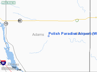
| From nearest city: | 7 nautical miles SW of Oxford, WI |
| Location: | Adams County, WI |
| Magnetic Variation: | 00E (1985) |
Owner & Manager
| Ownership: | Privately owned |
| Owner: | George Snamiske |
| Address: | 3109 Windsor Dr.
Racine, WI 53404 |
| Phone number: | 414-637-0821 |
| Manager: | George Snamiske |
| Address: | 3109 Windsor Dr.
Racine, WI 53404 |
| Phone number: | 414-637-0821 |
Airport Operations and Facilities
| Airport Use: | Private |
| Wind indicator: | Yes |
| Segmented Circle: | No |
| Control Tower: | No |
| Sectional chart: | Chicago |
| Region: | AGL - Great Lakes |
| Boundary ARTCC: | ZAU - Chicago |
| Tie-in FSS: | GRB - Green Bay |
| FSS on Airport: | No |
| FSS Toll Free: | 1-800-WX-BRIEF |
Runway Information
Runway N/S
| Dimension: | 2020 x 50 ft / 615.7 x 15.2 m |
| Surface: | TURF, |
| |
Runway N |
Runway S |
| Traffic Pattern: | Left | Left |
| Obstruction: | 35 ft trees, 10.0 ft from runway | |
|
Radio Navigation Aids
| ID |
Type |
Name |
Ch |
Freq |
Var |
Dist |
| HBW | NDB | Kickapoo | | 251.00 | 03E | 27.3 nm |
| ISW | NDB | Wisconsin Rapids | | 215.00 | 01W | 37.7 nm |
| CMY | NDB | Mccoy | | 412.00 | 00E | 41.8 nm |
| MS | NDB | Monah | | 400.00 | 00E | 43.9 nm |
| PCZ | NDB | Waupaca | | 382.00 | 01W | 46.6 nm |
| UNU | NDB | Juneau | | 344.00 | 01W | 48.0 nm |
| VOK | TACAN | Volk | 041X | | 00E | 26.4 nm |
| LNR | VOR/DME | Lone Rock | 075X | 112.80 | 00E | 32.5 nm |
| DLL | VORTAC | Dells | 117X | 117.00 | 03E | 11.7 nm |
| MSN | VORTAC | Madison | 023X | 108.60 | 03E | 39.5 nm |
| STE | VORTAC | Stevens Point | 043X | 110.60 | 01W | 48.8 nm |
Images and information placed above are from
http://www.airport-data.com/airport/WS02/
We thank them for the data!
| General Info
|
| Country |
United States
|
| State |
WISCONSIN
|
| FAA ID |
WS02
|
| Latitude |
43-44-32.917N
|
| Longitude |
089-42-57.447W
|
| Elevation |
1030 feet
|
| Near City |
OXFORD
|
We don't guarantee the information is fresh and accurate. The data may
be wrong or outdated.
For more up-to-date information please refer to other sources.
|
|


