 |
|
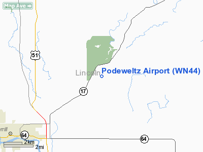
Location & QuickFacts
| FAA Information Effective: | 2008-09-25 |
| Airport Identifier: | WN44 |
| Airport Status: | Operational |
| Longitude/Latitude: | 089-34-08.4430W/45-14-21.8730N
-89.569012/45.239409 (Estimated) |
| Elevation: | 1470 ft / 448.06 m (Estimated) |
| Land: | 0 acres |
| From nearest city: | 6 nautical miles NE of Merrill, WI |
| Location: | Lincoln County, WI |
| Magnetic Variation: | 00E (1985) |
Owner & Manager
| Ownership: | Privately owned |
| Owner: | Wayne Podeweltz |
| Address: | W2810 Hwy C
Merrill, WI 54452 |
| Phone number: | 715-536-6791 |
| Manager: | Wayne Podeweltz |
| Address: | W2810 Hwy C
Merrill, WI 54452 |
| Phone number: | 715-536-6791 |
Airport Operations and Facilities
| Airport Use: | Private |
| Wind indicator: | Yes |
| Segmented Circle: | No |
| Control Tower: | No |
| Sectional chart: | Green Bay |
| Region: | AGL - Great Lakes |
| Boundary ARTCC: | ZMP - Minneapolis |
| Tie-in FSS: | GRB - Green Bay |
| FSS Toll Free: | 1-800-WX-BRIEF |
Runway Information
Runway 18/36
| Dimension: | 2200 x 80 ft / 670.6 x 24.4 m |
| Surface: | TURF, |
| |
Runway 18 |
Runway 36 |
| Traffic Pattern: | Left | Left |
| Markings: | Nonstandard,
18/36 END MARKERS AND 16 INCH CONES 200' APART; LIGHTED ON REQUEST 715-536-6791. | Nonstandard, |
|
Radio Navigation Aids
| ID |
Type |
Name |
Ch |
Freq |
Var |
Dist |
| RRL | NDB | Merrill | | 257.00 | 01W | 6.2 nm |
| FZK | NDB | Wausau | | 243.00 | 01E | 18.9 nm |
| AIG | NDB | Antigo | | 347.00 | 02W | 19.9 nm |
| MDZ | NDB | Medford | | 335.00 | 00E | 32.4 nm |
| DO | NDB | Dougy | | 236.00 | 01W | 36.4 nm |
| ARV | NDB | Arbor Vitae | | 221.00 | 01W | 41.8 nm |
| EGV | NDB | Eagle River | | 341.00 | 02W | 43.6 nm |
| MFI | NDB | Marshfield | | 391.00 | 00E | 44.6 nm |
| PBH | NDB | Phillips | | 263.00 | 00E | 45.2 nm |
| AUW | VORTAC | Wausau | 053X | 111.60 | 02E | 23.6 nm |
| RHI | VORTAC | Rhinelander | 029X | 109.20 | 02E | 24.2 nm |
| STE | VORTAC | Stevens Point | 043X | 110.60 | 01W | 41.9 nm |
Remarks
- FILED FOR RECORD PURPOSES ONLY.
Images and information placed above are from
http://www.airport-data.com/airport/WN44/
We thank them for the data!
| General Info
|
| Country |
United States
|
| State |
WISCONSIN
|
| FAA ID |
WN44
|
| Latitude |
45-14-21.873N
|
| Longitude |
089-34-08.443W
|
| Elevation |
1470 feet
|
| Near City |
MERRILL
|
We don't guarantee the information is fresh and accurate. The data may
be wrong or outdated.
For more up-to-date information please refer to other sources.
|
|


