 |
|
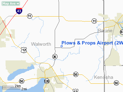
Location & QuickFacts
| FAA Information Effective: | 2008-09-25 |
| Airport Identifier: | 2WI4 |
| Airport Status: | Operational |
| Longitude/Latitude: | 088-23-55.3440W/42-38-34.0590N
-88.398707/42.642794 (Estimated) |
| Elevation: | 840 ft / 256.03 m (Estimated) |
| Land: | 5 acres |
| From nearest city: | 1 nautical miles E of Springfield, WI |
| Location: | Walworth County, WI |
| Magnetic Variation: | 01W (1985) |
Owner & Manager
| Ownership: | Privately owned |
| Owner: | John M. Schnaubelt |
| Address: | Rt 5 Box 810
Lake Geneva, WI 53147 |
| Phone number: | 414-248-9471 |
| Manager: | John M Schnaubelt |
| Address: | Rte 5 Box 810
Lake Geneva, WI 53147 |
| Phone number: | 414-248-9471 |
Airport Operations and Facilities
| Airport Use: | Private |
| Wind indicator: | Yes |
| Segmented Circle: | No |
| Control Tower: | No |
| Landing fee charge: | No |
| Sectional chart: | Chicago |
| Region: | AGL - Great Lakes |
| Traffic Pattern Alt: | 600 ft |
| Boundary ARTCC: | ZAU - Chicago |
| Tie-in FSS: | GRB - Green Bay |
| FSS on Airport: | No |
| FSS Toll Free: | 1-800-WX-BRIEF |
Airport Communications
Airport Services
| Airframe Repair: | NONE |
| Power Plant Repair: | NONE |
Runway Information
Runway 07/25
| Dimension: | 2200 x 70 ft / 670.6 x 21.3 m |
| Surface: | TURF, |
| |
Runway 07 |
Runway 25 |
| Traffic Pattern: | Left | Left |
| Obstruction: | | 30 ft trees, 200.0 ft from runway |
|
Radio Navigation Aids
| ID |
Type |
Name |
Ch |
Freq |
Var |
Dist |
| LVV | NDB | Lake Lawn | | 404.00 | 00W | 9.2 nm |
| RA | NDB | Paser | | 206.00 | 00E | 22.2 nm |
| GM | NDB | Teels | | 242.00 | 02W | 22.5 nm |
| UES | NDB | Waukesha | | 359.00 | 01W | 25.2 nm |
| JVL | NDB | Janesville | | 375.00 | 03E | 28.5 nm |
| BL | NDB | Yanks | | 260.00 | 02W | 34.0 nm |
| RYV | NDB | Rock River | | 371.00 | 01W | 35.0 nm |
| HXF | NDB | Hartford | | 200.00 | 00E | 42.4 nm |
| ME | NDB | Deana | | 350.00 | 00E | 43.8 nm |
| DKB | NDB | Dekalb | | 209.00 | 02W | 44.8 nm |
| LLE | NDB | Kettle Moraine | | 329.00 | 01W | 48.5 nm |
| MS | NDB | Monah | | 400.00 | 00E | 48.8 nm |
| UNU | NDB | Juneau | | 344.00 | 01W | 49.1 nm |
| BJB | VOR | West Bend | | 109.80 | 01W | 48.4 nm |
| BUU | VOR/DME | Burbun | 092X | 114.50 | 01W | 5.1 nm |
| ENW | VOR/DME | Kenosha | 029X | 109.20 | 02W | 20.8 nm |
| HRK | VOR/DME | Horlick | 124X | 117.70 | 02W | 26.8 nm |
| JVL | VOR/DME | Janesville | 090X | 114.30 | 03E | 31.7 nm |
| OBK | VOR/DME | Northbrook | 077X | 113.00 | 02W | 32.2 nm |
| LJT | VOR/DME | Timmerman | 072X | 112.50 | 02W | 32.3 nm |
| RFD | VOR/DME | Rockford | 045X | 110.80 | 01E | 43.5 nm |
| ORD | VOR/DME | Chicago O'hare | 086X | 113.90 | 02E | 45.1 nm |
| DPA | VOR/DME | Dupage | 021X | 108.40 | 02E | 45.3 nm |
| BAE | VORTAC | Badger | 111X | 116.40 | 02E | 28.9 nm |
| MKE | VOT | Milwaukee | | 109.00 | | 28.8 nm |
| ORD | VOT | Chicago O'hare Intl | | 112.00 | | 45.3 nm |
Remarks
- ARPT IS CLSD WHEN TURF IS WET OR SOFT, CONTACT OWNER BEFORE OPERATING ON AIRFIELD.
- EFFICENT USE OF AIRSPACE WILL ADVERSELY AFFECT ACFT OPERATING FROM PLAYBOY, MT.FUJI & WAG-AERO ARPTS
Images and information placed above are from
http://www.airport-data.com/airport/2WI4/
We thank them for the data!
| General Info
|
| Country |
United States
|
| State |
WISCONSIN
|
| FAA ID |
2WI4
|
| Latitude |
42-38-34.059N
|
| Longitude |
088-23-55.344W
|
| Elevation |
840 feet
|
| Near City |
SPRINGFIELD
|
We don't guarantee the information is fresh and accurate. The data may
be wrong or outdated.
For more up-to-date information please refer to other sources.
|
|


