|
|
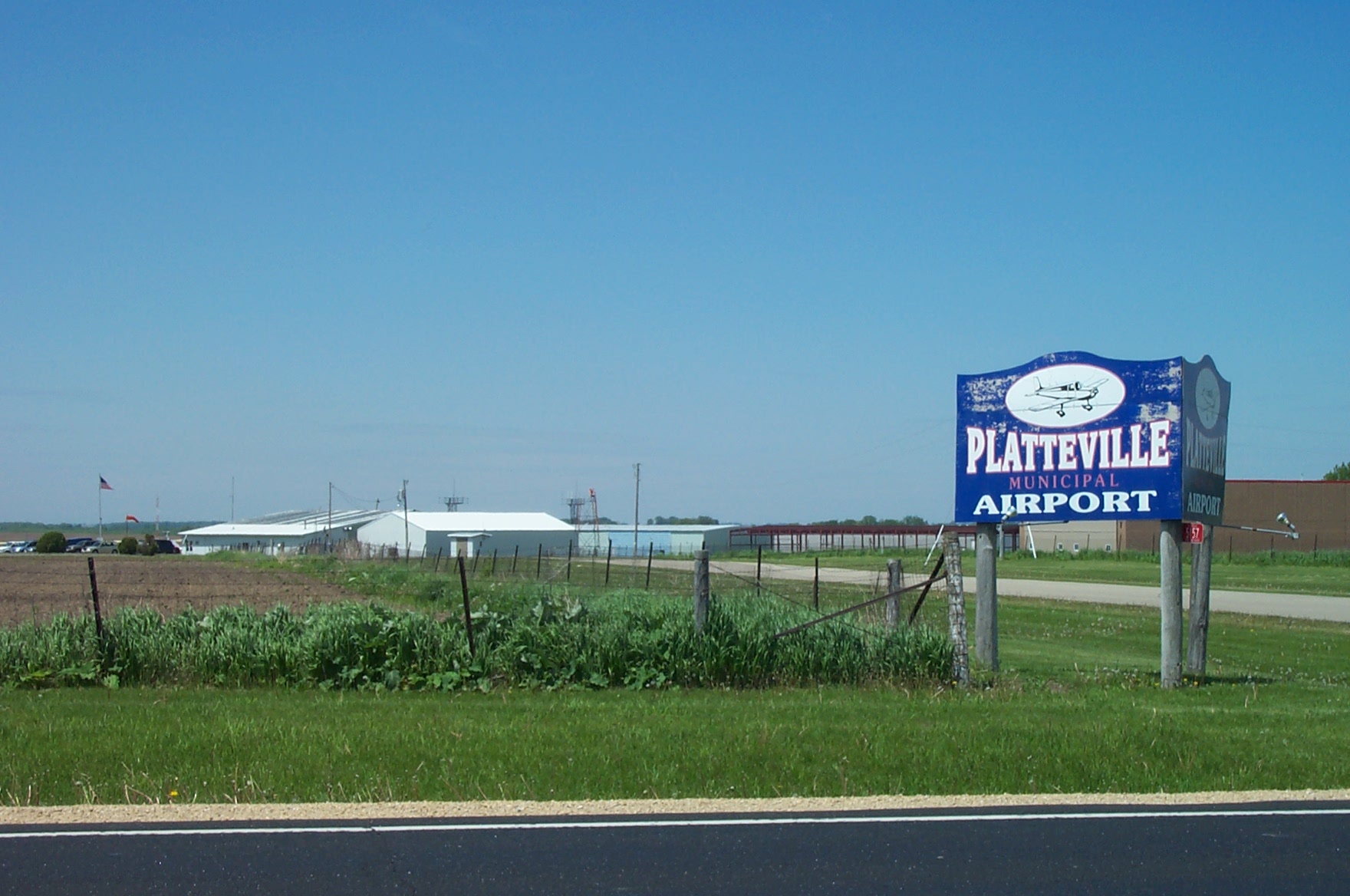
| Platteville Municipal Airport |
 |
| IATA: none – ICAO: KPVB – FAA LID: PVB |
| Summary |
| Airport type |
Public |
| Owner |
City of Platteville |
| Serves |
Platteville, Wisconsin |
| Elevation AMSL |
1,024 ft / 312 m |
| Coordinates |
42°41′22″N 090°26′40″W / 42.68944°N 90.44444°W / 42.68944; -90.44444 |
| Runways |
| Direction |
Length |
Surface |
| ft |
m |
| 15/33 |
4,000 |
1,219 |
Asphalt |
| 7/25 |
3,600 |
1,097 |
Asphalt |
| Statistics (2006) |
| Aircraft operations |
13,550 |
| Based aircraft |
25 |
| Source: Federal Aviation Administration |
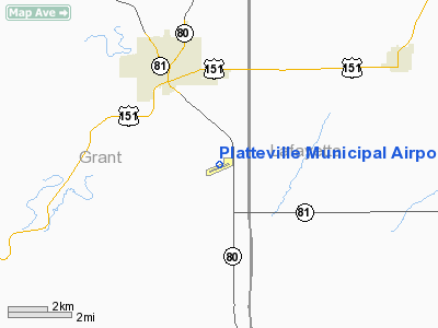
Platteville Municipal Airport (ICAO: KPVB, FAA LID: PVB) is a city-owned public-use airport located three nautical miles (6 km) southeast of the central business district of Platteville, a city in Grant County, Wisconsin, United States.
Although most U.S. airports use the same three-letter location identifier for the FAA and IATA, this airport is assigned PVB by the FAA but has no designation from the IATA. Facilities and aircraft
Platteville Municipal Airport covers an area of 533 acres (216 ha) at an elevation of 1,024 feet (312 m) above mean sea level. It has two asphalt paved runways: 15/33 is 4,000 by 75 feet (1,219 x 23 m); 7/25 is 3,600 by 75 feet (1,097 x 23 m).
A Non-directional beacon is at the facility, 203 kHz, ident PVB.
Fixed base operator: Hughes Aviation
For the 12-month period ending June 22, 2006, the airport had 13,550 aircraft operations, an average of 37 per day: 96% general aviation, 4% air taxi and <1% military. At that time there were 25 aircraft based at this airport: 92% single-engine, 4% multi-engine and 4% ultralight.
The above content comes from Wikipedia and is published under free licenses – click here to read more.
Location & QuickFacts
| FAA Information Effective: | 2008-09-25 |
| Airport Identifier: | PVB |
| Airport Status: | Operational |
| Longitude/Latitude: | 090-26-39.8000W/42-41-21.7000N
-90.444389/42.689361 (Estimated) |
| Elevation: | 1024 ft / 312.12 m (Surveyed) |
| Land: | 533 acres |
| From nearest city: | 3 nautical miles SE of Platteville, WI |
| Location: | Grant County, WI |
| Magnetic Variation: | 02E (1980) |
Owner & Manager
| Ownership: | Publicly owned |
| Owner: | City Of Platteville |
| Address: | 75 N Bonson
Platteville, WI 53818 |
| Phone number: | 608-348-9741 |
| Manager: | Jim Hughes |
| Address: | 5157 Hwy 80 South
Platteville, WI 53818 |
| Phone number: | 608-348-3582 |
Airport Operations and Facilities
| Airport Use: | Open to public |
| Wind indicator: | Yes |
| Segmented Circle: | Yes |
| Control Tower: | No |
| Lighting Schedule: | DUSK-DAWN
ACTVT MIRL RYS 07/25 & 15/33; REIL RYS 15 & 33 - CTAF. |
| Beacon Color: | Clear-Green (lighted land airport) |
| Landing fee charge: | No |
| Sectional chart: | Chicago |
| Region: | AGL - Great Lakes |
| Boundary ARTCC: | ZAU - Chicago |
| Tie-in FSS: | GRB - Green Bay |
| FSS on Airport: | No |
| FSS Toll Free: | 1-800-WX-BRIEF |
| NOTAMs Facility: | GRB (NOTAM-d service avaliable) |
| Federal Agreements: | NGY |
Airport Communications
| CTAF: | 122.700 |
| Unicom: | 122.700 |
Airport Services
| Fuel available: | 100LLA
24 HR SELF SVC FUEL AVBL WITH CREDIT CARD. |
| Bottled Oxygen: | NONE |
| Bulk Oxygen: | NONE |
Runway Information
Runway 07/25
| Dimension: | 3600 x 75 ft / 1097.3 x 22.9 m |
| Surface: | ASPH, Fair Condition |
| Weight Limit: | Single wheel: 30000 lbs.
Dual wheel: 35000 lbs. |
| Edge Lights: | Medium |
| |
Runway 07 |
Runway 25 |
| Longitude: | 090-27-04.2220W | 090-26-19.4760W |
| Latitude: | 42-41-08.8420N | 42-41-22.0670N |
| Elevation: | 999.00 ft | 1022.00 ft |
| Alignment: | 68 | 127 |
| Traffic Pattern: | Left | Left |
| Markings: | Non-precision instrument, Fair Condition | Non-precision instrument, Fair Condition |
| Runway End Identifier: | No | No |
| Centerline Lights: | No | No |
| Touchdown Lights: | No | No |
| Obstruction: | 70 ft trees, 2600.0 ft from runway, 400 ft left of centerline, 34:1 slope to clear | 31 ft road, 750.0 ft from runway, 330 ft left of centerline, 17:1 slope to clear |
|
Runway 15/33
| Dimension: | 4000 x 75 ft / 1219.2 x 22.9 m |
| Surface: | ASPH, Fair Condition |
| Weight Limit: | Single wheel: 12500 lbs. |
| Edge Lights: | Medium |
| |
Runway 15 |
Runway 33 |
| Longitude: | 090-26-53.4026W | 090-26-22.5531W |
| Latitude: | 42-41-43.4368N | 42-41-11.1440N |
| Elevation: | 1023.00 ft | 1022.00 ft |
| Alignment: | 127 | 127 |
| Traffic Pattern: | Left | Left |
| Markings: | Non-precision instrument, Fair Condition | Non-precision instrument, Fair Condition |
| Crossing Height: | 0.00 ft | 25.00 ft |
| VASI: | | 2-light PAPI on left side |
| Visual Glide Angle: | 0.00° | 3.00° |
| Runway End Identifier: | Yes | Yes |
|
Radio Navigation Aids
| ID |
Type |
Name |
Ch |
Freq |
Var |
Dist |
| PVB | NDB | Platteville | | 203.00 | 01E | 0.4 nm |
| MRJ | NDB | Mineral Point | | 365.00 | 00W | 15.3 nm |
| OQW | NDB | Maquoketa | | 386.00 | 02E | 40.5 nm |
| MXO | NDB | Monticello | | 397.00 | 01E | 42.5 nm |
| FEP | NDB | Freeport | | 335.00 | 00E | 46.5 nm |
| LNR | VOR/DME | Lone Rock | 075X | 112.80 | 00E | 38.9 nm |
| DBQ | VORTAC | Dubuque | 105X | 115.80 | 04E | 20.9 nm |
Images and information placed above are from
http://www.airport-data.com/airport/PVB/
We thank them for the data!
| General Info
|
| Country |
United States
|
| State |
WISCONSIN
|
| FAA ID |
PVB
|
| Latitude |
42-41-21.681N
|
| Longitude |
090-26-39.814W
|
| Elevation |
1024 feet
|
| Near City |
PLATTEVILLE
|
We don't guarantee the information is fresh and accurate. The data may
be wrong or outdated.
For more up-to-date information please refer to other sources.
|
|