 |
|
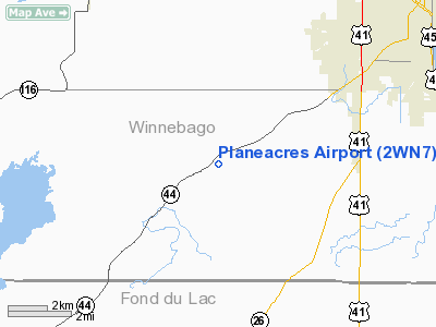
Location & QuickFacts
| FAA Information Effective: | 2008-09-25 |
| Airport Identifier: | 2WN7 |
| Airport Status: | Operational |
| Longitude/Latitude: | 088-40-23.5000W/43-56-55.5000N
-88.673194/43.948750 (Estimated) |
| Elevation: | 844 ft / 257.25 m (Estimated) |
| Land: | 69 acres |
| From nearest city: | 1 nautical miles S of Fisk, WI |
| Location: | Winnebago County, WI |
| Magnetic Variation: | 02W (2000) |
Owner & Manager
| Ownership: | Privately owned |
| Owner: | Lyle M Forsgren |
| Address: | 1848 Queens Dr
Oshkosh, WI 54904 |
| Phone number: | 920-589-6501 |
| Manager: | Lyle M Forsgren |
| Address: | 1848 Queens Dr
Oshkosh, WI 54904 |
| Phone number: | 920-589-6501 |
Airport Operations and Facilities
| Airport Use: | Private |
| Wind indicator: | Yes |
| Segmented Circle: | No |
| Control Tower: | No |
| Sectional chart: | Chicago |
| Region: | AGL - Great Lakes |
| Boundary ARTCC: | ZAU - Chicago |
| Tie-in FSS: | GRB - Green Bay |
| FSS Toll Free: | 1-800-WX-BRIEF |
Runway Information
Runway 18/36
| Dimension: | 2200 x 66 ft / 670.6 x 20.1 m |
| Surface: | TURF, |
| |
Runway 18 |
Runway 36 |
| Traffic Pattern: | Right | Left |
| Displaced threshold: | 400.00 ft
DSPLCD THLD MKD WITH ORANGE CONES. | 0.00 ft |
| Obstruction: | 50 ft trees, 400.0 ft from runway | |
|
Radio Navigation Aids
| ID |
Type |
Name |
Ch |
Freq |
Var |
Dist |
| AQ | NDB | Kooky | | 407.00 | 02W | 20.0 nm |
| PCZ | NDB | Waupaca | | 382.00 | 01W | 27.4 nm |
| UNU | NDB | Juneau | | 344.00 | 01W | 31.3 nm |
| SG | NDB | Depre | | 332.00 | 02W | 35.7 nm |
| HXF | NDB | Hartford | | 200.00 | 00E | 38.1 nm |
| LLE | NDB | Kettle Moraine | | 329.00 | 01W | 39.4 nm |
| CLI | NDB | Clintonville | | 209.00 | 02W | 40.4 nm |
| RYV | NDB | Rock River | | 371.00 | 01W | 46.6 nm |
| BJB | VOR | West Bend | | 109.80 | 01W | 39.6 nm |
| FAH | VOR/DME | Falls | 37X | 110.00 | 02W | 37.4 nm |
| MTW | VOR/DME | Manitowoc | 047X | 111.00 | 02W | 44.3 nm |
| OSH | VORTAC | Oshkosh | 055X | 111.80 | 02E | 5.7 nm |
| GRB | VORTAC | Green Bay | 102X | 115.50 | 01E | 41.9 nm |
Remarks
- 394 FT TOWER 1.4 NM E OF RY & 247 FT TOWER 2.5 NM ESE OF RY.
- PRVDD LETTER OF AGREEMENT WOTH WITTMAN RGNL ARPT RESOLVES THE INCOMPATIBLE TFC PATTERNS AND ALL OPNS ARE W OF RY; CLEAR 20:1 APCHS; CLEAR OBSTACLE FREE ZONE; AND CLEAR RY SAFETY AREA.
Images and information placed above are from
http://www.airport-data.com/airport/2WN7/
We thank them for the data!
| General Info
|
| Country |
United States
|
| State |
WISCONSIN
|
| FAA ID |
2WN7
|
| Latitude |
43-56-55.500N
|
| Longitude |
088-40-23.500W
|
| Elevation |
844 feet
|
| Near City |
FISK
|
We don't guarantee the information is fresh and accurate. The data may
be wrong or outdated.
For more up-to-date information please refer to other sources.
|
|


